Status: In_progress
INCHES
INCHES
MPH
REPORTED
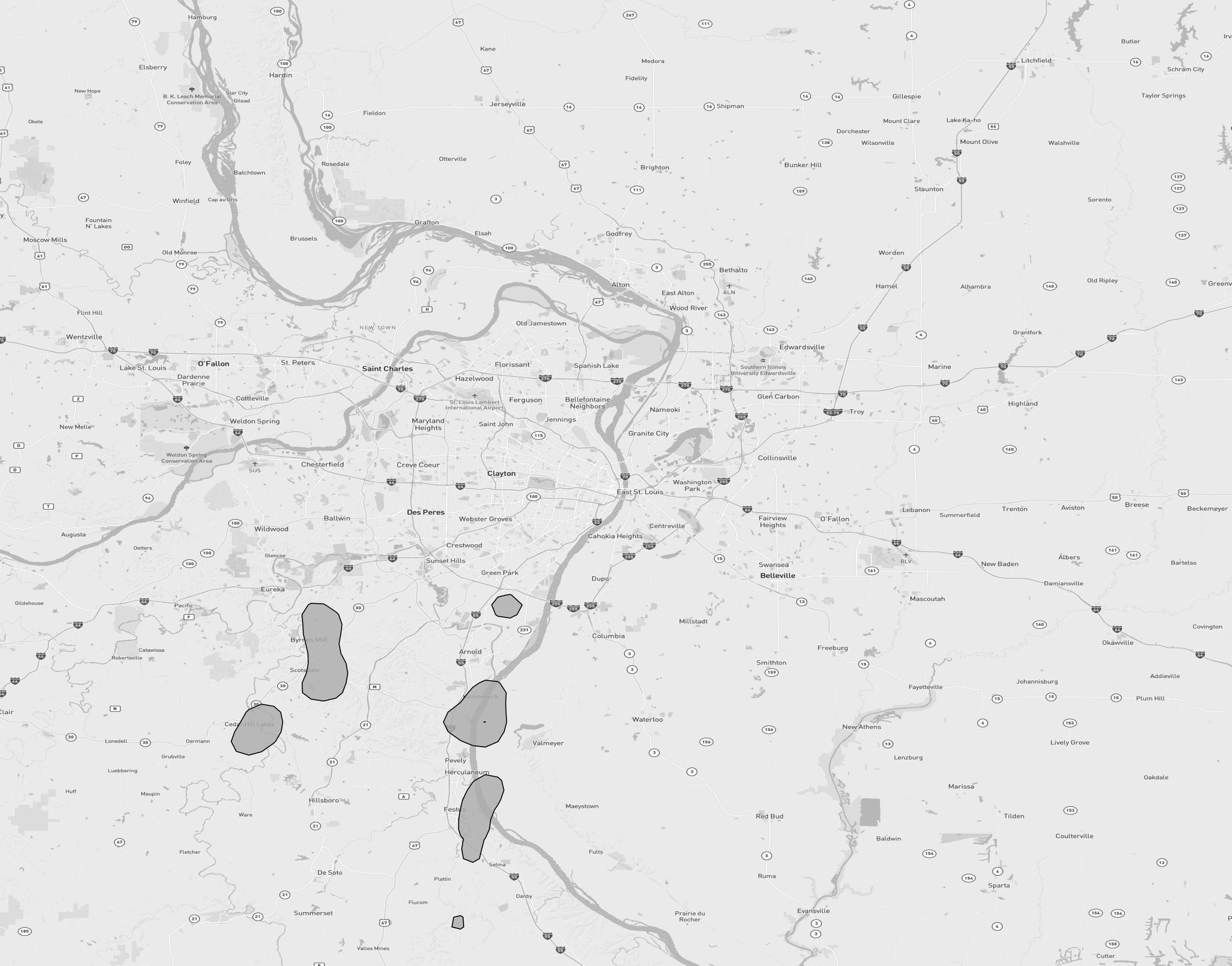
Saint Louis (MO), Arnold (MO), Barnhart (MO), High Ridge (MO), Liguori (MO), Hillsboro (MO), Crystal City (MO), House Springs (MO), Imperial (MO), Kimmswick (MO), Eureka (MO), Pevely (MO), Dittmer (MO), Cedar Hill (MO), Valmeyer (IL), Festus (MO)
63010, 63012, 63016, 63019, 63023, 63025, 63028, 63049, 63050, 63051, 63052, 63053, 63057, 63070, 63129, 62295
| DATE/TIME | SIZE | LOCATION | COUNTY | STATE | DESCRIPTION |
|---|---|---|---|---|---|
| No hail reports available. | |||||
| DATE/TIME | SPEED | LOCATION | COUNTY | STATE | DESCRIPTION |
|---|---|---|---|---|---|
| July 29, 2025, 10:39 p.m. | UNK | 1 WSW Pevely | Jefferson | MO | View |
|
DESCRIPTION:
Photo sent by trained spotter shows a large... healthy branch roughly 6 to 8 inches in diameter from maple tree snapped. Spotter also reported additional large limbs snapped and power lines down in neighborhood. Time estimated from radar.
|
|||||
| July 29, 2025, 10:39 p.m. | UNK | 0 Pevely | Jefferson | MO | View |
|
DESCRIPTION:
Photos show that the canopy at Mr. Fuel Travel Center had large sections of blown off... with several trees in the surrounding vicinity snapped or uprooted.
|
|||||
| DATE/TIME | MAGNITUDE | LOCATION | COUNTY | STATE | DESCRIPTION |
|---|---|---|---|---|---|
| No tornado reports available. | |||||