

Hail Swath Map Preview
The Nashville, TN hail swath map preview was last reviewed on August 29, 2026 and shows mapped hail estimates up to 2.50". There are 26 public hail reports, 37 public wind reports, and 8 nearby tornado reports listed for the May 8, 2024 event.
View the May 8, 2024 Nashville, TN hail event on the free interactive hail map, then check a free Hail Report by ZIP to see a more local hail signal for your area.
Impact Area and Population for the Nashville, TN Hail Map
The May 8, 2024 hail swath map for Nashville, TN covers approximately 6,146 square miles and includes an estimated 942,066 people inside the mapped footprint. The largest mapped area is in the 0.50-0.75" hail band, covering 2,109 square miles. The highest estimated population exposure is in the 0.50-0.75" hail band with 312,420 people.
| Mapped Hail Band | Impact Area | Population |
|---|---|---|
| < 0.50" | 1,307 sq mi | 275,230 |
| 0.50-0.75" | 2,109 sq mi | 312,420 |
| 0.75-1.00" | 1,202 sq mi | 176,802 |
| 1.00-1.25" | 757 sq mi | 86,204 |
| 1.25-1.50" | 401 sq mi | 40,425 |
| 1.50-1.75" | 224 sq mi | 25,661 |
| 1.75-2.00" | 94 sq mi | 16,367 |
| 2.00-2.25" | 30 sq mi | 2,121 |
| 2.25-2.50" | 14 sq mi | 2,142 |
| 2.50-2.75" | 7 sq mi | 4,694 |
Get a free Hail Report by ZIP to see a more local hail signal and whether the May 8, 2024 Nashville, TN hail event may have reached your area.
Housing Exposure Inside the Nashville, TN Hail Swath Map
Inside the May 8, 2024 hail swath map area for Nashville, TN, HailGeeks estimates 367,430 single-family homes, 23,946 townhomes, and 112,357 multifamily properties within the mapped storm footprint. Single-family-home exposure is highest in the 0.50-0.75" hail band, with 125,374 single-family homes.
| Mapped Hail Band | Single-Family | Townhomes | Multifamily |
|---|---|---|---|
| < 0.50" | 98,384 | 8,873 | 46,941 |
| 0.50-0.75" | 125,374 | 7,359 | 34,310 |
| 0.75-1.00" | 69,908 | 5,385 | 16,702 |
| 1.00-1.25" | 34,881 | 1,191 | 7,285 |
| 1.25-1.50" | 18,053 | 379 | 2,169 |
| 1.50-1.75" | 10,368 | 233 | 2,421 |
| 1.75-2.00" | 6,453 | 349 | 1,384 |
| 2.00-2.25" | 960 | 19 | 27 |
| 2.25-2.50" | 1,009 | 38 | 167 |
| 2.50-2.75" | 2,040 | 120 | 951 |
Use this table to review housing exposure by hail band for the May 8, 2024 Nashville, TN hail map. To check a specific property more closely, use a free Hail Report by Address.
Counties Inside the Nashville, TN Hail Map
Hail from the May 8, 2024 storm was mapped across 50 counties in the Nashville, TN region. Montgomery County, TN had the strongest mapped signal, peaking at 2.50" with roughly 36,568 single-family homes inside the swath.
County pages group every mapped hail event in the area. For a closer look, drop to the city or ZIP level below, or run a free Hail Report by Address.
Cities Inside the Nashville, TN Hail Map
Zooming in, the swath touched 82 cities near Nashville, TN. Clarksville, TN had the strongest mapped signal at 2.50", with an estimated 25,998 single-family homes exposed.
City cards show where the May 8, 2024 Nashville, TN hail activity was mapped, but your ZIP can show a closer local signal. Get a free Hail Report by ZIP, and if the signal looks meaningful, ask a local pro about a Remote Hail Inspection to see whether an on-site roof or exterior review may be worth scheduling.
ZIP Codes Inside the Nashville, TN Hail Swath Map
At the ZIP level, the May 8, 2024 Nashville, TN hail map spans 141 ZIP codes. ZIP 37040 shows the strongest local signal, with mapped hail estimates up to 2.50" and an estimated single-family-home exposure of 11,316.
Check your ZIP in seconds to see whether hail activity from the May 8, 2024 Nashville, TN event was mapped near your area.
Public Hail, Wind, and Tornado Reports
Public storm report tables connected to the May 8, 2024 hail map for Nashville, TN currently list 26 public hail reports, 37 public wind reports, and 8 tornado reports.
| Date & Time | Hail Size | City | State | Description |
|---|---|---|---|---|
May 8, 2024 7:05 AM CT |
1.00 in | 1 SSE Red Boiling Sprin | TN | . |
May 8, 2024 2:20 PM CT |
1.00 in | 8 E Ashland City | TN | Twitter photo showed hail up to quarter size in the Beaman Park area. |
May 8, 2024 2:57 PM CT |
2.00 in | Cedar Hill | TN | Facebook report of 2 inch diameter hail in Cedar Hill. |
May 8, 2024 3:15 PM CT |
2.50 in | 7 NNE Springfield | TN | Facebook report of tennis ball size hail in the Youngville area. |
May 8, 2024 3:28 PM CT |
1.00 in | 2 N Cross Plains | TN | Report from mPING: Quarter (1.00 in.). |
May 8, 2024 3:54 PM CT |
1.25 in | 1 SSE Portland | TN | No National Weather Service description provided. |
May 8, 2024 4:01 PM CT |
1.00 in | 5 NNW Fort Campbell Nor | KY | No National Weather Service description provided. |
May 8, 2024 4:05 PM CT |
3.00 in | Clarksville | TN | Tspotter photo of apple size hail in Clarksville. |
May 8, 2024 4:06 PM CT |
1.75 in | 2 SW Clarksville | TN | Report from mPING: Golf Ball (1.75 in.). |
May 8, 2024 4:08 PM CT |
1.75 in | Clarksville | TN | No National Weather Service description provided. |
May 8, 2024 4:17 PM CT |
2.00 in | 5 SSW Clarksville | TN | No National Weather Service description provided. |
May 8, 2024 4:36 PM CT |
1.25 in | 2 SE Hohenwald | TN | Report from mPING: Half Dollar (1.25 in.). |
May 8, 2024 4:43 PM CT |
1.75 in | Hohenwald | TN | No National Weather Service description provided. |
May 8, 2024 4:43 PM CT |
1.75 in | 2 SE Hohenwald | TN | Estimated golf ball size hail. |
May 8, 2024 4:44 PM CT |
1.50 in | 2 SE Hohenwald | TN | Estimated 1.5 inch hail. |
May 8, 2024 4:54 PM CT |
1.75 in | 2 SE Hohenwald | TN | Estimated golf ball size hail. |
May 8, 2024 5:00 PM CT |
1.75 in | 5 WSW Cross Plains | TN | Facebook report of estimated golf ball size hail along Baggett Road east of Springfield. |
May 8, 2024 5:09 PM CT |
1.00 in | 1 NE White House | TN | Report from mPING: Quarter (1.00 in.). |
May 8, 2024 5:10 PM CT |
1.00 in | Cumberland Furnace | TN | Facebook photo showed quarter size hail in Cumberland Furnace. |
May 8, 2024 5:15 PM CT |
2.00 in | 2 N White House | TN | No National Weather Service description provided. |
May 8, 2024 5:17 PM CT |
1.00 in | 1 NE White House | TN | Report from mPING: Quarter (1.00 in.). |
May 8, 2024 5:30 PM CT |
2.00 in | 3 E Ashland City | TN | Estimated 2 inch hail. |
May 8, 2024 5:34 PM CT |
1.25 in | 6 S Coopertown | TN | Report from mPING: Half Dollar (1.25 in.). |
May 8, 2024 5:43 PM CT |
1.00 in | 2 W Gallatin | TN | Estimated quarter size hail. |
May 8, 2024 6:03 PM CT |
1.00 in | 1 SSE Inglewood | TN | No National Weather Service description provided. |
May 8, 2024 8:53 PM CT |
2.00 in | Manchester | TN | Facebook report of estimated 2" hail with photo near Manchester TN around 8:50 PM. |
| Date & Time | Wind Speed | City | State | Description |
|---|---|---|---|---|
May 8, 2024 7:06 AM CT | 3 SSE Red Boiling Sprin | TN | Downed trees. Delayed report. | |
May 8, 2024 12:45 PM CT | 3 S Clifty | KY | Roof damage and an outhouse destroyed... time estimated from radar. | |
May 8, 2024 1:06 PM CT | 1 S Elkton | KY | Possible tornado damage to a barn. | |
May 8, 2024 2:20 PM CT | 3 NNW Fredonia | TN | Facebook report of a tree snapped near McAdoo Creek Road and Highway 12 along with damage to a barn roof. | |
May 8, 2024 5:14 PM CT | Fountain Run | KY | Delayed report of multiple trees down in Fountain Run. | |
May 8, 2024 5:27 PM CT | Ashland City | TN | Facebook photo showed tree down on home in Ashland City off River Road. | |
May 8, 2024 5:28 PM CT | 4 S Ashland City | TN | Trees and powerlines down on Overlook Road. Time is radar estimated. | |
May 8, 2024 5:28 PM CT | 6 SE Ashland City | TN | Trees and powerlines down. Time is radar estimated. | |
May 8, 2024 5:29 PM CT | 7 NNE Lebanon | TN | Trees and powerlines down on Thomas Road near the county line of Trousdale/Wilson Counties. Tornado damage possible. | |
May 8, 2024 5:30 PM CT | 2 ESE White House | TN | Several trees were blown down near intersection of Meadows and N Palmers Chapel Rd. | |
May 8, 2024 5:30 PM CT | 3 E White House | TN | Several trees were blown down along Fern Valley Road. | |
May 8, 2024 5:34 PM CT | 4 W South Carthage | TN | Trees and powerlines reported down in Dickson Springs west of Carthage. Time is radar estimated. Possible tornado damage. | |
May 8, 2024 5:45 PM CT | 1 ESE White House | TN | Large tree down along Dawn Court. | |
May 8, 2024 5:48 PM CT | 6 E Columbia | TN | Photo received of significant amount of damage done to an RV and the surrounding area. Multiple trees snapped... furniture flipped... RV toppled over. Time is radar estimated. Likely tornado damage. | |
May 8, 2024 5:57 PM CT | 3 SSE Eagleville | TN | Photos received of tress down on fence. Time is radar estimated. Possible tornado damage. | |
May 8, 2024 5:57 PM CT | 2 NNW Shelbyville | TN | Photo received of tree down with damage to fence on either side. Time is radar estimated. Possible tornado damage. | |
May 8, 2024 5:57 PM CT | 1 SE Gallatin | TN | Thunderstorm wind damage reported just south of Gallatin... including broken tree limbs and broken power poles. | |
May 8, 2024 5:57 PM CT | 3 S Gallatin | TN | Facebook report of a tree down along Woods Ferry Road just south of Gallatin. | |
May 8, 2024 6:00 PM CT | 8 NE Lebanon | TN | Facebook report of numerous trees down in the Taylorsville area along with a collapsed barn. | |
May 8, 2024 6:05 PM CT | 5 E Gallatin | TN | Multiple large trees were blown down near Bledsoe Creek State Park. | |
May 8, 2024 6:10 PM CT | 4 E Gallatin | TN | Uprooted trees reported along Hidden Woods Trail east of Gallatin from severe thunderstorm winds. | |
May 8, 2024 6:10 PM CT | 1 NNW Hartsville | TN | Several trees were blown down in Hartsville. | |
May 8, 2024 6:21 PM CT | 1 E Hartsville | TN | Broken tree limbs and snapped power poles reported from severe thunderstorm winds east of Hartsville. | |
May 8, 2024 6:22 PM CT | 4 ENE Eagleville | TN | Lucky Ladd Farms received structural damage and has numerous trees down. Time is radar estimated. Tornado damage possible. | |
May 8, 2024 6:30 PM CT | 7 NE Lebanon | TN | Trees were blown down and outbuildings were damaged along Taylorsville Rd. | |
May 8, 2024 6:34 PM CT | 4 W South Carthage | TN | Corrected report for time. Trees and powerlines reported down in Dickson Springs west of Carthage. Time is radar estimated. Possible tornado damage. | |
May 8, 2024 6:40 PM CT | 7 ENE Lebanon | TN | Delayed report - tree damage and multiple uprooted trees in Lebanon off of Carthage Highway. | |
May 8, 2024 6:42 PM CT | Carthage | TN | Photos received on social media of numerous trees and powerlines down along Jefferson Ave. Time is radar estimated. Tornado damage possible. | |
May 8, 2024 6:43 PM CT | Carthage | TN | Photos received on social media of trees snapped and a large tree uprooted along Cullum Street. Structural damage to a house caused by fallen tree. Tornado damage possible. Time is radar estimated. | |
May 8, 2024 6:47 PM CT | Carthage | TN | Structure damage reported along Carmack and Colonial Avenue in Carthage. Time is radar estimated. Tornado damage possible. | |
May 8, 2024 6:49 PM CT | Carthage | TN | Steeple blown off North Carthage Baptist Church... cars also damaged by falling trees in the area. Possible tornado damage. | |
May 8, 2024 6:52 PM CT | 8 NE Unionville | TN | Photo received of large tree down and tree resting on powerlines and on top of a house. Time is radar estimated. Tornado damage possible. | |
May 8, 2024 7:20 PM CT | 1 NW Manchester | TN | Facebook report of a downed tree on Taylor Street in Manchester. | |
May 8, 2024 7:34 PM CT | 7 ESE Manchester | TN | Facebook report of a tree down near the intersection of Highway 41 and Highway 127 in Hillsboro. | |
May 9, 2024 1:10 AM CT | 1 SE Adairville | KY | Trees/powerlines down along Riverview Dr. | |
May 8, 2024 6:42 PM CT | 70 mph | 7 S Murfreesboro | TN | No National Weather Service description provided. |
May 8, 2024 6:51 PM CT | 70 mph | 9 NNW Bell Buckle | TN | 70 MPH winds reported in Christiana. Time is radar estimated. Tornado possible. |
| Date & Time | Rating | City | State | Description |
|---|---|---|---|---|
May 8, 2024 2:43 PM CT | UNK | 7 ENE Fredonia | TN | An EF1 tornado touched down about 1 mile northeast of the I-24 and Stroudville Road intersection in far southwest Robertson County and moved eastward. Several videos of the tornado were taken by residents and stormchasers as the tornado crossed Winters Road and Maxey Road... although the only damage was scattered blown down trees. The tornado strengthened as it turned southeast and followed Ridge Road... blowing down dozens of trees and damaging several homes and barns. Three homes had shingle and roofing material loss... along with gutter and soffit damage. One home had 14 trees snapped or uprooted... with one falling onto their home. An older 20 by 40 barn on Ridge Rd south of Center Dr was picked up and thrown in a northeasterly direction... with metal sheeting blown into and wrapped around trees. The tornado took a sharp turn back to the east and continued blowing down trees before it lifted northeast of the Ridge Rd and Corlew Rd intersection. |
May 8, 2024 2:47 PM CT | UNK | 7 E Fredonia | TN | Reported by spotter on mile marker 19 on I-24. |
May 8, 2024 2:54 PM CT | UNK | 4 NW Coopertown | TN | Still ongoing northwest of Coopertown. Exact location estimated by radar. |
May 8, 2024 5:37 PM CT | UNK | 3 ESE Columbia | TN | *** 1 FATAL... 12 INJ *** Updated info. This EF-3 tornado touched down along the Duck River east of Columbia and moved northeast causing tree damage and minor structure damage on Iron Bridge Rd Mount Olivet Rd. Multiple homes received substantial damage along Cothran Rd and Cranford Hollow Rd before the tornado crossed Highway 412. More intense damage began to occur on Old Highway 99 and Blackburn Lane where large sections of roofs were removed from houses and hundreds of trees were snapped or uprooted. The tornado reached its maximum strength along Blackburn Rd and Lasea Rd where a large transmission power truss collapsed... a house was destroyed with only a small interior room left standing... and a doublewide mobile home was swept away. The tornado continued northeast damaging additional homes and blowing down trees before crossing I-65 near mile marker 47. More homes were heavily damaged and a wide swath of trees was blown down along Rally Hill Cutoff Rd and Kedron Rd. The tornado cro |
May 8, 2024 5:44 PM CT | UNK | 4 ENE Columbia | TN | No National Weather Service description provided. |
May 8, 2024 5:53 PM CT | UNK | 6 SSE Spring Hill | TN | Significant... large tornado reported. |
May 8, 2024 6:31 PM CT | UNK | 7 NE Unionville | TN | An EF-0 tornado touched down near the intersection of Threet Rd and New Zion Rd. The tornado moved east along New Zion Rd snapping large branches off from hardwood trees. Trees were uprooted near the intersection of Midland Rd and Jones Rd. The tornado continued east along Jones Rd snapping large limbs and uprooting a few trees before the tornado transitioned to straight line winds near the Gray Fox neighborhood. Path length of 2.95 miles... maximum width of 100 yards. |
May 8, 2024 6:32 PM CT | UNK | 7 NE Unionville | TN | Updated info. An EF-0 tornado touched down near the intersection of Threet Rd and New Zion Rd. The tornado moved east along New Zion Rd snapping large branches off from hardwood trees. Trees were uprooted in all directions near the intersection of Midland Rd and Jones Rd. The tornado continued east along Jones Rd snapping large limbs and uprooting a few trees before the tornado transitioned to straight line winds near the Gray Fox neighborhood. Path length of 3.02 miles... maximum width of 100 yards. |
This table includes only public storm reports connected to the May 8, 2024 Nashville, TN storm event. When available, each report may include the time, size or magnitude, city, state, and a short description.
Related Hail Maps in the Nashville, TN Region
We found 6 more hail maps with reports from the same Nashville, TN region as the May 8, 2024 event. These related maps cover storm dates from Apr 2, 2024 through May 7, 2024, with mapped hail estimates ranging from 0.75" to 2.00". In this set, the strongest related map reached 2.00", and the most recent map shown is from May 7, 2024.


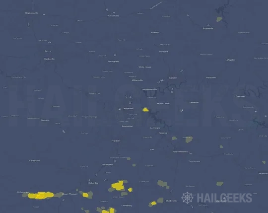


If none of these related Nashville, TN hail maps look close enough to your property, check a free Hail Report by Address. It reviews hail history for a specific location — not just the broader Nashville, TN region — so you can check whether hail activity may have reached your property.
Local Hail Review Options Near Nashville, TN
Not sure whether the May 8, 2024 Nashville, TN hail map matters for your property? Start with a free Hail Report by Address to see whether hail activity was mapped for that property. If the property signal looks meaningful, you can choose a local pro serving the Nashville, TN region and ask about a Remote Hail Inspection before deciding whether an on-site roof or exterior review is worth scheduling.
Check a specific property to see whether hail activity from the May 8, 2024 Nashville, TN event — or another recent hail event — may have been mapped at that address.
Find a roof or exterior pro serving the Nashville, TN region who can help you understand what the property hail signal may mean.
A participating local pro reviews property-level hail history remotely — not just the May 8, 2024 event — to help decide whether an on-site inspection may be worth scheduling.
A free Hail Report by Address and a Remote Hail Inspection can help you look beyond the May 8, 2024 hail map visuals alone. They do not confirm property damage and do not replace an on-site inspection for a property in the Nashville, TN region, but they can help you make a more informed next decision before anyone climbs on the roof.
Frequently Asked Questions
Common questions about the May 8, 2024 Nashville, TN hail event.