

Hail Swath Map Preview
The Knoxville, TN hail swath map preview was last reviewed on August 29, 2026 and shows mapped hail estimates up to 1.50". There are 8 public hail reports, 43 public wind reports, and 0 nearby tornado reports listed for the May 26, 2024 event.
View the May 26, 2024 Knoxville, TN hail event on the free interactive hail map, then check a free Hail Report by ZIP to see a more local hail signal for your area.
Impact Area and Population for the Knoxville, TN Hail Map
The May 26, 2024 hail swath map for Knoxville, TN covers approximately 832 square miles and includes an estimated 210,730 people inside the mapped footprint. The largest mapped area is in the < 0.50" hail band, covering 355 square miles. The highest estimated population exposure is in the 0.50-0.75" hail band with 78,545 people.
| Mapped Hail Band | Impact Area | Population |
|---|---|---|
| < 0.50" | 355 sq mi | 47,557 |
| 0.50-0.75" | 326 sq mi | 78,545 |
| 0.75-1.00" | 108 sq mi | 57,795 |
| 1.00-1.25" | 18 sq mi | 20,105 |
| 1.25-1.50" | 13 sq mi | 4,556 |
| 1.50-1.75" | 12 sq mi | 2,172 |
Get a free Hail Report by ZIP to see a more local hail signal and whether the May 26, 2024 Knoxville, TN hail event may have reached your area.
Housing Exposure Inside the Knoxville, TN Hail Swath Map
Inside the May 26, 2024 hail swath map area for Knoxville, TN, HailGeeks estimates 88,272 single-family homes, 6,368 townhomes, and 37,400 multifamily properties within the mapped storm footprint. Single-family-home exposure is highest in the 0.50-0.75" hail band, with 30,721 single-family homes.
| Mapped Hail Band | Single-Family | Townhomes | Multifamily |
|---|---|---|---|
| < 0.50" | 18,990 | 1,105 | 6,377 |
| 0.50-0.75" | 30,721 | 2,503 | 17,113 |
| 0.75-1.00" | 26,708 | 1,897 | 8,294 |
| 1.00-1.25" | 8,831 | 749 | 4,733 |
| 1.25-1.50" | 1,948 | 84 | 825 |
| 1.50-1.75" | 1,074 | 30 | 58 |
Use this table to review housing exposure by hail band for the May 26, 2024 Knoxville, TN hail map. To check a specific property more closely, use a free Hail Report by Address.
Counties Inside the Knoxville, TN Hail Map
Hail from the May 26, 2024 storm was mapped across 19 counties in the Knoxville, TN region. Knox County, TN had the strongest mapped signal, peaking at 1.50" with roughly 64,039 single-family homes inside the swath.
County pages group every mapped hail event in the area. For a closer look, drop to the city or ZIP level below, or run a free Hail Report by Address.
Cities Inside the Knoxville, TN Hail Map
Zooming in, the swath touched 21 cities near Knoxville, TN. Knoxville, TN had the strongest mapped signal at 1.50", with an estimated 47,096 single-family homes exposed.
City cards show where the May 26, 2024 Knoxville, TN hail activity was mapped, but your ZIP can show a closer local signal. Get a free Hail Report by ZIP, and if the signal looks meaningful, ask a local pro about a Remote Hail Inspection to see whether an on-site roof or exterior review may be worth scheduling.
ZIP Codes Inside the Knoxville, TN Hail Swath Map
At the ZIP level, the May 26, 2024 Knoxville, TN hail map spans 51 ZIP codes. ZIP 37924 shows the strongest local signal, with mapped hail estimates up to 1.50" and an estimated single-family-home exposure of 3,281.
Check your ZIP in seconds to see whether hail activity from the May 26, 2024 Knoxville, TN event was mapped near your area.
Public Hail, Wind, and Tornado Reports
Public storm report tables connected to the May 26, 2024 hail map for Knoxville, TN currently list 8 public hail reports, 43 public wind reports, and 0 tornado reports.
| Date & Time | Hail Size | City | State | Description |
|---|---|---|---|---|
May 26, 2024 3:45 PM CT |
1.00 in | 2 SSE Halls | TN | Multiple public reports of Quarter sized hail in the fountain city area. Reports occurred via social media. |
May 26, 2024 3:57 PM CT |
1.75 in | 5 S Maloneyville | TN | Location approximate. Golf ball sized hail reported near I-40 and Asheville Highway. |
May 26, 2024 3:58 PM CT |
1.00 in | 2 W Strawberry Plains | TN | Quarter sized hail on Clear Springs Road off Mascot Rd. |
May 26, 2024 4:10 PM CT |
1.00 in | Talbott | TN | Relayed from Ham Radio Operators. |
May 26, 2024 4:39 PM CT |
1.75 in | Hartford | TN | Public report of ping pong to golf ball size hail in Hartford. Elevation roughly 1800ft. |
May 26, 2024 4:45 PM CT |
1.00 in | Happy Valley | TN | Dispatch report of quarter size hail in Happy Valley area. |
May 26, 2024 4:54 PM CT |
1.00 in | 1 ENE Marble | NC | Quarter size hail report near Marble North Carolina passed along by HAM operators. |
May 26, 2024 5:08 PM CT |
1.00 in | Townsend | TN | Report from mPING: Quarter (1.00 in.). |
| Date & Time | Wind Speed | City | State | Description |
|---|---|---|---|---|
May 26, 2024 11:46 AM CT | 12 NE Jamestown | TN | Widespread trees down in the area of Pickett State Park. | |
May 26, 2024 11:50 AM CT | 11 NE Jamestown | TN | NWS storm survey found a large 2.5 mile wide by 7 mile long downburst with embedded stronger microbursts blew down hundreds of trees across northeast Fentress and eastern Pickett Counties... especially in Pickett State Park and Big South Fork Recreation Area. The park was temporarily closed due to all roads being blocked by downed trees. Max winds were estimated up to 85 mph. | |
May 26, 2024 12:10 PM CT | Marshes Siding | KY | Reports of trees and power lines down throughout the county... including a few trees blocking roadways. | |
May 26, 2024 12:13 PM CT | 1 N Whitley City | KY | Trees and powerlines down. Additional tree damage countywide. | |
May 26, 2024 12:18 PM CT | 1 NNW Oneida | TN | Dispatch reports numerous trees and utility poles down across northern portions of Scott County. Time estimated by radar. | |
May 26, 2024 12:30 PM CT | 1 S Pathfork | KY | Tree down blocking KY Hwy 2005. Time estimated via radar. | |
May 26, 2024 12:50 PM CT | Fonde | KY | 2 foot diameter tree on power line and shingles blown off of a roof in Fonde. | |
May 26, 2024 12:59 PM CT | Fonde | KY | Trees uprooted and power lines down in Fonde area. Location estimated. Report via social media with photo. Time estimated by radar. | |
May 26, 2024 1:07 PM CT | Pineville | KY | Large tree snapped on Oak Drive in Pineville. Report with photo via social media. Time estimated via radar. | |
May 26, 2024 1:08 PM CT | Noetown | KY | Photo of a tree leaning on house. Report with photos via social media. Time estimated by radar. | |
May 26, 2024 1:10 PM CT | 1 ESE Noetown | KY | Social media report with photo of large tree down at East End Trailer Park near Lower Gibson Lane in Middlesboro. Time estimated by radar. | |
May 26, 2024 1:10 PM CT | 1 SE Noetown | KY | Tree down with electric pole leaning at Middlesboro Fire Station #2. Report via social media. Time estimated by radar. | |
May 26, 2024 1:10 PM CT | Noetown | KY | Social media report with photos of trees snapped and uprooted on Blakely Lane in Middlesboro. Time estimated via radar. | |
May 26, 2024 1:10 PM CT | Noetown | KY | Corrects previous tstm wnd dmg report from Noetown. 2 large trees down on Stone Creek Drive. Report via social media. Time estimated via radar. | |
May 26, 2024 1:10 PM CT | Noetown | KY | Large tree down on camper vehicle. Report with photo via social media. Time estimated by radar. | |
May 26, 2024 1:11 PM CT | Middlesboro | KY | Tree down on power lines on Edgewood Road in Middlesboro. Report with photo via social media. Time estimated by radar. | |
May 26, 2024 1:11 PM CT | Middlesboro | KY | Large tree down on house at Virginia Ave in Middlesboro. Report with photo via social media. Tine estimated by radar. | |
May 26, 2024 1:13 PM CT | 1 ESE Middlesboro | KY | Social media report with drone photos of large trees down on the east side of Middlesboro. Time estimated by radar. | |
May 26, 2024 1:14 PM CT | Calvin | KY | Social media report of trees down on power lines in the Page community off US Hwy 119. Lines also down near train trestle. Time estimated by radar. | |
May 26, 2024 1:14 PM CT | 1 SE Middlesboro | KY | Many trees blown down around the city of Middlesboro. | |
May 26, 2024 1:16 PM CT | Calvin | KY | Tree blown down on KY-1534 about 1/4 mile off of US-119. | |
May 26, 2024 1:40 PM CT | 3 NNE Howard Quarter | TN | Dispatch reported large oak tree across Hancock County side of Snake Hollow Rd. Time Estimated by Radar. | |
May 26, 2024 3:30 PM CT | 1 N Benton | TN | Several Trees Down. | |
May 26, 2024 3:50 PM CT | 2 N Benton | TN | Dispatch passed along report of multiple trees down around Benton area. | |
May 26, 2024 4:15 PM CT | 5 E Oliver Springs | TN | Few trees down in north Oak Ridge. | |
May 26, 2024 4:19 PM CT | 1 ESE Knoxville | TN | Down powerlines from fallen branches via Knox 911 email alerts. | |
May 26, 2024 4:24 PM CT | 3 SW Halls | TN | Couple of trees down along different parts of Dry Gap Pike... blocking traffic and downed a couple powerlines via Knox 911 email alerts. | |
May 26, 2024 4:30 PM CT | 4 S Harrisburg | TN | Corrects previous tstm wnd dmg report from 4 S Harrisburg. Dispatch relayed a few trees have been reported down across the county. | |
May 26, 2024 4:37 PM CT | 4 NW Halls | TN | Couple trees across the entire roadway via Knox 911 email alerts. | |
May 26, 2024 4:44 PM CT | 3 SW Halls | TN | Trees down blocking both lanes near Dry Gap Pike and Cunningham Rd via Knox 911 email alerts. | |
May 26, 2024 4:49 PM CT | 1 NNE Halls | TN | Down tree resulted in down powerlines via Knox 911 email alerts. | |
May 26, 2024 4:50 PM CT | Bybee | TN | Dispatch reported a few trees down in Bybee area. | |
May 26, 2024 5:17 PM CT | 1 SSE Nantahala Lake | NC | Several trees down around Nantahala Lake. | |
May 26, 2024 5:30 PM CT | 4 S Harrisburg | TN | Dispatch relayed a few trees have been reported down across the county. | |
May 26, 2024 6:12 PM CT | Noetown | KY | 2 large trees down on Stone Creek Drive. Report via social media. | |
May 27, 2024 12:56 AM CT | Oneida | TN | Trees down near Oneida. | |
May 27, 2024 1:35 AM CT | 1 NNE La Follette | TN | Powerlines down in La Follette. | |
May 27, 2024 2:15 AM CT | 3 S Karns | TN | Large tree knocked powerlines into a ditch via Knox 911 email alerts. Time estimated by radar. | |
May 27, 2024 2:35 AM CT | 1 E Rutledge | TN | Trees down county-wide. Time estimated by radar. | |
May 27, 2024 2:40 AM CT | 2 ESE Pigeon Forge | TN | Trees down county-wide. Time estimated by radar. | |
May 27, 2024 2:40 AM CT | 1 SSW Sneedville | TN | Multiple trees down on state and county roads. Time estimated by radar. | |
May 27, 2024 2:55 AM CT | 2 ESE Pigeon Forge | TN | Corrects previous tstm wnd dmg report from 2 ESE Pigeon Forge. Trees down county-wide. Time estimated by radar. | |
May 27, 2024 3:00 AM CT | 4 NW Saint Clair | TN | Couple of trees down. Time approximated by radar. |
| Date & Time | Rating | City | State | Description |
|---|---|---|---|---|
| No public tornado reports are available for this event. | ||||
This table includes only public storm reports connected to the May 26, 2024 Knoxville, TN storm event. When available, each report may include the time, size or magnitude, city, state, and a short description.
Related Hail Maps in the Knoxville, TN Region
We found 6 more hail maps with reports from the same Knoxville, TN region as the May 26, 2024 event. These related maps cover storm dates from Sep 9, 2023 through May 23, 2024, with mapped hail estimates ranging from 0.75" to 2.50". In this set, the strongest related map reached 2.50", and the most recent map shown is from May 23, 2024.
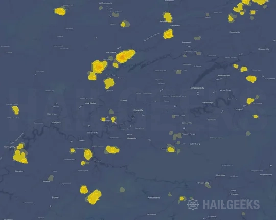
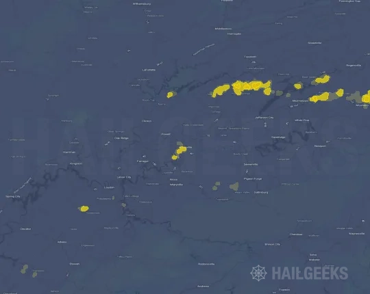
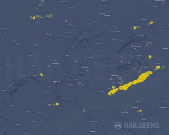
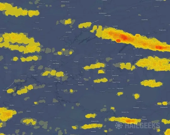
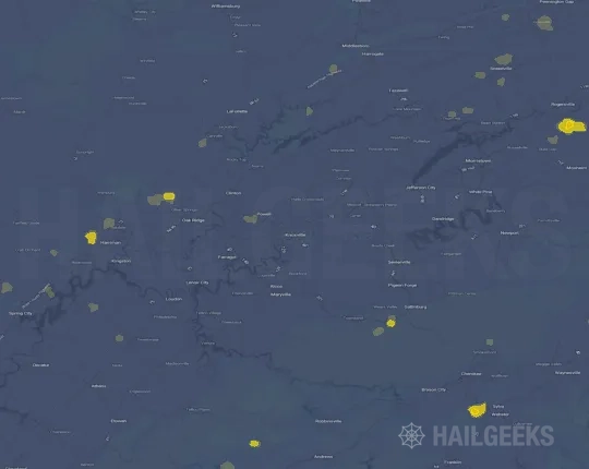
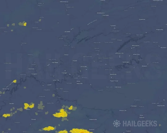
If none of these related Knoxville, TN hail maps look close enough to your property, check a free Hail Report by Address. It reviews hail history for a specific location — not just the broader Knoxville, TN region — so you can check whether hail activity may have reached your property.
Local Hail Review Options Near Knoxville, TN
Not sure whether the May 26, 2024 Knoxville, TN hail map matters for your property? Start with a free Hail Report by Address to see whether hail activity was mapped for that property. If the property signal looks meaningful, you can choose a local pro serving the Knoxville, TN region and ask about a Remote Hail Inspection before deciding whether an on-site roof or exterior review is worth scheduling.
Check a specific property to see whether hail activity from the May 26, 2024 Knoxville, TN event — or another recent hail event — may have been mapped at that address.
Find a roof or exterior pro serving the Knoxville, TN region who can help you understand what the property hail signal may mean.
A participating local pro reviews property-level hail history remotely — not just the May 26, 2024 event — to help decide whether an on-site inspection may be worth scheduling.
A free Hail Report by Address and a Remote Hail Inspection can help you look beyond the May 26, 2024 hail map visuals alone. They do not confirm property damage and do not replace an on-site inspection for a property in the Knoxville, TN region, but they can help you make a more informed next decision before anyone climbs on the roof.
Frequently Asked Questions
Common questions about the May 26, 2024 Knoxville, TN hail event.