

Hail Swath Map Preview
The Wheeling, WV hail swath map preview was last reviewed on August 29, 2026 and shows mapped hail estimates up to 1.25". There are 1 public hail reports, 49 public wind reports, and 0 nearby tornado reports listed for the June 17, 2024 event.
View the June 17, 2024 Wheeling, WV hail event on the free interactive hail map, then check a free Hail Report by ZIP to see a more local hail signal for your area.
Impact Area and Population for the Wheeling, WV Hail Map
The June 17, 2024 hail swath map for Wheeling, WV covers approximately 748 square miles and includes an estimated 142,562 people inside the mapped footprint. The largest mapped area is in the < 0.50" hail band, covering 357 square miles. The highest estimated population exposure is in the < 0.50" hail band with 65,502 people.
| Mapped Hail Band | Impact Area | Population |
|---|---|---|
| < 0.50" | 357 sq mi | 65,502 |
| 0.50-0.75" | 289 sq mi | 52,869 |
| 0.75-1.00" | 73 sq mi | 16,987 |
| 1.00-1.25" | 27 sq mi | 7,073 |
| 1.25-1.50" | 2 sq mi | 131 |
Get a free Hail Report by ZIP to see a more local hail signal and whether the June 17, 2024 Wheeling, WV hail event may have reached your area.
Housing Exposure Inside the Wheeling, WV Hail Swath Map
Inside the June 17, 2024 hail swath map area for Wheeling, WV, HailGeeks estimates 66,108 single-family homes, 4,808 townhomes, and 14,364 multifamily properties within the mapped storm footprint. Single-family-home exposure is highest in the < 0.50" hail band, with 31,106 single-family homes.
| Mapped Hail Band | Single-Family | Townhomes | Multifamily |
|---|---|---|---|
| < 0.50" | 31,106 | 1,843 | 5,478 |
| 0.50-0.75" | 23,834 | 2,118 | 5,444 |
| 0.75-1.00" | 8,322 | 579 | 2,176 |
| 1.00-1.25" | 2,774 | 268 | 1,262 |
| 1.25-1.50" | 72 | 0 | 4 |
Use this table to review housing exposure by hail band for the June 17, 2024 Wheeling, WV hail map. To check a specific property more closely, use a free Hail Report by Address.
Counties Inside the Wheeling, WV Hail Map
Hail from the June 17, 2024 storm was mapped across 25 counties in the Wheeling, WV region. Jefferson County, OH had the strongest mapped signal, peaking at 1.25" with roughly 7,596 single-family homes inside the swath.
County pages group every mapped hail event in the area. For a closer look, drop to the city or ZIP level below, or run a free Hail Report by Address.
Cities Inside the Wheeling, WV Hail Map
Zooming in, the swath touched 47 cities near Wheeling, WV. Bridgewater, PA had the strongest mapped signal at 1.00", with an estimated 1,516 single-family homes exposed.
City cards show where the June 17, 2024 Wheeling, WV hail activity was mapped, but your ZIP can show a closer local signal. Get a free Hail Report by ZIP, and if the signal looks meaningful, ask a local pro about a Remote Hail Inspection to see whether an on-site roof or exterior review may be worth scheduling.
ZIP Codes Inside the Wheeling, WV Hail Swath Map
At the ZIP level, the June 17, 2024 Wheeling, WV hail map spans 85 ZIP codes. ZIP 43943 shows the strongest local signal, with mapped hail estimates up to 1.25" and an estimated single-family-home exposure of 320.
Check your ZIP in seconds to see whether hail activity from the June 17, 2024 Wheeling, WV event was mapped near your area.
Public Hail, Wind, and Tornado Reports
Public storm report tables connected to the June 17, 2024 hail map for Wheeling, WV currently list 1 public hail reports, 49 public wind reports, and 0 tornado reports.
| Date & Time | Hail Size | City | State | Description |
|---|---|---|---|---|
June 17, 2024 5:06 PM CT |
1.00 in | 1 S Magnolia | OH | No National Weather Service description provided. |
| Date & Time | Wind Speed | City | State | Description |
|---|---|---|---|---|
June 17, 2024 1:00 PM CT | 5 WNW Massillon | OH | Tree damage in several locations between North Lawrence and Massillon. | |
June 17, 2024 1:08 PM CT | 4 WNW Massillon | OH | Photos of trees down near Lincolnway NW and Culverne NW on the west side of Massillon. | |
June 17, 2024 2:05 PM CT | Hanoverton | OH | Trees down in Hanover Township. Time estimated via radar. | |
June 17, 2024 2:05 PM CT | Winona | OH | Trees and branches down in Winona. Time estimated via radar. | |
June 17, 2024 2:35 PM CT | Hanoverton | OH | Trees down in Hanover Township. Time estimated via radar. | |
June 17, 2024 2:35 PM CT | Winona | OH | Trees and branches down in Winona. Time estimated via radar. | |
June 17, 2024 3:28 PM CT | Bridgewater | PA | Roof torn off of automotive service building. Time estimated from radar. | |
June 17, 2024 3:30 PM CT | Ellwood City | PA | Trees down in Ellwood City. Time estimated via radar. | |
June 17, 2024 3:37 PM CT | New Brighton | PA | Tree down on 7th Street and 3rd Ave. | |
June 17, 2024 3:38 PM CT | Fombell | PA | Trees and power lines down in the Fombell area. | |
June 17, 2024 3:40 PM CT | Bridgewater | PA | Tree down on Terrace Ave and Western Street. | |
June 17, 2024 3:40 PM CT | New Cumberland | WV | Trees down across the county. | |
June 17, 2024 3:45 PM CT | 1 NNW Davidson Heights | PA | Trees down in Hopewell Township | |
June 17, 2024 3:50 PM CT | Mars | PA | tress and power lines down in adams township | |
June 17, 2024 3:50 PM CT | 1 SSE Eidenau | PA | Numerous trees down and transformers blown. Time estimated via radar. | |
June 17, 2024 3:55 PM CT | 2 NE Mccandless Townshi | PA | Delayed report: wires down at intersecion of Pearce Mill Road and North Ridge Drive. (corrected time from previous issuance) | |
June 17, 2024 3:56 PM CT | Seven Fields | PA | Trees down on Wellington Drive. | |
June 17, 2024 3:56 PM CT | 1 WNW Duff City | PA | Trees down on Big Swickley Creek Road. | |
June 17, 2024 4:00 PM CT | Mars | PA | Tree on a home on Warrendale Road. | |
June 17, 2024 4:00 PM CT | Laurel Gardens | PA | Trees down | |
June 17, 2024 4:00 PM CT | 2 WNW Bradford Woods | PA | Trees down across Markman Park Road. Time estimated via radar. | |
June 17, 2024 4:02 PM CT | 1 ESE Glen Eden | PA | Tree uprooted on North Boundary Road. | |
June 17, 2024 4:06 PM CT | Wexford | PA | Trees down on Brandt School Road... road closed. | |
June 17, 2024 4:08 PM CT | 1 NE Bakerstown Station | PA | Tree and large branches down along State Road near Middlesex Road | |
June 17, 2024 4:08 PM CT | 1 SSW Valencia | PA | Trees down across Bakerstown Road near Holy Savior Cemetery | |
June 17, 2024 4:08 PM CT | 1 NE Bakerstown Station | PA | Trees down at intersection of Glasgow and Ridge Road | |
June 17, 2024 4:09 PM CT | 1 ENE Lower Burrell | PA | Numerous trees and wires down in Lower Burrell area. Arnold Ave... Hulton Road... Diane Street... Spooky Hollow Road... Wildlife Lodge Road... Claremont Drive... and Youngwood Wood had either trees or wires down. | |
June 17, 2024 4:10 PM CT | 1 NE Bakerstown Station | PA | Trees down at intersection of Glasgow Road and Ridge Road | |
June 17, 2024 4:11 PM CT | 2 SSE Metcalf | PA | Wires down on Greenwood Road. | |
June 17, 2024 4:12 PM CT | Shannon Heights | PA | Multiple large branches blown down. Time estimated from radar. | |
June 17, 2024 4:13 PM CT | Millvale | PA | Wires down. Time estimated via radar. | |
June 17, 2024 4:14 PM CT | Allegheny Center | PA | Large tree snapped and laying across roadway. Time estimated via radar. | |
June 17, 2024 4:15 PM CT | Rosedale | PA | Trees down at intersection of Verona Road and Brinley Dr | |
June 17, 2024 4:23 PM CT | 1 SSE Holiday Park | PA | Wires down on Route 286. | |
June 17, 2024 4:25 PM CT | 1 W Ingomar | PA | Several trees down on Lenora Drive in Franklin Park. Time estimated via radar. | |
June 17, 2024 4:26 PM CT | 1 NNW Sardis | PA | Tree down on Beighley Road. | |
June 17, 2024 4:30 PM CT | 1 WSW Municipality Of M | PA | 80 foot tree uprooted and down on property. Time estimated via radar. | |
June 17, 2024 4:34 PM CT | 1 WNW Export | PA | Numerous trees and wires down between Murrysville and Export. Roads impact were: Cherry Drive... Ringertown Road... Wilson Road... Virgina Street... Silvis Road... Hilty Road... Mallard Lane... Logan Ferry Road... Hills Church Road... School Road... Roundtop Road. | |
June 17, 2024 4:35 PM CT | 1 E Emblem | PA | Tree down on Ridge Road and Myers Lane. Damage from the gust front. | |
June 17, 2024 4:40 PM CT | 1 N Lowber | PA | Wires down on Kunkle Road... damage from the gust front. | |
June 17, 2024 4:40 PM CT | 1 WSW Adamsburg | PA | Wires down on Yellowknife Street. | |
June 17, 2024 4:43 PM CT | 1 ESE Harrison City | PA | Tree down on Berlin Road and Dogwood Circle. | |
June 17, 2024 4:48 PM CT | 2 NE Mcadams | PA | Tree down on Seabright Road and North Branch Road. | |
June 17, 2024 5:00 PM CT | 2 SW Hampton Township | PA | several trees snapped on Wallace Road | |
June 17, 2024 5:14 PM CT | 2 E New Manchester | WV | Damage to power lines on Frankfort Road | |
June 17, 2024 5:46 PM CT | 1 NW Ogle | PA | Trees down on Unionville Road | |
June 17, 2024 6:05 PM CT | 1 NNW Deyarmonville | OH | Trees down and powerline damage. | |
June 17, 2024 1:04 PM CT | 60 mph | 2 SSW Canal Fulton | OH | Amateur radio report of 60 mph winds and measured hail of 1/4 to 3/8 in in Lawrence Township. |
June 17, 2024 4:20 PM CT | 60 mph | Lawrenceville | PA | estimated 60 MPH gusts |
| Date & Time | Rating | City | State | Description |
|---|---|---|---|---|
| No public tornado reports are available for this event. | ||||
This table includes only public storm reports connected to the June 17, 2024 Wheeling, WV storm event. When available, each report may include the time, size or magnitude, city, state, and a short description.
Related Hail Maps in the Wheeling, WV Region
We found 6 more hail maps with reports from the same Wheeling, WV region as the June 17, 2024 event. These related maps cover storm dates from Apr 17, 2024 through Jun 14, 2024, with mapped hail estimates ranging from 0.75" to 1.75". In this set, the strongest related map reached 1.75", and the most recent map shown is from Jun 14, 2024.
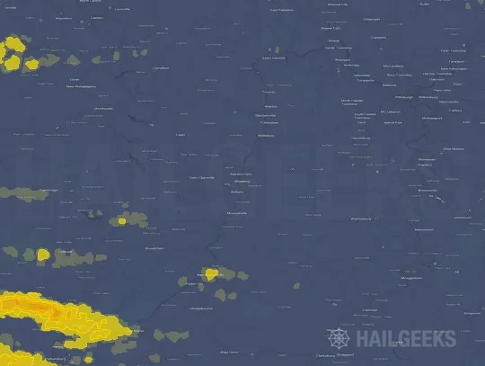


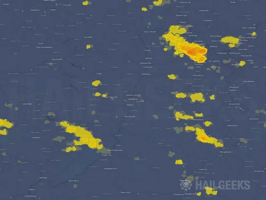

If none of these related Wheeling, WV hail maps look close enough to your property, check a free Hail Report by Address. It reviews hail history for a specific location — not just the broader Wheeling, WV region — so you can check whether hail activity may have reached your property.
Local Hail Review Options Near Wheeling, WV
Not sure whether the June 17, 2024 Wheeling, WV hail map matters for your property? Start with a free Hail Report by Address to see whether hail activity was mapped for that property. If the property signal looks meaningful, you can choose a local pro serving the Wheeling, WV region and ask about a Remote Hail Inspection before deciding whether an on-site roof or exterior review is worth scheduling.
Check a specific property to see whether hail activity from the June 17, 2024 Wheeling, WV event — or another recent hail event — may have been mapped at that address.
Find a roof or exterior pro serving the Wheeling, WV region who can help you understand what the property hail signal may mean.
A participating local pro reviews property-level hail history remotely — not just the June 17, 2024 event — to help decide whether an on-site inspection may be worth scheduling.
A free Hail Report by Address and a Remote Hail Inspection can help you look beyond the June 17, 2024 hail map visuals alone. They do not confirm property damage and do not replace an on-site inspection for a property in the Wheeling, WV region, but they can help you make a more informed next decision before anyone climbs on the roof.
Frequently Asked Questions
Common questions about the June 17, 2024 Wheeling, WV hail event.