

Hail Swath Map Preview
The Kenosha, WI hail swath map preview was last reviewed on August 29, 2026 and shows mapped hail estimates up to 1.25". There are 2 public hail reports, 39 public wind reports, and 5 nearby tornado reports listed for the June 25, 2024 event.
View the June 25, 2024 Kenosha, WI hail event on the free interactive hail map, then check a free Hail Report by ZIP to see a more local hail signal for your area.
Impact Area and Population for the Kenosha, WI Hail Map
The June 25, 2024 hail swath map for Kenosha, WI covers approximately 1,375 square miles and includes an estimated 973,790 people inside the mapped footprint. The largest mapped area is in the 0.50-0.75" hail band, covering 570 square miles. The highest estimated population exposure is in the < 0.50" hail band with 447,425 people.
| Mapped Hail Band | Impact Area | Population |
|---|---|---|
| < 0.50" | 494 sq mi | 447,425 |
| 0.50-0.75" | 570 sq mi | 395,210 |
| 0.75-1.00" | 236 sq mi | 94,427 |
| 1.00-1.25" | 68 sq mi | 32,560 |
| 1.25-1.50" | 7 sq mi | 4,168 |
Get a free Hail Report by ZIP to see a more local hail signal and whether the June 25, 2024 Kenosha, WI hail event may have reached your area.
Housing Exposure Inside the Kenosha, WI Hail Swath Map
Inside the June 25, 2024 hail swath map area for Kenosha, WI, HailGeeks estimates 303,598 single-family homes, 53,675 townhomes, and 181,002 multifamily properties within the mapped storm footprint. Single-family-home exposure is highest in the 0.50-0.75" hail band, with 131,112 single-family homes.
| Mapped Hail Band | Single-Family | Townhomes | Multifamily |
|---|---|---|---|
| < 0.50" | 127,657 | 20,659 | 108,527 |
| 0.50-0.75" | 131,112 | 26,712 | 53,271 |
| 0.75-1.00" | 30,948 | 4,738 | 15,879 |
| 1.00-1.25" | 12,132 | 1,558 | 3,258 |
| 1.25-1.50" | 1,749 | 8 | 67 |
Use this table to review housing exposure by hail band for the June 25, 2024 Kenosha, WI hail map. To check a specific property more closely, use a free Hail Report by Address.
Counties Inside the Kenosha, WI Hail Map
Hail from the June 25, 2024 storm was mapped across 16 counties in the Kenosha, WI region. McHenry County, IL had the strongest mapped signal, peaking at 1.25" with roughly 73,824 single-family homes inside the swath.
County pages group every mapped hail event in the area. For a closer look, drop to the city or ZIP level below, or run a free Hail Report by Address.
Cities Inside the Kenosha, WI Hail Map
Zooming in, the swath touched 100 cities near Kenosha, WI. McHenry, IL had the strongest mapped signal at 1.00", with an estimated 5,989 single-family homes exposed.
City cards show where the June 25, 2024 Kenosha, WI hail activity was mapped, but your ZIP can show a closer local signal. Get a free Hail Report by ZIP, and if the signal looks meaningful, ask a local pro about a Remote Hail Inspection to see whether an on-site roof or exterior review may be worth scheduling.
ZIP Codes Inside the Kenosha, WI Hail Swath Map
At the ZIP level, the June 25, 2024 Kenosha, WI hail map spans 77 ZIP codes. ZIP 60010 shows the strongest local signal, with mapped hail estimates up to 1.25" and an estimated single-family-home exposure of 12,760.
Check your ZIP in seconds to see whether hail activity from the June 25, 2024 Kenosha, WI event was mapped near your area.
Public Hail, Wind, and Tornado Reports
Public storm report tables connected to the June 25, 2024 hail map for Kenosha, WI currently list 2 public hail reports, 39 public wind reports, and 5 tornado reports.
| Date & Time | Hail Size | City | State | Description |
|---|---|---|---|---|
June 25, 2024 6:08 AM CT |
1.00 in | Merton | WI | Photo provided on X. |
June 25, 2024 6:27 PM CT |
1.00 in | 3 WSW Woodstock | IL | Photo shared on social media showed nickel to quarter size hail near South Street and Franklinville Road. Time estimated. |
| Date & Time | Wind Speed | City | State | Description |
|---|---|---|---|---|
June 25, 2024 8:30 PM CT | Hebron | IL | Numerous trees and large branches down. | |
June 25, 2024 8:37 PM CT | Richmond | IL | Photographs of several large tree limbs down across Richmond shared via social media. Some appear to be as large as 12 inches in diameter. Time estimated from radar. | |
June 25, 2024 8:46 PM CT | 1 SE Antioch | IL | Reported via social media of a 9 inch tree branch down just southeast of Antioch... IL. Time approximated by radar. | |
June 25, 2024 8:50 PM CT | Antioch | IL | Large trees down near Lagoona Lake. | |
June 25, 2024 8:57 PM CT | Lindenhurst | IL | Delayed report from 6/22. Power pole snapped and fence panel blown out in Lindenhurst. Time estimated from radar. | |
June 25, 2024 8:59 PM CT | 1 NNW Long Lake | IL | Delayed report from 6/22. Tree downed in Ingleside. Time estimated from radar. | |
June 25, 2024 9:15 PM CT | 2 SE Zion | IL | Report on social media of numerous downed trees... a couple which look like lightning strikes... in Illinois Beach State Park. Time approximated by radar and KUGN ASOS obs. | |
June 25, 2024 10:25 PM CT | 1 NE Dekalb | IL | Delayed report from 6/22. Approximately 8 inch diameter tree uprooted in DeKalb. Time estimated from radar. | |
June 25, 2024 10:48 PM CT | 1 NNW Batavia | IL | Numerous large branches and trees downed... including one large Oak tree uprooted. Tree down into powerlines. | |
June 25, 2024 10:49 PM CT | 2 NW Batavia | IL | Numerous downed trees and large branches in the Randall Square area and near Fabyan Pkwy. | |
June 25, 2024 10:50 PM CT | 1 WNW Geneva | IL | Tree reported down on a house on Maple Lane near Center Street. | |
June 25, 2024 10:50 PM CT | 1 NNW Batavia | IL | Large branches down on Fabyan Rd. | |
June 25, 2024 10:50 PM CT | 1 ENE Batavia | IL | Reported via social media that on the northeast side of Batavia had a lot of tree branches down including one full grown tree. Time approximated by radar. | |
June 25, 2024 10:51 PM CT | 2 NW Batavia | IL | Tree down across Randall Rd. near Fabyan Parkway. | |
June 25, 2024 10:58 PM CT | 2 S West Chicago | IL | Delayed report from 6/22. Small carport lofted and thrown 100 feet into a fence. Large branches downed in the area as well. | |
June 25, 2024 11:00 PM CT | Carol Stream | IL | Large willow tree down on fence. | |
June 25, 2024 11:05 PM CT | 2 S Wheaton | IL | Numerous trees and large branches down across south part of Wheaton... including one large tree uprooted onto a car. | |
June 25, 2024 11:05 PM CT | 2 NNW Lisle | IL | Report passed along of several trees and large limbs down... along with some sign damage on Butterfield RD between Wheaton and Glen Ellyn. Time estimated by radar. | |
June 25, 2024 11:09 PM CT | 3 NNW Downers Grove | IL | Several large branches downed and also 2 large old Willow trees uprooted. | |
June 25, 2024 11:11 PM CT | 1 N Downers Grove | IL | Delayed report from 6/22. An NWS storm survey confirmed that widespread tree damage across the north side of Downers Grove was caused primarily by strong straight-line winds. A church steeple was also bent. | |
June 25, 2024 11:13 PM CT | 1 NNW Westmont | IL | Large tree uprooted. | |
June 25, 2024 11:14 PM CT | 1 N Westmont | IL | Delayed report from 6/22. An NWS storm survey confirmed that widespread tree damage across the north side of Westmont was caused by strong straight-line winds. | |
June 25, 2024 11:15 PM CT | Clarendon Hills | IL | Delayed report from 6/22. An NWS storm survey confirmed that widespread tree damage in Clarendon Hills was caused by strong straight-line winds. | |
June 25, 2024 11:17 PM CT | Hinsdale | IL | Delayed report from 6/22. An NWS storm survey confirmed that widespread tree damage in Hinsdale was caused by strong straight-line winds. | |
June 25, 2024 8:37 PM CT | 80 mph | Twin Lakes | WI | NWS Storm Survey: Estimated peak downburst winds of 70-80mph in the Twin Lakes area. Random pockets of tree damage blown down in a divergent pattern from north of Twin Lakes down through and area west of Lake Elizabeth near Esch Rd. |
June 25, 2024 8:49 PM CT | 59 mph | 1 SSE Lake Catherine | IL | Personal weather station. |
June 25, 2024 8:59 PM CT | 60 mph | 1 E Third Lake | IL | Ambient personal weather station. |
June 25, 2024 9:09 PM CT | 63 mph | 1 SW Beach Park | IL | Corrects previous non-tstm wnd gst report from 1 SW Beach Park. ASOS station KUGN Waukegan Airport. |
June 25, 2024 11:14 PM CT | 61 mph | 1 N Westmont | IL | Davis personal weather station. |
June 25, 2024 6:25 AM CT | 1 N Dekalb | IL | Numerous branches down on the 1700 block of N 1st street. Tall tree split/snapped. Tree downed onto a house in the area as well. | |
June 25, 2024 6:42 AM CT | 3 SE Kaneville | IL | Power lines down near 498 Lasher Road. Time estimated from radar. | |
June 25, 2024 6:46 AM CT | 1 NE Wheeling | IL | Estimated 60 mph along with numerous 3 inch diameter branches down in Wheeling. | |
June 25, 2024 7:05 AM CT | Pleasant Prairie | WI | Photo of downed tree limbs relayed via broadcast media. Time estimated from radar. | |
June 25, 2024 7:07 AM CT | Norwood Park - Chicago | IL | Social media photo of 3-4 inch diameter limb down in the Norwood Park neighborhood area. | |
June 25, 2024 7:10 AM CT | 1 NE Portage Park - Chi | IL | Social media report of inbound trains halted at Mayfair due to tree down on the tracks. Time estimated based on radar. | |
June 25, 2024 7:10 AM CT | 1 NE Harwood Heights | IL | Numerous large limbs near 6 inches in diameter and power line damage from Nagle to Harlem Ave between Foster and Gunnison in the Norwood Park neighborhood. | |
June 25, 2024 6:27 PM CT | 4 N Union | IL | Sproadic tree damage was reported on Vermont Street. | |
June 25, 2024 7:24 AM CT | 63 mph | 3 NE Navy Pier | IL | Corrects time of previous marine tstm wind report from 3 NE Navy Pier. Measured at the Harrison-Dever Crib. |
June 25, 2024 7:56 AM CT | 63 mph | 3 NE Navy Pier | IL | Corrects time of previous marine tstm wind report from 3 NE Navy Pier. Measured at the Harrison-Dever Crib. |
| Date & Time | Rating | City | State | Description |
|---|---|---|---|---|
June 25, 2024 8:42 PM CT | UNK | 2 ENE Powers Lake | WI | NWS Damage Survey: EF-0 Tornado with estimated peak wind speeds of 70mph. Most of the damage was to trees which had limbs knocked down in a convergent path along 368th Ave. One small shed had been pushed back to the NW and possibly lifted up. |
June 25, 2024 10:37 PM CT | UNK | Elburn | IL | Delayed report from 6/22. An NWS storm survey confirmed that an EF-0 tornado with estimated peak winds of 75 mph... path length of 2.3 miles... and maximum width of 300 yards impacted Elburn... causing damage to trees and a corn field. |
June 25, 2024 11:02 PM CT | UNK | 2 NE Warrenville | IL | Delayed report from 6/22. An NWS storm survey confirmed that an EF-0 tornado with estimated peak winds of 80 mph... path length of 4.9 miles... and maximum width of 300 yards tracked through the south side of Wheaton... primarily causing damage to trees before lifting soon after it entered the Morton Arboretum. |
June 25, 2024 11:08 PM CT | UNK | 2 SSE Glen Ellyn | IL | Delayed report from 6/22. An NWS storm survey confirmed that an EF-0 tornado with estimated peak winds of 70 mph... path length of 1.2 miles... and maximum width of 50 yards produced a narrow corridor of minor damage to trees and residences in the Butterfield West subdivision near Glen Ellyn and Lombard. |
June 25, 2024 11:13 PM CT | UNK | 2 NNE Downers Grove | IL | Delayed report from 6/22. An NWS storm survey confirmed that an EF-0 tornado with estimated peak winds of 80 mph... path length of 0.9 miles... and maximum width of 50 yards touched down on the far southwest side of Oak Brook and tracked southeast into Downers Grove... damaging several trees and causing minor damage to a few residences. |
This table includes only public storm reports connected to the June 25, 2024 Kenosha, WI storm event. When available, each report may include the time, size or magnitude, city, state, and a short description.
Related Hail Maps in the Kenosha, WI Region
We found 6 more hail maps with reports from the same Kenosha, WI region as the June 25, 2024 event. These related maps cover storm dates from Jun 3, 2024 through Jun 24, 2024, with mapped hail estimates ranging from 0.75" to 1.25". In this set, the strongest related map reached 1.25", and the most recent map shown is from Jun 24, 2024.


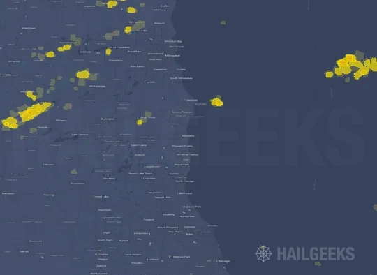
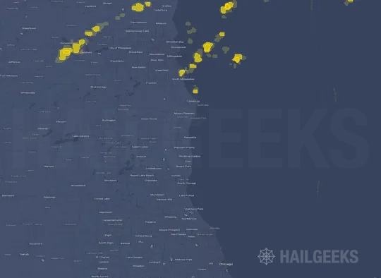

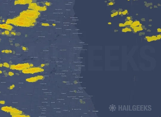
If none of these related Kenosha, WI hail maps look close enough to your property, check a free Hail Report by Address. It reviews hail history for a specific location — not just the broader Kenosha, WI region — so you can check whether hail activity may have reached your property.
Local Hail Review Options Near Kenosha, WI
Not sure whether the June 25, 2024 Kenosha, WI hail map matters for your property? Start with a free Hail Report by Address to see whether hail activity was mapped for that property. If the property signal looks meaningful, you can choose a local pro serving the Kenosha, WI region and ask about a Remote Hail Inspection before deciding whether an on-site roof or exterior review is worth scheduling.
Check a specific property to see whether hail activity from the June 25, 2024 Kenosha, WI event — or another recent hail event — may have been mapped at that address.
Find a roof or exterior pro serving the Kenosha, WI region who can help you understand what the property hail signal may mean.
A participating local pro reviews property-level hail history remotely — not just the June 25, 2024 event — to help decide whether an on-site inspection may be worth scheduling.
A free Hail Report by Address and a Remote Hail Inspection can help you look beyond the June 25, 2024 hail map visuals alone. They do not confirm property damage and do not replace an on-site inspection for a property in the Kenosha, WI region, but they can help you make a more informed next decision before anyone climbs on the roof.
Frequently Asked Questions
Common questions about the June 25, 2024 Kenosha, WI hail event.