

Hail Swath Map Preview
The Chattanooga, TN hail swath map preview was last reviewed on August 29, 2026 and shows mapped hail estimates up to 1.50". There are 4 public hail reports, 49 public wind reports, and 0 nearby tornado reports listed for the August 17, 2024 event.
View the August 17, 2024 Chattanooga, TN hail event on the free interactive hail map, then check a free Hail Report by ZIP to see a more local hail signal for your area.
Impact Area and Population for the Chattanooga, TN Hail Map
The August 17, 2024 hail swath map for Chattanooga, TN covers approximately 1,666 square miles and includes an estimated 212,235 people inside the mapped footprint. The largest mapped area is in the 0.50-0.75" hail band, covering 631 square miles. The highest estimated population exposure is in the < 0.50" hail band with 82,102 people.
| Mapped Hail Band | Impact Area | Population |
|---|---|---|
| < 0.50" | 607 sq mi | 82,102 |
| 0.50-0.75" | 631 sq mi | 79,691 |
| 0.75-1.00" | 288 sq mi | 33,851 |
| 1.00-1.25" | 117 sq mi | 14,173 |
| 1.25-1.50" | 22 sq mi | 2,409 |
| 1.50-1.75" | 2 sq mi | 9 |
Get a free Hail Report by ZIP to see a more local hail signal and whether the August 17, 2024 Chattanooga, TN hail event may have reached your area.
Housing Exposure Inside the Chattanooga, TN Hail Swath Map
Inside the August 17, 2024 hail swath map area for Chattanooga, TN, HailGeeks estimates 89,037 single-family homes, 4,263 townhomes, and 23,125 multifamily properties within the mapped storm footprint. Single-family-home exposure is highest in the < 0.50" hail band, with 35,067 single-family homes.
| Mapped Hail Band | Single-Family | Townhomes | Multifamily |
|---|---|---|---|
| < 0.50" | 35,067 | 1,738 | 9,979 |
| 0.50-0.75" | 32,781 | 1,496 | 9,493 |
| 0.75-1.00" | 13,767 | 815 | 2,828 |
| 1.00-1.25" | 6,408 | 186 | 672 |
| 1.25-1.50" | 1,009 | 28 | 152 |
| 1.50-1.75" | 5 | 0 | 1 |
Use this table to review housing exposure by hail band for the August 17, 2024 Chattanooga, TN hail map. To check a specific property more closely, use a free Hail Report by Address.
Counties Inside the Chattanooga, TN Hail Map
Hail from the August 17, 2024 storm was mapped across 28 counties in the Chattanooga, TN region. Franklin County, TN had the strongest mapped signal, peaking at 1.50" with roughly 773 single-family homes inside the swath.
County pages group every mapped hail event in the area. For a closer look, drop to the city or ZIP level below, or run a free Hail Report by Address.
Cities Inside the Chattanooga, TN Hail Map
Zooming in, the swath touched 39 cities near Chattanooga, TN. Dalton, GA had the strongest mapped signal at 1.00", with an estimated 7,274 single-family homes exposed.
City cards show where the August 17, 2024 Chattanooga, TN hail activity was mapped, but your ZIP can show a closer local signal. Get a free Hail Report by ZIP, and if the signal looks meaningful, ask a local pro about a Remote Hail Inspection to see whether an on-site roof or exterior review may be worth scheduling.
ZIP Codes Inside the Chattanooga, TN Hail Swath Map
At the ZIP level, the August 17, 2024 Chattanooga, TN hail map spans 90 ZIP codes. ZIP 37376 shows the strongest local signal, with mapped hail estimates up to 1.50" and an estimated single-family-home exposure of 189.
Check your ZIP in seconds to see whether hail activity from the August 17, 2024 Chattanooga, TN event was mapped near your area.
Public Hail, Wind, and Tornado Reports
Public storm report tables connected to the August 17, 2024 hail map for Chattanooga, TN currently list 4 public hail reports, 49 public wind reports, and 0 tornado reports.
| Date & Time | Hail Size | City | State | Description |
|---|---|---|---|---|
August 17, 2024 2:30 PM CT |
1.00 in | East Brainerd | TN | Social Media report of quarter sized hail in East Brainerd. Time estimated from radar. |
August 17, 2024 2:47 PM CT |
1.00 in | 1 S Trenton | GA | Hail from the size of pennies to quarters was reported at the intersection of Hickory Street and Poplar Avenue. |
August 17, 2024 3:49 PM CT |
1.00 in | 3 N Tilton | GA | Report from mPING: Quarter (1.00 in.). |
August 17, 2024 3:51 PM CT |
1.50 in | 3 SE Dalton | GA | Report from mPING: Ping Pong Ball (1.50 in.). |
| Date & Time | Wind Speed | City | State | Description |
|---|---|---|---|---|
August 18, 2024 4:48 AM CT | 1 NW Marblehill | GA | Per local EMC there was a broken and downed powerline along McClain Mountain Rd NW of Marblehill Georgia. | |
August 17, 2024 2:05 PM CT | 6 SSW Chattanooga | TN | Power Poles down on Rossville Blvd. Location approximate from dispatch. | |
August 17, 2024 2:10 PM CT | 3 NNE South Pittsburg | TN | Trees down in Jasper Highlands community. Time estimated from radar. | |
August 17, 2024 2:17 PM CT | 6 WNW Estill Springs | TN | Trees were reported down on Highway 130. Time estimated by radar. | |
August 17, 2024 2:18 PM CT | 5 NW Estill Springs | TN | Trees were reported down on Rock Creek Road. Time estimated by radar. | |
August 17, 2024 2:20 PM CT | Jasper | TN | Trees down in the Jasper area and elsewhere in the county. | |
August 17, 2024 2:26 PM CT | 3 N Estill Springs | TN | Trees were reported down on Spring Creek Road. Time estimated by radar. | |
August 17, 2024 2:26 PM CT | 1 WSW Dutton | AL | A tree was reported down at the 3000 block of Alabama Highway 71. Time estimated by radar. | |
August 17, 2024 2:30 PM CT | Whitwell | TN | Trees down in the Whitwell area. Time estimated from radar. | |
August 17, 2024 2:33 PM CT | 8 SE Cowan | TN | Trees were reported down in Sherwood. Time estimated by radar. | |
August 17, 2024 2:33 PM CT | 12 SSE Cowan | TN | Two trees were reported down blocking a lane of TN Highway 56 near the railroad tracks. in Sherwood. Time estimated by radar. | |
August 17, 2024 2:36 PM CT | 1 WSW Stephensville | GA | A tree was reported down across Fuller Road. | |
August 17, 2024 2:36 PM CT | 2 NW Stephensville | GA | A tree was reported down across Hartline Road. | |
August 17, 2024 2:36 PM CT | Lone Oak | TN | Trees down in the Lone Oak area. Time estimated from radar. | |
August 17, 2024 2:40 PM CT | 2 NE Signal Mountain | TN | Trees down in the Walden and Fairmont area. Time estimated from radar. | |
August 17, 2024 2:50 PM CT | 1 NW Flint Springs | TN | Trees down on Blue Springs Road near Hungry Hollow Road. Trees down on Dalton Pike Hwy 60 in the Flint Springs area. Time estimated from radar. | |
August 17, 2024 2:50 PM CT | 4 WNW Middle Valley | TN | Power Lines down southwest of Soddy Daisy. Time estimated from radar. Location Roberts Mill Road and Levi Road. | |
August 17, 2024 3:02 PM CT | 5 ESE Bridgeport | AL | A tree was reported down on CR 297. Time estimated by radar. | |
August 17, 2024 3:03 PM CT | 4 NNW Skyline | AL | A tree was knocked down onto a power line. Time estimated by radar. | |
August 17, 2024 3:04 PM CT | 6 ESE Bridgeport | AL | A tree was knocked down onto power lines at the intersection of CR 290 and CR 291. Time estimated by radar. | |
August 17, 2024 3:10 PM CT | Benton | TN | Four to five trees down on Etowah Road or Hwy 411 in Benton. Time estimated from radar. | |
August 17, 2024 3:10 PM CT | 2 NNE Ocoee | TN | One tree down and Power lines down in Ocoee TN. Time estimated by radar. | |
August 17, 2024 3:15 PM CT | 2 SW Varnell | GA | Power line and transformer downed along Princess Drive. | |
August 17, 2024 3:25 PM CT | 1 SSE Varnell | GA | Tree down across the roadway near the intersection of Meers Rd and Durham St. | |
August 17, 2024 3:28 PM CT | 3 SE Cohutta | GA | Tree reported down across the road near the intersection of McGaughey Chapel Rd and Wilson Rd. | |
August 17, 2024 3:30 PM CT | 1 N Dawnville | GA | Tree reported down in the road near the intersection of Dawnville Beaverdal Rd and Renfroe Rd. NE. | |
August 17, 2024 3:30 PM CT | 5 WNW Ider | AL | A tree was knocked down blocking the roadway at 16435 Alabama Highway 71. Time estimated by radar. | |
August 17, 2024 3:40 PM CT | 3 ESE Wood Station | GA | Large tree blocking both lanes of traffic near the intersection of Kala Wy and Old Ringgold Rd. | |
August 17, 2024 3:44 PM CT | 1 E Dawnville | GA | Tree downed along Wiggins Road NE blocking both lanes. | |
August 17, 2024 3:44 PM CT | 1 ESE Epworth | GA | Tree downed along Galloway Road SE of Hwy 5. | |
August 17, 2024 3:45 PM CT | 3 NW Mill Creek | GA | Tree reported down across the road near the intersection of Lafayette Rd and McArthur Rd. | |
August 17, 2024 3:47 PM CT | 1 ESE Dawnville | GA | Several Trees down at Goswick Rd and Mitchell Bridge Rd. | |
August 17, 2024 3:52 PM CT | 3 SW Fort Payne | AL | A tree was reported down at 1000 Godfrey South in Fort Payne. Time estimated by radar. | |
August 17, 2024 3:53 PM CT | 1 SE Fort Payne | AL | A tree was knocked down onto a home near Highway 35 in the Little River Canyon area. More specific location not available. Time estimated by radar. | |
August 17, 2024 3:56 PM CT | 5 SW Center Post | GA | Large tree down along roadway at the intersection of Hemphill Rd and Old Teloga Crossroads. | |
August 17, 2024 3:56 PM CT | 1 WNW Menlo | GA | Tree down across Highway 48 NW of the city of Menlo. | |
August 17, 2024 4:00 PM CT | 4 SSW Subligna | GA | Tree down along Farmersville Rd near the intersection of Mustang Dr and Farmersville Rd. | |
August 17, 2024 4:00 PM CT | 2 NW Tidings | GA | Tree down partially blocking John Jones Rd near the town of Summerville. | |
August 17, 2024 4:00 PM CT | 2 S Trion | GA | Tree limbs knocked down powerlines along Rena Street. | |
August 17, 2024 4:14 PM CT | 1 W Cedar Bluff | AL | A tree was blown down and blocking the road on Cedar Street. | |
August 17, 2024 4:15 PM CT | 3 NE Sand Rock | AL | A tree was blown down and blocking the roadway on CR 52 in Tuckers Chapel. | |
August 17, 2024 4:21 PM CT | 2 NNE Yellow Creek Fall | AL | Trees down blocking the roadway on CR 43 in Tuckers Chapel. | |
August 17, 2024 4:22 PM CT | 2 WSW Broomtown | AL | Trees were blown down and blocking the roadway on CR 143. | |
August 17, 2024 4:33 PM CT | 2 NNE Blaine | GA | Powerlines down leading to road closure along Swan Bridge Road NW of Talking Rock. | |
August 17, 2024 4:33 PM CT | Blaine | GA | Powerlines down leading to road closure at the intersection of Swan Bridge Road and Creek Bank Drive. | |
August 17, 2024 4:48 PM CT | 1 NW Marblehill | GA | Corrects previous tstm wnd dmg report from 1 NW Marblehill. Per local EMC there was a broken and downed powerline along McClain Mountain Rd NW of Marblehill Georgia. | |
August 17, 2024 4:49 PM CT | Jasper | GA | Public reports a tree down near the Woodbridge Inn and Tavern. | |
August 17, 2024 4:55 PM CT | 1 NNW Talmadge | GA | Tree downed at the intersection of Carlan Rd and Roper Rd blocking lanes. | |
August 17, 2024 5:02 PM CT | Waleska | GA | A tree was downed on Fincher Rd at Reinhardt College Pkwy. |
| Date & Time | Rating | City | State | Description |
|---|---|---|---|---|
| No public tornado reports are available for this event. | ||||
This table includes only public storm reports connected to the August 17, 2024 Chattanooga, TN storm event. When available, each report may include the time, size or magnitude, city, state, and a short description.
Related Hail Maps in the Chattanooga, TN Region
We found 6 more hail maps with reports from the same Chattanooga, TN region as the August 17, 2024 event. These related maps cover storm dates from Jul 17, 2024 through Aug 16, 2024, with mapped hail estimates ranging from 0.75" to 1.50". In this set, the strongest related map reached 1.50", and the most recent map shown is from Aug 16, 2024.
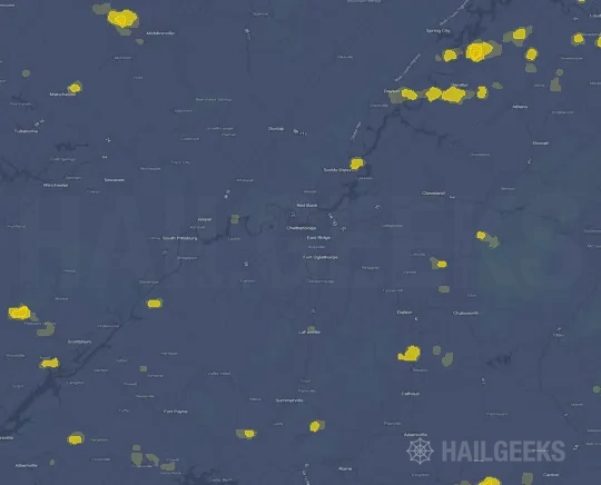


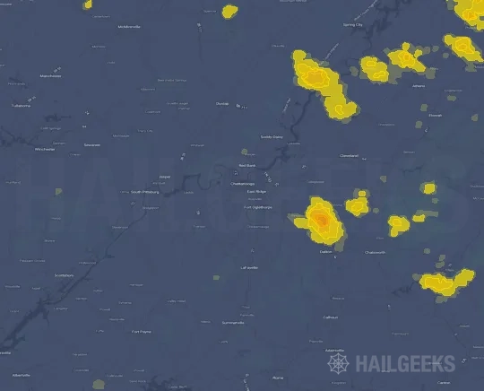

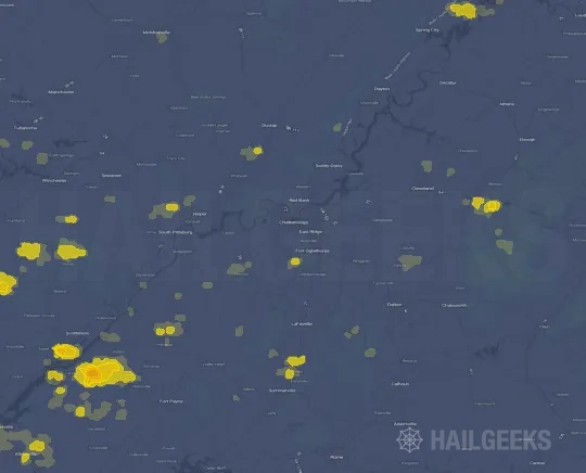
If none of these related Chattanooga, TN hail maps look close enough to your property, check a free Hail Report by Address. It reviews hail history for a specific location — not just the broader Chattanooga, TN region — so you can check whether hail activity may have reached your property.
Local Hail Review Options Near Chattanooga, TN
Not sure whether the August 17, 2024 Chattanooga, TN hail map matters for your property? Start with a free Hail Report by Address to see whether hail activity was mapped for that property. If the property signal looks meaningful, you can choose a local pro serving the Chattanooga, TN region and ask about a Remote Hail Inspection before deciding whether an on-site roof or exterior review is worth scheduling.
Check a specific property to see whether hail activity from the August 17, 2024 Chattanooga, TN event — or another recent hail event — may have been mapped at that address.
Find a roof or exterior pro serving the Chattanooga, TN region who can help you understand what the property hail signal may mean.
A participating local pro reviews property-level hail history remotely — not just the August 17, 2024 event — to help decide whether an on-site inspection may be worth scheduling.
A free Hail Report by Address and a Remote Hail Inspection can help you look beyond the August 17, 2024 hail map visuals alone. They do not confirm property damage and do not replace an on-site inspection for a property in the Chattanooga, TN region, but they can help you make a more informed next decision before anyone climbs on the roof.
Frequently Asked Questions
Common questions about the August 17, 2024 Chattanooga, TN hail event.