

Hail Swath Map Preview
The Kankakee, IL hail swath map preview was last reviewed on August 29, 2026 and shows mapped hail estimates up to 0.75". There are 5 public hail reports, 20 public wind reports, and 8 nearby tornado reports listed for the March 19, 2025 event.
View the March 19, 2025 Kankakee, IL hail event on the free interactive hail map, then check a free Hail Report by ZIP to see a more local hail signal for your area.
Impact Area and Population for the Kankakee, IL Hail Map
The March 19, 2025 hail swath map for Kankakee, IL covers approximately 239 square miles and includes an estimated 57,755 people inside the mapped footprint. The largest mapped area is in the < 0.50" hail band, covering 149 square miles. The highest estimated population exposure is in the < 0.50" hail band with 48,557 people.
| Mapped Hail Band | Impact Area | Population |
|---|---|---|
| < 0.50" | 149 sq mi | 48,557 |
| 0.50-0.75" | 72 sq mi | 8,651 |
| 0.75-1.00" | 18 sq mi | 547 |
Get a free Hail Report by ZIP to see a more local hail signal and whether the March 19, 2025 Kankakee, IL hail event may have reached your area.
Housing Exposure Inside the Kankakee, IL Hail Swath Map
Inside the March 19, 2025 hail swath map area for Kankakee, IL, HailGeeks estimates 21,884 single-family homes, 2,406 townhomes, and 5,993 multifamily properties within the mapped storm footprint. Single-family-home exposure is highest in the < 0.50" hail band, with 18,142 single-family homes.
| Mapped Hail Band | Single-Family | Townhomes | Multifamily |
|---|---|---|---|
| < 0.50" | 18,142 | 2,022 | 5,418 |
| 0.50-0.75" | 3,478 | 377 | 553 |
| 0.75-1.00" | 264 | 7 | 22 |
Use this table to review housing exposure by hail band for the March 19, 2025 Kankakee, IL hail map. To check a specific property more closely, use a free Hail Report by Address.
Counties Inside the Kankakee, IL Hail Map
Hail from the March 19, 2025 storm was mapped across 6 counties in the Kankakee, IL region. Kankakee County, IL had the strongest mapped signal, peaking at 0.75" with roughly 8,013 single-family homes inside the swath.
County pages group every mapped hail event in the area. For a closer look, drop to the city or ZIP level below, or run a free Hail Report by Address.
Cities Inside the Kankakee, IL Hail Map
Zooming in, the swath touched 5 cities near Kankakee, IL. Bourbonnais, IL had the strongest mapped signal at 0.50", with an estimated 2,623 single-family homes exposed.
City cards show where the March 19, 2025 Kankakee, IL hail activity was mapped, but your ZIP can show a closer local signal. Get a free Hail Report by ZIP, and if the signal looks meaningful, ask a local pro about a Remote Hail Inspection to see whether an on-site roof or exterior review may be worth scheduling.
ZIP Codes Inside the Kankakee, IL Hail Swath Map
At the ZIP level, the March 19, 2025 Kankakee, IL hail map spans 9 ZIP codes. ZIP 60901 shows the strongest local signal, with mapped hail estimates up to 0.75" and an estimated single-family-home exposure of 1,595.
Check your ZIP in seconds to see whether hail activity from the March 19, 2025 Kankakee, IL event was mapped near your area.
Public Hail, Wind, and Tornado Reports
Public storm report tables connected to the March 19, 2025 hail map for Kankakee, IL currently list 5 public hail reports, 20 public wind reports, and 8 tornado reports.
| Date & Time | Hail Size | City | State | Description |
|---|---|---|---|---|
March 19, 2025 5:06 PM CT |
1.00 in | 1 NE Romeoville | IL | Romeoville EMA called in a report of quarter sized with the passing storm. |
March 19, 2025 5:18 PM CT |
1.00 in | 2 E Lemont | IL | Report from mPING: Quarter (1.00 in.). |
March 19, 2025 5:30 PM CT |
1.00 in | 1 W Kankakee | IL | No National Weather Service description provided. |
March 19, 2025 5:30 PM CT |
1.25 in | 1 W Oak Lawn | IL | Report from mPING: Half Dollar (1.25 in.). Time estimated from radar. |
March 19, 2025 5:33 PM CT |
1.25 in | 1 W Hometown | IL | Report from mPING: Half Dollar (1.25 in.). Time estimated from radar. |
| Date & Time | Wind Speed | City | State | Description |
|---|---|---|---|---|
March 19, 2025 3:57 PM CT | 1 N Streator | IL | Power lines down and tree branches broken. Time estimated by radar. | |
March 19, 2025 4:30 PM CT | Chenoa | IL | Power outages from strong winds and small hail. | |
March 19, 2025 4:32 PM CT | 8 SSE Graymont | IL | Semi overturned on I-55 southbound south of mile marker 191. Relayed by broadcast media. | |
March 19, 2025 4:53 PM CT | 1 SE Plainfield | IL | 6 inch diameter limbs down on route 30 before route 59. | |
March 19, 2025 5:27 PM CT | Michigan City | IN | Photos passed along from media showing several large downed trees in Michigan City. Time estimated by radar. | |
March 19, 2025 5:28 PM CT | Steger | IL | Roof torn off industrial building. Report via social media. Time estimated by radar. | |
March 19, 2025 5:42 PM CT | 1 SSE Highland | IN | Three trees uprooted on houses on Forrest Dr. Via social media. Time estimated by radar. | |
March 19, 2025 5:47 PM CT | 2 WSW Gary | IN | Branches down. Garage collapsed. Roof damage. Power pole damage. Time estimated by radar. Reports from emergency management and social media. | |
March 19, 2025 6:27 PM CT | Michigan City | IN | Corrects time of previous tstm wnd dmg report from Michigan City. Photos passed along from media showing several large downed trees in Michigan City. Time estimated by radar. | |
March 19, 2025 6:50 PM CT | 1 ESE Waterford | IN | Trained spotter reports a tree blown down into power lines due to strong straight line winds southeast of Waterford at 675 W 400 N in La Porte County Indiana. | |
March 19, 2025 3:55 PM CT | 59 mph | 1 N Ancona | IL | Reported by a personal weather station. |
March 19, 2025 4:23 PM CT | 65 mph | 9 S Flanagan | IL | Measured by an Ambient Weather station. |
March 19, 2025 4:45 PM CT | 60 mph | 1 ESE Channahon | IL | Reported by personal weather station KILMORRI23. |
March 19, 2025 4:47 PM CT | 58 mph | 3 NE Fairbury | IL | Measured by an Ambient Weather Station. Outflow associated with a thunderstorm just to the northwest. |
March 19, 2025 4:51 PM CT | 60 mph | 4 W Cullom | IL | Measured by an Ambient Weather station. |
March 19, 2025 4:54 PM CT | 67 mph | 3 SE Batavia | IL | Reported by personal weather station KILAUROR58. |
March 19, 2025 5:10 PM CT | 60 mph | 1 SSW Buckley | IL | No National Weather Service description provided. |
March 19, 2025 5:15 PM CT | 59 mph | 6 NW Peotone | IL | Reported by personal weather station west of Monee. |
March 19, 2025 5:29 PM CT | 71 mph | 1 SSW Park Forest | IL | Reported by personal weather station KILPARKF15. |
March 19, 2025 6:18 PM CT | 64 mph | 3 NE Beverly Shores | IN | Measured at the Michigan City GLERL site. |
| Date & Time | Rating | City | State | Description |
|---|---|---|---|---|
March 19, 2025 5:00 PM CT | UNK | 1 E Preston Heights | IL | Damage surveys confirmed an EF-0 tornado. A tornado touched down just southeast of the intersection of Rowell Avenue and Eunice Avenue. This brief tornado moved east northeast across Eunice Road... causing shingle damage to one house and uprooting a few trees. Metal panels and pieces of a car port were blown to the northeast at least 200 yards... and one vehicle was blown over. Peak winds were estimated at 75 mph. This tornado dissipated near Howliston Court. |
March 19, 2025 5:18 PM CT | UNK | 2 SSE Frankfort Square | IL | Damage surveys confirmed an EF-0 tornado. A tornado briefly touched down near Sauk Trail near the Sauk Trail Forest Preserve in Frankfort. This tornado moved to the north northeast into a residential area along Shetland Drive and Troon Circle. Damage was mostly confined to broken branches and a few small uprooted trees. Peak winds were estimated at 65 mph. The tornado dissipated just past this neighborhood near Harlem Avenue. |
March 19, 2025 5:28 PM CT | UNK | 1 WSW Steger | IL | Damage surveys confirmed an EF-1 tornado. A tornado touched down near Kings Road south of Richton Road in Steger. This tornado moved east northeast toward Richton Road... intensified briefly... causing damage to shingles at multiple houses. Wind speed was estimated up to 80 mph in this area. The tornado continued east northeast through residential areas... weakening slightly... with damage mostly confined to broken branches. The tornado again intensified briefly as it neared IL-1 where a large section of metal roof panels was removed from a metal warehouse building. Wind speeds were estimated at 90 mph in this area. Debris from the warehouse was blown across nearby railroad tracks. The tornado weakened as it moved into another residential area... with damage confined to broken branches. The tornado dissipated near Hereford Avenue and Durham Drive. |
March 19, 2025 5:35 PM CT | UNK | 1 WSW Lynwood | IL | Damage surveys confirmed an EF-0 tornado. A tornado touched down near Joe Orr Road west of Torrence Avenue in Lynwood. This brief tornado caused damage to the roof of two industrial buildings with winds estimated at 85 mph. Pieces of debris were blown onto Torrence Avenue. The tornado dissipated shortly after it crossed Torrence Avenue. |
March 19, 2025 5:43 PM CT | UNK | 1 SW Highland | IN | Damage surveys confirmed an EF-0 tornado. A tornado touched down just northwest of the intersection of US-41 and 45th Street in Highland. This tornado first caused damage to the roof of a commercial building on US-41... then continued east northeast into a residential area near Merkley Elementary School where damage was mostly small branches broken and a few instances of shingle damage. The tornado briefly intensified as it neared Forrest Drive and Sac Drive... with a few trees uprooted and multiple large branches broken. One large tree was uprooted onto a house... causing roof damage. Winds were estimated at 85 mph in this neighborhood. Fences were also damaged in the vicinity. The tornado continued northeast toward the residential area near Southridge Elementary School... where damage was mostly confined to small branches. The tornado dissipated near Wirth Road just west of Kleinman Road. |
March 19, 2025 5:46 PM CT | UNK | 2 NNE Griffith | IN | Damage surveys confirmed an EF-0 tornado. A tornado touched down near West 29th Place... just east of Colfax Street in Gary. This brief tornado uprooted two large trees with estimated winds of 75 mph... as well as blowing out the glass doors at the entrance of the Hard Rock Casino. The tornado dissipated shortly after passing the casino before Burr Street. |
March 19, 2025 5:47 PM CT | UNK | 3 WSW Gary | IN | *** 1 INJ *** Damage surveys confirmed an EF-1 tornado. A tornado touched down near Morton Street between West 23rd Avenue and West 22nd Plaza in Gary. This brief tornado ripped a portion of the gymnasium roof off of Frankie Woods McCullough Academy... blew out the garage and ripped off the roofs of several homes on West 21st Avenue... as well as bent several power poles and light fixtures. Officials reported an adult female was injured due to part of the roof collapsing onto them. They were taken to the hospital and were reported to be in stable condition. The tornado dissipated just before the New Revelation Baptist Church on West 21st Avenue... just before Chase Street. |
March 19, 2025 5:50 PM CT | UNK | 1 SW Gary | IN | Damage surveys confirmed an EF-0 tornado. A tornado touched down near Norton Park... just south of West 13th Avenue in Gary. This brief tornado blew tree debris across roadways and uprooted several small trees east of the Gary Business District with estimated winds of 73 mph. The tornado dissipated around MLK Drive... just north of East 7th Avenue before reaching the Dunes Highway. |
This table includes only public storm reports connected to the March 19, 2025 Kankakee, IL storm event. When available, each report may include the time, size or magnitude, city, state, and a short description.
Related Hail Maps in the Kankakee, IL Region
We found 6 more hail maps with reports from the same Kankakee, IL region as the March 19, 2025 event. These related maps cover storm dates from Jul 31, 2024 through Sep 16, 2024, with mapped hail estimates ranging from 0.75" to 1.50". In this set, the strongest related map reached 1.50", and the most recent map shown is from Sep 16, 2024.

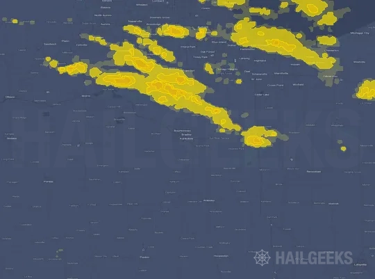


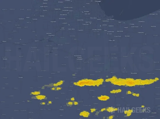

If none of these related Kankakee, IL hail maps look close enough to your property, check a free Hail Report by Address. It reviews hail history for a specific location — not just the broader Kankakee, IL region — so you can check whether hail activity may have reached your property.
Local Hail Review Options Near Kankakee, IL
Not sure whether the March 19, 2025 Kankakee, IL hail map matters for your property? Start with a free Hail Report by Address to see whether hail activity was mapped for that property. If the property signal looks meaningful, you can choose a local pro serving the Kankakee, IL region and ask about a Remote Hail Inspection before deciding whether an on-site roof or exterior review is worth scheduling.
Check a specific property to see whether hail activity from the March 19, 2025 Kankakee, IL event — or another recent hail event — may have been mapped at that address.
Find a roof or exterior pro serving the Kankakee, IL region who can help you understand what the property hail signal may mean.
A participating local pro reviews property-level hail history remotely — not just the March 19, 2025 event — to help decide whether an on-site inspection may be worth scheduling.
A free Hail Report by Address and a Remote Hail Inspection can help you look beyond the March 19, 2025 hail map visuals alone. They do not confirm property damage and do not replace an on-site inspection for a property in the Kankakee, IL region, but they can help you make a more informed next decision before anyone climbs on the roof.
Frequently Asked Questions
Common questions about the March 19, 2025 Kankakee, IL hail event.