
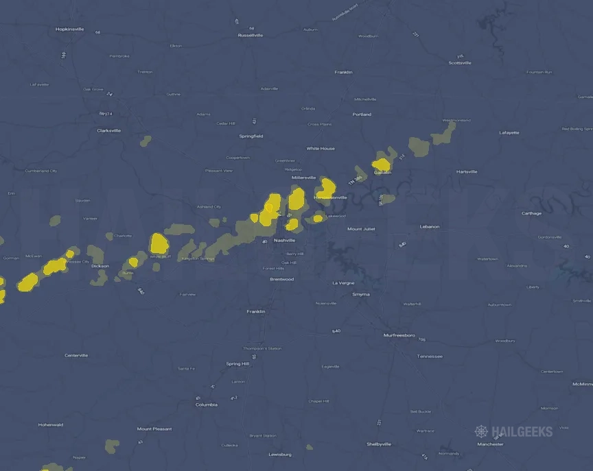
Hail Swath Map Preview
The Nashville, TN hail swath map preview was last reviewed on August 29, 2026 and shows mapped hail estimates up to 0.75". There are 0 public hail reports, 50 public wind reports, and 1 nearby tornado reports listed for the April 5, 2025 event.
View the April 5, 2025 Nashville, TN hail event on the free interactive hail map, then check a free Hail Report by ZIP to see a more local hail signal for your area.
Impact Area and Population for the Nashville, TN Hail Map
The April 5, 2025 hail swath map for Nashville, TN covers approximately 306 square miles and includes an estimated 118,329 people inside the mapped footprint. The largest mapped area is in the < 0.50" hail band, covering 227 square miles. The highest estimated population exposure is in the < 0.50" hail band with 80,965 people.
| Mapped Hail Band | Impact Area | Population |
|---|---|---|
| < 0.50" | 227 sq mi | 80,965 |
| 0.50-0.75" | 78 sq mi | 37,091 |
| 0.75-1.00" | 2 sq mi | 273 |
Get a free Hail Report by ZIP to see a more local hail signal and whether the April 5, 2025 Nashville, TN hail event may have reached your area.
Housing Exposure Inside the Nashville, TN Hail Swath Map
Inside the April 5, 2025 hail swath map area for Nashville, TN, HailGeeks estimates 50,109 single-family homes, 4,087 townhomes, and 21,768 multifamily properties within the mapped storm footprint. Single-family-home exposure is highest in the < 0.50" hail band, with 34,040 single-family homes.
| Mapped Hail Band | Single-Family | Townhomes | Multifamily |
|---|---|---|---|
| < 0.50" | 34,040 | 3,036 | 15,864 |
| 0.50-0.75" | 15,918 | 1,047 | 5,893 |
| 0.75-1.00" | 151 | 4 | 11 |
Use this table to review housing exposure by hail band for the April 5, 2025 Nashville, TN hail map. To check a specific property more closely, use a free Hail Report by Address.
Counties Inside the Nashville, TN Hail Map
Hail from the April 5, 2025 storm was mapped across 9 counties in the Nashville, TN region. Davidson County, TN had the strongest mapped signal, peaking at 0.75" with roughly 28,265 single-family homes inside the swath.
County pages group every mapped hail event in the area. For a closer look, drop to the city or ZIP level below, or run a free Hail Report by Address.
Cities Inside the Nashville, TN Hail Map
Zooming in, the swath touched 5 cities near Nashville, TN. Hendersonville, TN had the strongest mapped signal at 0.50", with an estimated 6,914 single-family homes exposed.
City cards show where the April 5, 2025 Nashville, TN hail activity was mapped, but your ZIP can show a closer local signal. Get a free Hail Report by ZIP, and if the signal looks meaningful, ask a local pro about a Remote Hail Inspection to see whether an on-site roof or exterior review may be worth scheduling.
ZIP Codes Inside the Nashville, TN Hail Swath Map
At the ZIP level, the April 5, 2025 Nashville, TN hail map spans 14 ZIP codes. ZIP 37189 shows the strongest local signal, with mapped hail estimates up to 0.75" and an estimated single-family-home exposure of 1,253.
Check your ZIP in seconds to see whether hail activity from the April 5, 2025 Nashville, TN event was mapped near your area.
Public Hail, Wind, and Tornado Reports
Public storm report tables connected to the April 5, 2025 hail map for Nashville, TN currently list 0 public hail reports, 50 public wind reports, and 1 tornado reports.
| Date & Time | Hail Size | City | State | Description |
|---|---|---|---|---|
| No public hail reports are available for this event. | ||||
| Date & Time | Wind Speed | City | State | Description |
|---|---|---|---|---|
April 5, 2025 3:56 PM CT | 9 SSE Mcewen | TN | Trees & powerlines were reported downed along Poplar Grove Road in southern Humphreys County. | |
April 5, 2025 3:59 PM CT | 12 SE Waverly | TN | About 15 trees down over a stretch of about 400 yards... including one on a vehicle... along Poplar Grove Rd. near Bucksnort. | |
April 5, 2025 4:15 PM CT | Dickson | TN | Power lines down at the Waffle House and Pilot on Hwy 46 at the I-40 exit... debris on road near Pomona... other trees and power lines down around the area. | |
April 5, 2025 4:16 PM CT | 3 SSW Burns | TN | Multiple power poles damaged. One snapped. | |
April 5, 2025 4:30 PM CT | 3 NW Fairview | TN | Metal workshop and outbuilding significantly damaged... nearby timber damage. | |
April 5, 2025 4:31 PM CT | Kingston Springs | TN | Trees and powerlines down. | |
April 5, 2025 4:40 PM CT | Pegram | TN | Multiple trees down. | |
April 5, 2025 4:42 PM CT | Cross Plains | TN | 2...400+ customers currently without power. | |
April 5, 2025 4:45 PM CT | Fairview | TN | Tree branches snapped out of trees. | |
April 5, 2025 4:46 PM CT | Belle Meade | TN | Large tree down on power lines just past Richland Creek on Clarendon Ave. | |
April 5, 2025 4:48 PM CT | Nashville | TN | Large tree down blocking Cleeces Ferry Rd. and Old Hickory Blvd. | |
April 5, 2025 4:50 PM CT | 1 ENE Kingston Springs | TN | Tree fallen over Kingston Springs Road. | |
April 5, 2025 4:50 PM CT | Nashville | TN | Trees down in Haynes Park. | |
April 5, 2025 4:50 PM CT | 3 NW Inglewood | TN | Multiple downed trees... minor roof damage to home and damage to outbuilding. | |
April 5, 2025 4:54 PM CT | 1 NNW Belle Meade | TN | Large tree reported down on powerlines on Clarendon Ave at Richland Creek. Time approximated by radar. | |
April 5, 2025 4:56 PM CT | 1 NW Berry Hill | TN | A tree was reported down onto a Shell Gas Station next to Zanies on 8th Avenue in Nashville. Time approximated by radar. | |
April 5, 2025 4:58 PM CT | 1 WNW Madison | TN | Tree reported down on a powerline at the corner of Diane Road and Williams Ave in Madison. Time approximated by radar. | |
April 5, 2025 5:00 PM CT | 2 S Goodlettsville | TN | Large tree branches snapped and laying in parking lot at Rivergate Mall. | |
April 5, 2025 5:00 PM CT | 2 ESE Hendersonville | TN | Damage to back yard fence caused by fallen tree. Time estimated based on radar. | |
April 5, 2025 5:00 PM CT | 2 SSE Goodlettsville | TN | Downed stop lights along Gallatin Rd with damage to road signs. | |
April 5, 2025 5:00 PM CT | 2 NW Lakewood | TN | Powerline pole snapped and structure damage on Robinson Rd. Service van also blown over from wind. | |
April 5, 2025 5:00 PM CT | 2 WNW Hendersonville | TN | Major roof damage to buildings along west main street. Metal siding piled up in front of Red Rooster Cafe. | |
April 5, 2025 5:04 PM CT | 1 S Hendersonville | TN | Trees uprooted. | |
April 5, 2025 5:05 PM CT | 4 N Hendersonville | TN | Barn destroyed. Time estimated by RADAR. | |
April 5, 2025 5:06 PM CT | Goodlettsville | TN | Several trees down across Rivergate Pkwy. | |
April 5, 2025 5:07 PM CT | 3 NE Hendersonville | TN | Trees down... shutters damaged. Time estimated from RADAR. | |
April 5, 2025 5:08 PM CT | 2 WNW Hendersonville | TN | Roof was peeled off of a building along Main Street... close to Jolly Ollies in Hendersonville. Time approximated by radar. | |
April 5, 2025 5:08 PM CT | Hendersonville | TN | A few trees down at the 1100 block on Whitely Pl. | |
April 5, 2025 5:08 PM CT | 5 N Hendersonville | TN | Fence was downed in the Durham Farms community in Hendersonville. Time approximated by radar. | |
April 5, 2025 5:10 PM CT | 2 NNE Lakewood | TN | Trees and powerlines down at Curtis Crossroads & Roberta Drive... forcing the closure of the road. Time approximated by radar. | |
April 5, 2025 5:10 PM CT | 2 NE Hendersonville | TN | Tree down on home along Tyne Bay Drive in Hendersonville. Time approximated by radar. | |
April 5, 2025 5:12 PM CT | Gallatin | TN | Trees down near Hwy 25 behind Cambridge Farms. | |
April 5, 2025 5:15 PM CT | 3 N Mount Juliet | TN | Damage to house fascia and fence paneling. | |
April 5, 2025 5:16 PM CT | 3 NW Gallatin | TN | Trees uprooted along Highway 25 behind Cambridge Farms in Gallatin. Time approximated by radar. | |
April 5, 2025 5:16 PM CT | 10 NW Lebanon | TN | Trees and power lines down along Hwy 109 in Laguardo. | |
April 5, 2025 5:16 PM CT | 5 SW Gallatin | TN | Several large trees down in Rivermont off Douglas Bend in Gallatin. Time approximated by radar. | |
April 5, 2025 5:16 PM CT | 1 W Gallatin | TN | Tree was reported down on a home near the Aldis in Gallatin. Time approximated by radar. | |
April 5, 2025 5:18 PM CT | 7 S Gallatin | TN | Numerous trees down... damage to carports and shingles blown of houses. A barn damaged. | |
April 5, 2025 5:22 PM CT | 8 E Gallatin | TN | Multiple houses with trees on them along the 1100 block of Bledsoe Dr. in Castalian Springs. | |
April 5, 2025 5:24 PM CT | 3 SSW Scottsville | KY | Multiple trees down near the 3900 block of Old Gallatin Road. | |
April 5, 2025 5:26 PM CT | Bethpage | TN | Roof partially blown off a detached garage at 630 Bass Rd. | |
April 5, 2025 5:27 PM CT | 2 E Scottsville | KY | Multiple trees and power poles down near the 400 block of Brownsford Road. | |
April 5, 2025 5:28 PM CT | Lebanon | TN | Large tree down across the road along the 900 block of Maple Hill. | |
April 5, 2025 5:34 PM CT | Hartsville | TN | Trees down blocking roads... also two barns with roof damage. One on Halltown Rd.... one on Pumpkin Branch Rd. | |
April 5, 2025 5:49 PM CT | 1 W Tracy | KY | Roof of a barn torn off and throw about 75 yards. | |
April 5, 2025 5:53 PM CT | Red Boiling Spring | TN | Heavy roof damage to a garage. | |
April 5, 2025 5:55 PM CT | Red Boiling Spring | TN | Roof of a tin shed was peeled off in Red Boiling Springs. Time approximated by radar. | |
April 5, 2025 6:39 PM CT | 3 NNE Gallatin | TN | Damage to wooden fencing... multiple downed trees and power lines. | |
April 5, 2025 5:05 PM CT | 67 mph | Nashville | TN | BNA gusted to 58 kts. |
April 5, 2025 5:08 PM CT | 60 mph | Hendersonville | TN | Estimated 60+ mph near Indian Lake and Main. |
| Date & Time | Rating | City | State | Description |
|---|---|---|---|---|
April 5, 2025 4:15 PM CT | UNK | 1 SSW Dickson | TN | NWS Nashville confirmed a brief EF0 touchdown near Dickson with peak winds of 85 mph. |
This table includes only public storm reports connected to the April 5, 2025 Nashville, TN storm event. When available, each report may include the time, size or magnitude, city, state, and a short description.
Related Hail Maps in the Nashville, TN Region
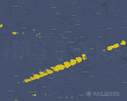
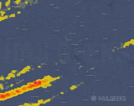
We found 6 more hail maps with reports from the same Nashville, TN region as the April 5, 2025 event. These related maps cover storm dates from Mar 13, 2025 through Apr 4, 2025, with mapped hail estimates ranging from 1.00" to 2.75". In this set, the strongest related map reached 2.75", and the most recent map shown is from Apr 4, 2025.




If none of these related Nashville, TN hail maps look close enough to your property, check a free Hail Report by Address. It reviews hail history for a specific location — not just the broader Nashville, TN region — so you can check whether hail activity may have reached your property.
Local Hail Review Options Near Nashville, TN
Not sure whether the April 5, 2025 Nashville, TN hail map matters for your property? Start with a free Hail Report by Address to see whether hail activity was mapped for that property. If the property signal looks meaningful, you can choose a local pro serving the Nashville, TN region and ask about a Remote Hail Inspection before deciding whether an on-site roof or exterior review is worth scheduling.
Check a specific property to see whether hail activity from the April 5, 2025 Nashville, TN event — or another recent hail event — may have been mapped at that address.
Find a roof or exterior pro serving the Nashville, TN region who can help you understand what the property hail signal may mean.
A participating local pro reviews property-level hail history remotely — not just the April 5, 2025 event — to help decide whether an on-site inspection may be worth scheduling.
A free Hail Report by Address and a Remote Hail Inspection can help you look beyond the April 5, 2025 hail map visuals alone. They do not confirm property damage and do not replace an on-site inspection for a property in the Nashville, TN region, but they can help you make a more informed next decision before anyone climbs on the roof.
Frequently Asked Questions
Common questions about the April 5, 2025 Nashville, TN hail event.