

Hail Swath Map Preview
The Charlottesville, VA hail swath map preview was last reviewed on August 30, 2026 and shows mapped hail estimates up to 1.75". There are 0 public hail reports, 38 public wind reports, and 0 nearby tornado reports listed for the July 27, 2025 event.
View the July 27, 2025 Charlottesville, VA hail event on the free interactive hail map, then check a free Hail Report by ZIP to see a more local hail signal for your area.
Impact Area and Population for the Charlottesville, VA Hail Map
The July 27, 2025 hail swath map for Charlottesville, VA covers approximately 552 square miles and includes an estimated 31,112 people inside the mapped footprint. The largest mapped area is in the < 0.50" hail band, covering 316 square miles. The highest estimated population exposure is in the < 0.50" hail band with 16,610 people.
| Mapped Hail Band | Impact Area | Population |
|---|---|---|
| < 0.50" | 316 sq mi | 16,610 |
| 0.50-0.75" | 176 sq mi | 12,737 |
| 0.75-1.00" | 44 sq mi | 1,361 |
| 1.00-1.25" | 5 sq mi | 123 |
| 1.25-1.50" | 7 sq mi | 197 |
| 1.50-1.75" | 1 sq mi | 38 |
| 1.75-2.00" | 2 sq mi | 46 |
Get a free Hail Report by ZIP to see a more local hail signal and whether the July 27, 2025 Charlottesville, VA hail event may have reached your area.
Housing Exposure Inside the Charlottesville, VA Hail Swath Map
Inside the July 27, 2025 hail swath map area for Charlottesville, VA, HailGeeks estimates 13,477 single-family homes, 775 townhomes, and 2,064 multifamily properties within the mapped storm footprint. Single-family-home exposure is highest in the < 0.50" hail band, with 7,913 single-family homes.
| Mapped Hail Band | Single-Family | Townhomes | Multifamily |
|---|---|---|---|
| < 0.50" | 7,913 | 294 | 464 |
| 0.50-0.75" | 4,761 | 472 | 1,594 |
| 0.75-1.00" | 629 | 7 | 5 |
| 1.00-1.25" | 55 | 1 | 0 |
| 1.25-1.50" | 85 | 0 | 1 |
| 1.50-1.75" | 16 | 1 | 0 |
| 1.75-2.00" | 18 | 0 | 0 |
Use this table to review housing exposure by hail band for the July 27, 2025 Charlottesville, VA hail map. To check a specific property more closely, use a free Hail Report by Address.
Counties Inside the Charlottesville, VA Hail Map
Hail from the July 27, 2025 storm was mapped across 20 counties in the Charlottesville, VA region. Buckingham County, VA had the strongest mapped signal, peaking at 1.75" with roughly 1,384 single-family homes inside the swath.
County pages group every mapped hail event in the area. For a closer look, drop to the city or ZIP level below, or run a free Hail Report by Address.
Cities Inside the Charlottesville, VA Hail Map
Zooming in, the swath touched 4 cities near Charlottesville, VA. Spotsylvania Courthouse, VA had the strongest mapped signal at 0.50", with an estimated 1,634 single-family homes exposed.
City cards show where the July 27, 2025 Charlottesville, VA hail activity was mapped, but your ZIP can show a closer local signal. Get a free Hail Report by ZIP, and if the signal looks meaningful, ask a local pro about a Remote Hail Inspection to see whether an on-site roof or exterior review may be worth scheduling.
ZIP Codes Inside the Charlottesville, VA Hail Swath Map
At the ZIP level, the July 27, 2025 Charlottesville, VA hail map spans 38 ZIP codes. ZIP 23004 shows the strongest local signal, with mapped hail estimates up to 1.75" and an estimated single-family-home exposure of 197.
Check your ZIP in seconds to see whether hail activity from the July 27, 2025 Charlottesville, VA event was mapped near your area.
Public Hail, Wind, and Tornado Reports
Public storm report tables connected to the July 27, 2025 hail map for Charlottesville, VA currently list 0 public hail reports, 38 public wind reports, and 0 tornado reports.
| Date & Time | Hail Size | City | State | Description |
|---|---|---|---|---|
| No public hail reports are available for this event. | ||||
| Date & Time | Wind Speed | City | State | Description |
|---|---|---|---|---|
July 27, 2025 1:38 PM CT | 2 NNW Independent Hill | VA | Trees blew down near the intersection of Marie Drive and Mary Jane Drive. | |
July 27, 2025 2:50 PM CT | 2 SE Rochelle | VA | Scattered tree damage over portions of southern Madison County. A bit more concentrated along South Blue Ridge Turnpike. | |
July 27, 2025 2:50 PM CT | Rapidan | VA | Trees down near the Rapidan Dam | |
July 27, 2025 2:57 PM CT | 1 NNW Chancellorsville | VA | Trees reported down on Elys Ford Road near Bullock Road. | |
July 27, 2025 3:00 PM CT | 2 WSW Barboursville | VA | 911 Call Center reported trees down along Stony Point Road near Burnley Station Road. Time matched by radar. | |
July 27, 2025 3:12 PM CT | 3 SE Madison Run | VA | Report of trees down along Cox Mill Road and Mallorys Ford Road | |
July 27, 2025 3:30 PM CT | Louisa | VA | Multiple trees down in Louisa in addition to one downed power line. Time estimated. | |
July 27, 2025 3:30 PM CT | 1 NNE Thornburg | VA | Trees blew down along VA-632 South Roxbury Mills Road. | |
July 27, 2025 4:08 PM CT | 2 NNE North Garden | VA | Report of trees down along Red Hill School Road/Route 760 to the east of Taylors Gap Road. | |
July 27, 2025 4:11 PM CT | 2 E Bumpass | VA | Tree down blocking the road on SR 715 near the town of Green Bay. Time estimated from radar. | |
July 27, 2025 4:15 PM CT | 2 WSW Gum Tree | VA | Multiple large trees down at 14490 New Found Rd. Time estimated from radar. | |
July 27, 2025 4:20 PM CT | 3 N Doswell | VA | Tree down in the road on US-1 north of Doswell. | |
July 27, 2025 4:30 PM CT | 3 SSE Gilman | VA | A tree and powerlines down in the roadway near the intersection of Ashland Rd and Cedar Ln in Hanover County. Time estimated from radar. | |
July 27, 2025 4:30 PM CT | 3 NW Hardware | VA | Multiple trees down on Dobby Creek Rd and Paynes Landing Rd in Fluvanna County. Time estimated. | |
July 27, 2025 4:32 PM CT | 3 SSW Glendower | VA | A report of trees down along Langhorne Road/Route 626 near Rock Castle Creek. | |
July 27, 2025 4:35 PM CT | Schuyler | VA | Trees and wires blew down in the 2100 block of VA-693 Salem Road causing a fire. | |
July 27, 2025 4:35 PM CT | 1 SSW Schuyler | VA | A tree was reported down along Tillman Lane... not far from Rockfish River Road. | |
July 27, 2025 4:35 PM CT | 2 SW Fork Union | VA | Tree down on a powerline on James Madison hwy in Fluvanna County. Time estimated. | |
July 27, 2025 4:35 PM CT | 3 WSW Central Plains | VA | Multiple trees down on West River Rd in Fluvanna County. Time estimated. | |
July 27, 2025 4:37 PM CT | 2 WSW Scottsville | VA | A tree was reported down around the 1000 block of James River Road. | |
July 27, 2025 4:40 PM CT | 3 ESE Short Pump | VA | Tree down on Pemberton Road near I-64 in Henrico County. | |
July 27, 2025 4:40 PM CT | 1 WSW Atlee | VA | Part of I-295 is blocked due to a tree down in the roadway in Henrico County near mm 42. | |
July 27, 2025 4:40 PM CT | 2 N Manakin | VA | Portion of the Rd blocked on Rt 1032 in Goochland County due to a tree down. Time estimated. | |
July 27, 2025 4:41 PM CT | 7 NNE Centenary | VA | Tree downed by thunderstorm winds at the intersection of Snowden Road and South Constitution Road. | |
July 27, 2025 5:02 PM CT | 3 SW Gold Hill | VA | Tree downed by thunderstorm winds at the intersection of Gravel Hill Road and North James Madison Highway. | |
July 27, 2025 5:06 PM CT | 3 SE Centenary | VA | Tree downed by thunderstorm winds at the intersection of Spreading Oak Road and Sharon Church Road. | |
July 27, 2025 5:15 PM CT | 2 SSE Wingina | VA | Tree downed by thunderstorm winds at the intersection of South James River Road and Meadow Creek Road. | |
July 27, 2025 5:25 PM CT | 4 NE Tower Hill | VA | Tree downed by thunderstorm winds at the intersection of West James Anderson Highway and Meadow Creek Road. | |
July 27, 2025 5:30 PM CT | Holly Hills | VA | Large tree down on Oak Lane. Time estimated. | |
July 27, 2025 5:30 PM CT | 1 NNE Ballsville | VA | Tree down on Cook Rd in Powhatan County. Time estimated. | |
July 27, 2025 5:43 PM CT | 3 E Amherst | VA | Tree down blocking Braxton Ridge Road. | |
July 27, 2025 5:55 PM CT | 2 SSE Falconerville | VA | Tree down blocking Izaak Walton Road. | |
July 27, 2025 5:57 PM CT | 3 ESE Falconerville | VA | Tree blown down on Partridge Creek Road blocking entire road. | |
July 27, 2025 5:57 PM CT | 2 N Lynchburg City | VA | Tree down on Kings Road partially blocking it. | |
July 27, 2025 6:05 PM CT | 4 S Deatonville | VA | Tree down on Holly Farms Rd near Dutchtown Rd in Nottoway County. Time estimated. | |
July 27, 2025 6:28 PM CT | 4 SW Goode | VA | Tree down near Krantzs Corner Rd. | |
July 27, 2025 6:35 PM CT | 3 E Rustburg | VA | Tree downed by thunderstorm winds on Bear Creek Road... and partially blocked the road. | |
July 27, 2025 6:54 PM CT | 4 S Rustburg | VA | Tree downed by thunderstorm winds near the intersection of Eilliott Road and East Ferry Road... and completely blocked the road. |
| Date & Time | Rating | City | State | Description |
|---|---|---|---|---|
| No public tornado reports are available for this event. | ||||
This table includes only public storm reports connected to the July 27, 2025 Charlottesville, VA storm event. When available, each report may include the time, size or magnitude, city, state, and a short description.
Related Hail Maps in the Charlottesville, VA Region
We found 6 more hail maps with reports from the same Charlottesville, VA region as the July 27, 2025 event. These related maps cover storm dates from Jul 16, 2025 through Jul 26, 2025, with mapped hail estimates ranging from 0.75" to 1.50". In this set, the strongest related map reached 1.50", and the most recent map shown is from Jul 26, 2025.

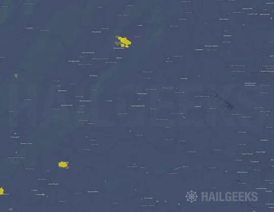

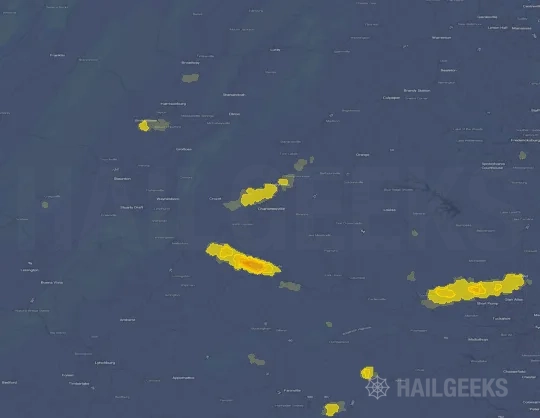


If none of these related Charlottesville, VA hail maps look close enough to your property, check a free Hail Report by Address. It reviews hail history for a specific location — not just the broader Charlottesville, VA region — so you can check whether hail activity may have reached your property.
Local Hail Review Options Near Charlottesville, VA
Not sure whether the July 27, 2025 Charlottesville, VA hail map matters for your property? Start with a free Hail Report by Address to see whether hail activity was mapped for that property. If the property signal looks meaningful, you can choose a local pro serving the Charlottesville, VA region and ask about a Remote Hail Inspection before deciding whether an on-site roof or exterior review is worth scheduling.
Check a specific property to see whether hail activity from the July 27, 2025 Charlottesville, VA event — or another recent hail event — may have been mapped at that address.
Find a roof or exterior pro serving the Charlottesville, VA region who can help you understand what the property hail signal may mean.
A participating local pro reviews property-level hail history remotely — not just the July 27, 2025 event — to help decide whether an on-site inspection may be worth scheduling.
A free Hail Report by Address and a Remote Hail Inspection can help you look beyond the July 27, 2025 hail map visuals alone. They do not confirm property damage and do not replace an on-site inspection for a property in the Charlottesville, VA region, but they can help you make a more informed next decision before anyone climbs on the roof.
Frequently Asked Questions
Common questions about the July 27, 2025 Charlottesville, VA hail event.