

Hail Swath Map Preview
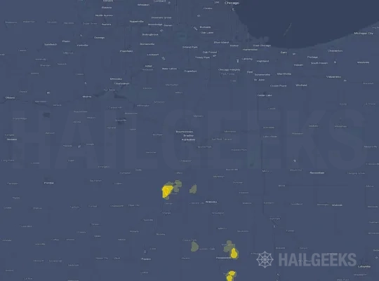
The Kankakee, IL hail swath map preview was last reviewed on August 30, 2026 and shows mapped hail estimates up to 1.00". There are 0 public hail reports, 11 public wind reports, and 7 nearby tornado reports listed for the December 28, 2025 event.
View the December 28, 2025 Kankakee, IL hail event on the free interactive hail map, then check a free Hail Report by ZIP to see a more local hail signal for your area.
Impact Area and Population for the Kankakee, IL Hail Map
The December 28, 2025 hail swath map for Kankakee, IL covers approximately 261 square miles and includes an estimated 7,105 people inside the mapped footprint. The largest mapped area is in the 0.50-0.75" hail band, covering 128 square miles. The highest estimated population exposure is in the 0.50-0.75" hail band with 4,521 people.
| Mapped Hail Band | Impact Area | Population |
|---|---|---|
| < 0.50" | 107 sq mi | 1,783 |
| 0.50-0.75" | 128 sq mi | 4,521 |
| 0.75-1.00" | 23 sq mi | 729 |
| 1.00-1.25" | 3 sq mi | 72 |
Get a free Hail Report by ZIP to see a more local hail signal and whether the December 28, 2025 Kankakee, IL hail event may have reached your area.
Housing Exposure Inside the Kankakee, IL Hail Swath Map
Inside the December 28, 2025 hail swath map area for Kankakee, IL, HailGeeks estimates 3,286 single-family homes, 50 townhomes, and 568 multifamily properties within the mapped storm footprint. Single-family-home exposure is highest in the 0.50-0.75" hail band, with 1,996 single-family homes.
| Mapped Hail Band | Single-Family | Townhomes | Multifamily |
|---|---|---|---|
| < 0.50" | 917 | 7 | 96 |
| 0.50-0.75" | 1,996 | 19 | 429 |
| 0.75-1.00" | 337 | 23 | 39 |
| 1.00-1.25" | 36 | 1 | 4 |
Use this table to review housing exposure by hail band for the December 28, 2025 Kankakee, IL hail map. To check a specific property more closely, use a free Hail Report by Address.
Counties Inside the Kankakee, IL Hail Map
Hail from the December 28, 2025 storm was mapped across 4 counties in the Kankakee, IL region. Livingston County, IL had the strongest mapped signal, peaking at 1.00" with roughly 1,890 single-family homes inside the swath.
County pages group every mapped hail event in the area. For a closer look, drop to the city or ZIP level below, or run a free Hail Report by Address.
Cities Inside the Kankakee, IL Hail Map
Zooming in, the swath touched 6 cities near Kankakee, IL. Lexington, IL had the strongest mapped signal at 1.00", with an estimated 367 single-family homes exposed.
City cards show where the December 28, 2025 Kankakee, IL hail activity was mapped, but your ZIP can show a closer local signal. Get a free Hail Report by ZIP, and if the signal looks meaningful, ask a local pro about a Remote Hail Inspection to see whether an on-site roof or exterior review may be worth scheduling.
ZIP Codes Inside the Kankakee, IL Hail Swath Map
At the ZIP level, the December 28, 2025 Kankakee, IL hail map spans 16 ZIP codes. ZIP 61753 shows the strongest local signal, with mapped hail estimates up to 1.00" and an estimated single-family-home exposure of 694.
Check your ZIP in seconds to see whether hail activity from the December 28, 2025 Kankakee, IL event was mapped near your area.
Public Hail, Wind, and Tornado Reports
Public storm report tables connected to the December 28, 2025 hail map for Kankakee, IL currently list 0 public hail reports, 11 public wind reports, and 7 tornado reports.
| Date & Time | Hail Size | City | State | Description |
|---|---|---|---|---|
| No public hail reports are available for this event. | ||||
| Date & Time | Wind Speed | City | State | Description |
|---|---|---|---|---|
December 28, 2025 10:30 AM CT | Fairbury | IL | Power poles downed. A farm outbuilding also had its roof torn off and sustained siding damage in the Fairbury area. Time estimated from radar. | |
December 28, 2025 10:34 AM CT | 2 W Forrest | IL | Power poles downed 1-2 miles west of Forrest. Time estimated from radar. | |
December 28, 2025 10:34 AM CT | 2 WNW Forrest | IL | Shed torn off of its foundation... swingset twisted and demolished... and multiple power poles downed on N 2500 East Road west of Forrest. Time estimated from radar. | |
December 28, 2025 10:37 AM CT | 1 NNW Forrest | IL | The roof of Prairie Central Junior High Schools gymnasium was torn off in Forrest. Power poles were also downed in the area. Time estimated from radar. | |
December 28, 2025 10:37 AM CT | Forrest | IL | Several large trees and power poles downed across the north side of Forrest. Time estimated from radar. | |
December 28, 2025 2:54 PM CT | Pontiac | IL | A large tree limb was downed onto North Mill Street in Pontiac. Time estimated from radar. | |
December 28, 2025 3:17 PM CT | Cullom | IL | Multiple large tree branches and limbs downed across the east side of Cullom. A video shared via broadcast media also showed a brief burst of strong winds blowing tree debris around. | |
December 28, 2025 3:25 PM CT | 3 ESE Saybrook | IL | Farm outbuilding destroyed. | |
December 28, 2025 3:31 PM CT | Gibson City | IL | Photo shows a large section of roof blown off a farm office building. Time Estimated. | |
December 28, 2025 4:06 PM CT | 5 NE Donovan | IL | Tree downed near the intersection of E 2880 North Rd. and N 3100 East Rd. | |
December 28, 2025 10:34 AM CT | 80 mph | 1 NNW Forrest | IL | An NWS damage survey confirmed that a concentrated area of straight-line winds with estimated peak winds of 80 MPH occurred in and west of Forrest... IL. These strong winds downed power poles and trees... damaged at least one shed... and blew off a portion of the roof of a junior high school gymnasium. |
| Date & Time | Rating | City | State | Description |
|---|---|---|---|---|
December 28, 2025 2:53 PM CT | UNK | 1 WNW Pontiac | IL | An NWS damage survey confirmed an EF-1 tornado with estimated peak winds of 90 MPH... path length of 0.95 miles... and maximum width of 125 yards impacted a portion of northwest Pontiac... IL... resulting in damage to roofing and siding to multiple houses... apartments... and manufactured homes. |
December 28, 2025 3:24 PM CT | UNK | 3 ESE Saybrook | IL | An EF-1 tornado touched down about 3 miles east-southeast of Saybrook and destroyed a large outbuilding throwing the debris to the E- NE. The tornado appears to have dissipated before reaching the Ford County line. Radar images supported a brief tornado... with the circulation continuing into Ford County where it went on to produce a brief EF-0 tornado just south of Gibson City. |
December 28, 2025 3:31 PM CT | UNK | 6 ESE Stelle | IL | An NWS damage survey confirmed an EF-0 tornado with estimated peak winds of 80 MPH... path length of 2.64 miles... and maximum width of 100 yards impacted rural areas west of Clifton... IL... resulting in damage to power poles... farm outbuildings... and the roof of a house. |
December 28, 2025 3:32 PM CT | UNK | 2 S Gibson City | IL | Based on eyewitness accounts and an assessment of damage photos provided to the NWS by the Ford County EMA and local broadcast media... it has been confirmed that a brief EF-0 tornado with estimated peak winds of 85 MPH... path length of 0.85 miles... and maximum width of 20 yards impacted the GDM facility south of Gibson City... peeling a portion of the metal roof off of a building there. No additional damage appeared to be caused by this tornado. |
December 28, 2025 3:40 PM CT | UNK | 2 E Clifton | IL | An NWS damage survey confirmed an EF-1 tornado with estimated peak winds of 95 MPH... path length of 9.53 miles... and maximum width of 150 yards impacted rural areas between Clifton and St. Anne... IL... causing damage to homes... barns... and several large trees... and also knocking over an irrigation pivot. |
December 28, 2025 3:41 PM CT | UNK | 2 SSE Chebanse | IL | An NWS damage survey confirmed an EF-0 tornado with estimated peak winds of 85 MPH... path length of 3.35 miles... and maximum width of 75 yards impacted rural areas northeast of Clifton... IL... resulting in damage to a home and multiple farm outbuildings. |
December 28, 2025 3:53 PM CT | UNK | 2 WSW Martinton | IL | Video footage and photos taken by storm spotters and storm chasers show that a funnel cloud was intermittently in contact with the ground as it tracked across open farm fields south of Martinton... IL. The tornado did not cause any known damage... and thus... has been assigned the EF-U rating. |
This table includes only public storm reports connected to the December 28, 2025 Kankakee, IL storm event. When available, each report may include the time, size or magnitude, city, state, and a short description.
Related Hail Maps in the Kankakee, IL Region
We found 6 more hail maps with reports from the same Kankakee, IL region as the December 28, 2025 event. These related maps cover storm dates from Aug 16, 2025 through Sep 23, 2025, with mapped hail estimates ranging from 0.75" to 2.00". In this set, the strongest related map reached 2.00", and the most recent map shown is from Sep 23, 2025.
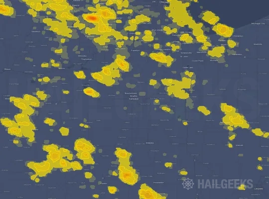




If none of these related Kankakee, IL hail maps look close enough to your property, check a free Hail Report by Address. It reviews hail history for a specific location — not just the broader Kankakee, IL region — so you can check whether hail activity may have reached your property.
Local Hail Review Options Near Kankakee, IL
Not sure whether the December 28, 2025 Kankakee, IL hail map matters for your property? Start with a free Hail Report by Address to see whether hail activity was mapped for that property. If the property signal looks meaningful, you can choose a local pro serving the Kankakee, IL region and ask about a Remote Hail Inspection before deciding whether an on-site roof or exterior review is worth scheduling.
Check a specific property to see whether hail activity from the December 28, 2025 Kankakee, IL event — or another recent hail event — may have been mapped at that address.
Find a roof or exterior pro serving the Kankakee, IL region who can help you understand what the property hail signal may mean.
A participating local pro reviews property-level hail history remotely — not just the December 28, 2025 event — to help decide whether an on-site inspection may be worth scheduling.
A free Hail Report by Address and a Remote Hail Inspection can help you look beyond the December 28, 2025 hail map visuals alone. They do not confirm property damage and do not replace an on-site inspection for a property in the Kankakee, IL region, but they can help you make a more informed next decision before anyone climbs on the roof.
Frequently Asked Questions
Common questions about the December 28, 2025 Kankakee, IL hail event.