

Hail Swath Map Preview
The Rockford, IL hail swath map preview was last reviewed on August 30, 2026 and shows mapped hail estimates up to 2.00". There are 9 public hail reports, 20 public wind reports, and 5 nearby tornado reports listed for the April 2, 2026 event.
View the April 2, 2026 Rockford, IL hail event on the free interactive hail map, then check a free Hail Report by ZIP to see a more local hail signal for your area.
Impact Area and Population for the Rockford, IL Hail Map
The April 2, 2026 hail swath map for Rockford, IL covers approximately 781 square miles and includes an estimated 109,599 people inside the mapped footprint. The largest mapped area is in the 0.50-0.75" hail band, covering 345 square miles. The highest estimated population exposure is in the < 0.50" hail band with 30,656 people.
| Mapped Hail Band | Impact Area | Population |
|---|---|---|
| < 0.50" | 326 sq mi | 30,656 |
| 0.50-0.75" | 345 sq mi | 30,087 |
| 0.75-1.00" | 66 sq mi | 22,513 |
| 1.00-1.25" | 19 sq mi | 13,832 |
| 1.25-1.50" | 15 sq mi | 7,892 |
| 1.50-1.75" | 8 sq mi | 4,564 |
| 2.00-2.25" | 2 sq mi | 55 |
Get a free Hail Report by ZIP to see a more local hail signal and whether the April 2, 2026 Rockford, IL hail event may have reached your area.
Housing Exposure Inside the Rockford, IL Hail Swath Map
Inside the April 2, 2026 hail swath map area for Rockford, IL, HailGeeks estimates 45,409 single-family homes, 3,373 townhomes, and 15,600 multifamily properties within the mapped storm footprint. Single-family-home exposure is highest in the 0.50-0.75" hail band, with 13,001 single-family homes.
| Mapped Hail Band | Single-Family | Townhomes | Multifamily |
|---|---|---|---|
| < 0.50" | 12,916 | 1,258 | 3,305 |
| 0.50-0.75" | 13,001 | 688 | 2,673 |
| 0.75-1.00" | 10,316 | 598 | 3,338 |
| 1.00-1.25" | 5,587 | 374 | 3,097 |
| 1.25-1.50" | 3,005 | 355 | 1,573 |
| 1.50-1.75" | 563 | 100 | 1,613 |
| 2.00-2.25" | 21 | 0 | 1 |
Use this table to review housing exposure by hail band for the April 2, 2026 Rockford, IL hail map. To check a specific property more closely, use a free Hail Report by Address.
Counties Inside the Rockford, IL Hail Map
Hail from the April 2, 2026 storm was mapped across 18 counties in the Rockford, IL region. Carroll County, IL had the strongest mapped signal, peaking at 2.00" with roughly 1,017 single-family homes inside the swath.
County pages group every mapped hail event in the area. For a closer look, drop to the city or ZIP level below, or run a free Hail Report by Address.
Cities Inside the Rockford, IL Hail Map
Zooming in, the swath touched 20 cities near Rockford, IL. Whitewater, WI had the strongest mapped signal at 1.50", with an estimated 1,281 single-family homes exposed.
City cards show where the April 2, 2026 Rockford, IL hail activity was mapped, but your ZIP can show a closer local signal. Get a free Hail Report by ZIP, and if the signal looks meaningful, ask a local pro about a Remote Hail Inspection to see whether an on-site roof or exterior review may be worth scheduling.
ZIP Codes Inside the Rockford, IL Hail Swath Map
At the ZIP level, the April 2, 2026 Rockford, IL hail map spans 40 ZIP codes. ZIP 61285 shows the strongest local signal, with mapped hail estimates up to 2.00" and an estimated single-family-home exposure of 185.
Check your ZIP in seconds to see whether hail activity from the April 2, 2026 Rockford, IL event was mapped near your area.
Public Hail, Wind, and Tornado Reports
Public storm report tables connected to the April 2, 2026 hail map for Rockford, IL currently list 9 public hail reports, 20 public wind reports, and 5 tornado reports.
| Date & Time | Hail Size | City | State | Description |
|---|---|---|---|---|
April 2, 2026 5:37 PM CT |
3.00 in | 3 N Thomson | IL | Pictures of hail ranging in size from 3.00 to 3.25 inches. The time of the event was estimated using radar. |
April 2, 2026 5:38 PM CT |
1.75 in | 2 N Thomson | IL | No National Weather Service description provided. |
April 2, 2026 5:48 PM CT |
1.50 in | Mount Carroll | IL | Social media picture of quarter to ping pong size hail. Relayed by media. |
April 2, 2026 6:19 PM CT |
1.25 in | 1 WNW Janesville | WI | Hail at Mercy Hospital. |
April 2, 2026 6:20 PM CT |
1.50 in | 2 SW Whiteside County A | IL | No National Weather Service description provided. |
April 2, 2026 6:22 PM CT |
1.50 in | 2 NNE Janesville | WI | No National Weather Service description provided. |
April 2, 2026 6:37 PM CT |
1.00 in | Dixon | IL | Nickel to quarter sized hail. |
April 2, 2026 6:41 PM CT |
2.00 in | 2 W Whitewater | WI | No National Weather Service description provided. |
April 2, 2026 7:02 PM CT |
1.00 in | 2 W Whitewater | WI | Report from mPING: Quarter (1.00 in.). |
| Date & Time | Wind Speed | City | State | Description |
|---|---|---|---|---|
April 2, 2026 5:57 PM CT | 1 SE Savanna | IL | Large tree down... other trees stripped of bark. Time estimated from radar. | |
April 2, 2026 6:11 PM CT | 6 SSW Polo | IL | Sheriff reports downed power poles and power lines... and a barn destroyed... on Mound Hill Road near Pilgrim Road in Lee County. Time estimated. | |
April 2, 2026 6:11 PM CT | 4 N Nelson | IL | Media showed video of trees down and a barn collapsed along Mound Hill Rd. Time estimated from radar. This LSR is likely a repeat but with a more precise location. | |
April 2, 2026 6:13 PM CT | 1 ENE Center Hill | IL | A few trees reported down west of Mount Carroll. | |
April 2, 2026 6:17 PM CT | 5 NNW Dixon | IL | Debris reported in fields along Rt 26 just south of Woosung. Time estimated. | |
April 2, 2026 6:19 PM CT | 5 NW Dixon | IL | Structure damage at a business along Hwy 26 south of Woosung. Time estimated. | |
April 2, 2026 6:23 PM CT | 1 NNW Grand Detour | IL | Reports of trees down and damage to outbuildings near W. Edgewood Rd and S. Ridge Rd in Ogle County. Time estimated. | |
April 2, 2026 6:25 PM CT | Fayette | WI | Tree down reported by Lafayette County dispatchers. Time estimated by radar. | |
April 2, 2026 6:44 PM CT | 2 SSE Davis Junction | IL | Trees and power lines down on Hwy 251 between Big Mound Rd and Holcomb Rd. Grain bin destroyed. | |
April 2, 2026 6:46 PM CT | 3 S Davis Junction | IL | Grain elevator down on train tracks. Trees and power lines also down in the area. Time estimated from radar. | |
April 2, 2026 6:50 PM CT | 1 WNW Monroe Center | IL | Roof or other structural material on road. Also downed tree at farm just east of I-39. Reported by retired NWS employee. Time estimated from radar. | |
April 2, 2026 6:57 PM CT | 2 WNW Palmyra | WI | Jefferson County Dispatch reports tree down on Power Line north of Palmyra. | |
April 2, 2026 7:04 PM CT | 6 E Evansville | WI | Tree down by Gibbs Lake reported by Rock County Dispatchers. Time estimated by radar. | |
April 2, 2026 7:19 PM CT | 1 SSW Whitewater | WI | Walworth County Dispatch reports trees and powerlines down on northwest side of county as well as near Whitewater. Time estimated by radar. | |
April 2, 2026 7:31 PM CT | 2 NW Elkhorn | WI | Walworth County Dispatch reports trees down in Sugar Creek Township. Time estimated by radar. | |
April 2, 2026 7:34 PM CT | 2 SSW Wonder Lake | IL | Reports of a large tree down across IL 120 and blocking the road between Wonder Lake Drive and Thompson Road. Time estimated based on radar. | |
April 2, 2026 7:47 PM CT | 1 ENE New Berlin | WI | Waukesha County Dispatch reports tree on a power line in New Berlin. Time estimated by radar. | |
April 2, 2026 5:54 PM CT | 67 mph | Prophetstown | IL | No National Weather Service description provided. |
April 2, 2026 6:25 PM CT | 65 mph | Dixon | IL | Estimated 60-70 mph gusts. |
April 2, 2026 6:30 PM CT | 60 mph | Oregon | IL | Small 2-inch limbs coming down. |
| Date & Time | Rating | City | State | Description |
|---|---|---|---|---|
April 2, 2026 6:00 PM CT | UNK | 2 NE Savanna | IL | A brief EF1 tornado developed northeast of Savanna with maximum winds near 90 mph. The tornado caused tree damage... with tree fall indicative of a convergent path... and also tossed and damaged a small shed. |
April 2, 2026 6:02 PM CT | UNK | 2 WSW Sterling | IL | An EF1 tornado passed through northern portions of Sterling... with estimated maximum wind speeds around 90 mph. Along the path... damage was done to trees (including snapped) and two garages in the path saw complete loss of their roofs. Minor damage was noted to two church roofs. There was also a 3000 lb rooftop HVAC unit rolled over... consistent with maximum winds of at least 90 mph. |
April 2, 2026 6:11 PM CT | UNK | 4 NNW Nelson | IL | An NWS damage survey confirmed that an EF-1 tornado with estimated peak winds of 100 mph tracked for 5.75 miles through northwestern Lee County. The tornado damaged or destroyed multiple farm outbuildings... downed several trees and power poles... and caused minor damage to a few residences. |
April 2, 2026 6:24 PM CT | UNK | 3 N Grand Detour | IL | An NWS damage survey confirmed that a brief EF-1 tornado with estimated peak winds of 105 mph impacted a few properties along Ridge Road in southern Ogle County. One house had two-thirds of its roof removed by the tornado... and several trees were damaged by the tornado as well. |
April 2, 2026 6:44 PM CT | UNK | 3 SSW Davis Junction | IL | An NWS damage survey confirmed that an EF-0 tornado with estimated peak winds of 85 mph and a path length of 2.71 miles tracked through the community of Holcomb in northeastern Ogle County. The tornado caused extensive tree damage in Holcomb... damaged a few farm outbuildings... and caused a grain leg to collapse onto railroad tracks. |
This table includes only public storm reports connected to the April 2, 2026 Rockford, IL storm event. When available, each report may include the time, size or magnitude, city, state, and a short description.
Related Hail Maps in the Rockford, IL Region
We found 6 more hail maps with reports from the same Rockford, IL region as the April 2, 2026 event. These related maps cover storm dates from Sep 20, 2025 through Mar 31, 2026, with mapped hail estimates ranging from 0.75" to 2.00". In this set, the strongest related map reached 2.00", and the most recent map shown is from Mar 31, 2026.
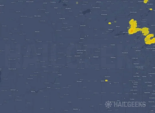


If none of these related Rockford, IL hail maps look close enough to your property, check a free Hail Report by Address. It reviews hail history for a specific location — not just the broader Rockford, IL region — so you can check whether hail activity may have reached your property.
Local Hail Review Options Near Rockford, IL
Not sure whether the April 2, 2026 Rockford, IL hail map matters for your property? Start with a free Hail Report by Address to see whether hail activity was mapped for that property. If the property signal looks meaningful, you can choose a local pro serving the Rockford, IL region and ask about a Remote Hail Inspection before deciding whether an on-site roof or exterior review is worth scheduling.
Check a specific property to see whether hail activity from the April 2, 2026 Rockford, IL event — or another recent hail event — may have been mapped at that address.
Find a roof or exterior pro serving the Rockford, IL region who can help you understand what the property hail signal may mean.
A participating local pro reviews property-level hail history remotely — not just the April 2, 2026 event — to help decide whether an on-site inspection may be worth scheduling.
A free Hail Report by Address and a Remote Hail Inspection can help you look beyond the April 2, 2026 hail map visuals alone. They do not confirm property damage and do not replace an on-site inspection for a property in the Rockford, IL region, but they can help you make a more informed next decision before anyone climbs on the roof.
Frequently Asked Questions
Common questions about the April 2, 2026 Rockford, IL hail event.