

Hail Swath Map Preview
The Rochester, MN hail swath map preview was last reviewed on August 30, 2026 and shows mapped hail estimates up to 1.50". There are 26 public hail reports, 0 public wind reports, and 15 nearby tornado reports listed for the April 17, 2026 event.
View the April 17, 2026 Rochester, MN hail event on the free interactive hail map, then check a free Hail Report by ZIP to see a more local hail signal for your area.
Impact Area and Population for the Rochester, MN Hail Map
The April 17, 2026 hail swath map for Rochester, MN covers approximately 1,977 square miles and includes an estimated 156,467 people inside the mapped footprint. The largest mapped area is in the 0.50-0.75" hail band, covering 850 square miles. The highest estimated population exposure is in the < 0.50" hail band with 56,812 people.
| Mapped Hail Band | Impact Area | Population |
|---|---|---|
| < 0.50" | 626 sq mi | 56,812 |
| 0.50-0.75" | 850 sq mi | 44,786 |
| 0.75-1.00" | 336 sq mi | 23,790 |
| 1.00-1.25" | 110 sq mi | 12,869 |
| 1.25-1.50" | 40 sq mi | 8,456 |
| 1.50-1.75" | 16 sq mi | 9,754 |
Get a free Hail Report by ZIP to see a more local hail signal and whether the April 17, 2026 Rochester, MN hail event may have reached your area.
Housing Exposure Inside the Rochester, MN Hail Swath Map
Inside the April 17, 2026 hail swath map area for Rochester, MN, HailGeeks estimates 56,910 single-family homes, 6,795 townhomes, and 17,704 multifamily properties within the mapped storm footprint. Single-family-home exposure is highest in the < 0.50" hail band, with 19,795 single-family homes.
| Mapped Hail Band | Single-Family | Townhomes | Multifamily |
|---|---|---|---|
| < 0.50" | 19,795 | 2,982 | 5,661 |
| 0.50-0.75" | 16,863 | 1,439 | 3,970 |
| 0.75-1.00" | 9,699 | 603 | 2,609 |
| 1.00-1.25" | 4,338 | 570 | 956 |
| 1.25-1.50" | 3,152 | 508 | 1,793 |
| 1.50-1.75" | 3,063 | 693 | 2,715 |
Use this table to review housing exposure by hail band for the April 17, 2026 Rochester, MN hail map. To check a specific property more closely, use a free Hail Report by Address.
Counties Inside the Rochester, MN Hail Map
Hail from the April 17, 2026 storm was mapped across 29 counties in the Rochester, MN region. Olmsted County, MN had the strongest mapped signal, peaking at 1.50" with roughly 16,304 single-family homes inside the swath.
County pages group every mapped hail event in the area. For a closer look, drop to the city or ZIP level below, or run a free Hail Report by Address.
Cities Inside the Rochester, MN Hail Map
Zooming in, the swath touched 52 cities near Rochester, MN. Rochester, MN had the strongest mapped signal at 1.50", with an estimated 12,211 single-family homes exposed.
City cards show where the April 17, 2026 Rochester, MN hail activity was mapped, but your ZIP can show a closer local signal. Get a free Hail Report by ZIP, and if the signal looks meaningful, ask a local pro about a Remote Hail Inspection to see whether an on-site roof or exterior review may be worth scheduling.
ZIP Codes Inside the Rochester, MN Hail Swath Map
At the ZIP level, the April 17, 2026 Rochester, MN hail map spans 86 ZIP codes. ZIP 55901 shows the strongest local signal, with mapped hail estimates up to 1.50" and an estimated single-family-home exposure of 9,314.
Check your ZIP in seconds to see whether hail activity from the April 17, 2026 Rochester, MN event was mapped near your area.
Public Hail, Wind, and Tornado Reports
Public storm report tables connected to the April 17, 2026 hail map for Rochester, MN currently list 26 public hail reports, 0 public wind reports, and 15 tornado reports.
| Date & Time | Hail Size | City | State | Description |
|---|---|---|---|---|
April 17, 2026 9:30 AM CT |
1.00 in | 4 NE Faribault | MN | No National Weather Service description provided. |
April 17, 2026 10:08 AM CT |
1.00 in | 1 S Cannon Falls | MN | No National Weather Service description provided. |
April 17, 2026 10:12 AM CT |
1.00 in | 2 SSW Cannon Falls | MN | Hail measurement photo provided via NWSChat. Time estimated via radar. |
April 17, 2026 1:36 PM CT |
1.75 in | 1 W Hayfield | MN | No National Weather Service description provided. |
April 17, 2026 1:37 PM CT |
1.00 in | Hayfield | MN | No National Weather Service description provided. |
April 17, 2026 1:41 PM CT |
1.00 in | Hayfield | MN | No National Weather Service description provided. |
April 17, 2026 1:45 PM CT |
1.00 in | 1 S Kasson | MN | No National Weather Service description provided. |
April 17, 2026 1:46 PM CT |
1.00 in | Hayfield | MN | No National Weather Service description provided. |
April 17, 2026 2:04 PM CT |
1.00 in | Dexter | MN | No National Weather Service description provided. |
April 17, 2026 2:05 PM CT |
1.50 in | 1 SE Red Wing | MN | Report from mPING: Ping Pong Ball (1.50 in.). |
April 17, 2026 2:08 PM CT |
1.25 in | 1 SE Red Wing | MN | Report from mPING: Half Dollar (1.25 in.). |
April 17, 2026 2:08 PM CT |
1.00 in | 2 SW Bay City | MN | Report from mPING: Quarter (1.00 in.). |
April 17, 2026 2:10 PM CT |
1.00 in | 1 SE Red Wing | MN | Report from mPING: Quarter (1.00 in.). |
April 17, 2026 2:12 PM CT |
1.50 in | 2 SW Bay City | MN | Report from mPING: Ping Pong Ball (1.50 in.). |
April 17, 2026 2:13 PM CT |
1.75 in | 4 N Rochester | MN | No National Weather Service description provided. |
April 17, 2026 2:13 PM CT |
1.00 in | 3 SE Douglas | MN | Report from mPING: Quarter (1.00 in.). |
April 17, 2026 2:14 PM CT |
1.00 in | 2 E Ellsworth | WI | No National Weather Service description provided. |
April 17, 2026 2:15 PM CT |
1.00 in | 2 WNW Oronoco | MN | No National Weather Service description provided. |
April 17, 2026 2:40 PM CT |
1.00 in | 2 SW Bay City | MN | Report from mPING: Quarter (1.00 in.). |
April 17, 2026 2:41 PM CT |
1.00 in | 2 S Red Wing | MN | Report from mPING: Quarter (1.00 in.). |
April 17, 2026 2:47 PM CT |
1.25 in | 4 NNW Bay City | WI | Emailed photos of large hail in backyard. Time estimated via radar. |
April 17, 2026 3:00 PM CT |
1.50 in | Saint Charles | MN | No National Weather Service description provided. |
April 17, 2026 3:05 PM CT |
1.50 in | Saint Charles | MN | No National Weather Service description provided. |
April 17, 2026 3:05 PM CT |
1.00 in | Altura | MN | No National Weather Service description provided. |
April 17, 2026 3:10 PM CT |
1.25 in | 3 SE Douglas | MN | No National Weather Service description provided. |
April 17, 2026 3:19 PM CT |
1.00 in | Rollingstone | MN | No National Weather Service description provided. |
| Date & Time | Wind Speed | City | State | Description |
|---|---|---|---|---|
| No public wind reports are available for this event. | ||||
| Date & Time | Rating | City | State | Description |
|---|---|---|---|---|
April 17, 2026 1:50 PM CT | UNK | 5 NE Sargeant | MN | Sheriff deputy reported that a tornado formed and dissipated and then a second tornado touched down. |
April 17, 2026 1:50 PM CT | UNK | 5 NE Sargeant | MN | Sheriff deputy reported that a tornado formed and dissipated and then a second tornado touched down. |
April 17, 2026 1:53 PM CT | UNK | 6 NE Sargeant | MN | This EF0 tornado affected mainly rural areas southeast of Oslo MN with estimated max winds around 80 mph. Mainly farm outbuildings and trees sustained light damage during the tornadoes 4 mile path. |
April 17, 2026 2:17 PM CT | UNK | 1 N Stewartville | MN | This EF-2 tornado (estimated peak wind 130 mph) formed just northeast of Stewartville around 2:17 pm and traveled about 10 miles northeast damaging numerous homes and farms. Some of the worst damage was seen near Marion Road just northeast of Highway 52 where homes were more severely damaged with roof removal and partially collapsed exterior walls. The tornado was on the ground for about 14 minutes using radar estimation. At its widest... mainly in rural areas... it was approximately 175 yards. |
April 17, 2026 2:30 PM CT | UNK | 4 NE Rochester | MN | The tornado began in a northeast suburb of Rochester at around 2:30 pm with just shingle damage to homes and traveled northeast into more rural areas. The first portion of the tornado was weak with mainly EF0 damage. On the second portion of the 12 mile track... the tornado intensified to produce approximately 100 mph winds with tree and farm outbuilding damage. The tornado finally lifted at 2:54 pm. |
April 17, 2026 2:32 PM CT | UNK | 4 N Stewartville | MN | Rochester Tower reported tornado on the ground near Highway 63. |
April 17, 2026 2:32 PM CT | UNK | 4 N Stewartville | MN | Rochester Tower reported tornado on the ground near Highway 63. |
April 17, 2026 2:46 PM CT | UNK | 2 E Viola | MN | The EF2 tornado affected mainly rural areas northeast of Rochester MN beginning about 5 miles east-northeast of Viola in Olmsted county around 2:46 pm. The tornado tracked northeast damaging trees and outbuildings. One farm house lost a complete roof and a garage lost roof portions. The tornado ended in Wabasha county a few miles southeast of Plainview MN at 3:00 pm. Maximum winds were estimated at around 125 mph near the farm house residence. |
April 17, 2026 2:47 PM CT | UNK | 1 NNW Saratoga | IA | *** 1 INJ *** Tornado confirmed via photos from Riceville firefighter. One house reported damaged. A box truck was also directly hit by the tornado and forced into a ditch. The driver appeared to have minor injuries. |
April 17, 2026 2:47 PM CT | UNK | 1 NNW Saratoga | IA | *** 1 INJ *** Tornado confirmed via photos from Riceville firefighter. One house reported damaged. A box truck was also directly hit by the tornado and forced into a ditch. The driver appeared to have minor injuries. |
April 17, 2026 2:47 PM CT | UNK | 1 WNW Saratoga | IA | *** 1 INJ *** This tornado developed northwest of Saratoga and tracked northeast... damaging one outbuilding during its existence... supporting an EF0 rating with maximum estimated winds of 85 mph. The tornado was witnessed and photographed by multiple individuals. The tornado rolled a truck... with the driver suffering minor injuries. Information on this tornado was relayed by Emergency Management. |
April 17, 2026 2:53 PM CT | UNK | 2 N Elgin | MN | Tornado touched down north of Elgin where it flipped a semi. It caused damage on 2 farmsteads. Ended 1 3/4 miles north of 247 near County Rd 2. |
April 17, 2026 2:53 PM CT | UNK | 2 NNW Elgin | MN | Tornado touched down north of Elgin where it flipped a semi. It caused damage on 2 farmsteads. Ended 1 3/4 miles north of 247 near County Rd 2. |
April 17, 2026 2:57 PM CT | UNK | 4 S Plainview | MN | Tornado caused roof damage and removed a barn off of its foundation at 50500 County Rd... Plainview... MN. Residents saw the tornado and took shelter in a basement. No injuries. |
April 17, 2026 3:27 PM CT | UNK | Cream | WI | This EF3 tornado (maximum estimated wind speed 140 mph) formed a few miles southwest of the town of Cream around 3:27 pm and traveled 8 miles to the northeast finally lifting north of Montana around 3:43 pm. The tornado damaged a family home residence of good construction removing many exterior walls and the roof near State Road 88 south of Cream. This damage suggests lower EF3 wind speeds. The upstream damage to trees suggests the tornado intensified heading into this area. Many trees were downed or snapped on the path with farm outbuildings also being destroyed. |
This table includes only public storm reports connected to the April 17, 2026 Rochester, MN storm event. When available, each report may include the time, size or magnitude, city, state, and a short description.
Related Hail Maps in the Rochester, MN Region
We found 6 more hail maps with reports from the same Rochester, MN region as the April 17, 2026 event. These related maps cover storm dates from Sep 21, 2025 through Apr 14, 2026, with mapped hail estimates ranging from 0.75" to 3.00". In this set, the strongest related map reached 3.00", and the most recent map shown is from Apr 14, 2026.


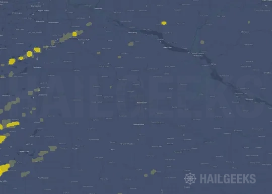


If none of these related Rochester, MN hail maps look close enough to your property, check a free Hail Report by Address. It reviews hail history for a specific location — not just the broader Rochester, MN region — so you can check whether hail activity may have reached your property.
Local Hail Review Options Near Rochester, MN
Not sure whether the April 17, 2026 Rochester, MN hail map matters for your property? Start with a free Hail Report by Address to see whether hail activity was mapped for that property. If the property signal looks meaningful, you can choose a local pro serving the Rochester, MN region and ask about a Remote Hail Inspection before deciding whether an on-site roof or exterior review is worth scheduling.
Check a specific property to see whether hail activity from the April 17, 2026 Rochester, MN event — or another recent hail event — may have been mapped at that address.
Find a roof or exterior pro serving the Rochester, MN region who can help you understand what the property hail signal may mean.
A participating local pro reviews property-level hail history remotely — not just the April 17, 2026 event — to help decide whether an on-site inspection may be worth scheduling.
A free Hail Report by Address and a Remote Hail Inspection can help you look beyond the April 17, 2026 hail map visuals alone. They do not confirm property damage and do not replace an on-site inspection for a property in the Rochester, MN region, but they can help you make a more informed next decision before anyone climbs on the roof.
Frequently Asked Questions
Common questions about the April 17, 2026 Rochester, MN hail event.