
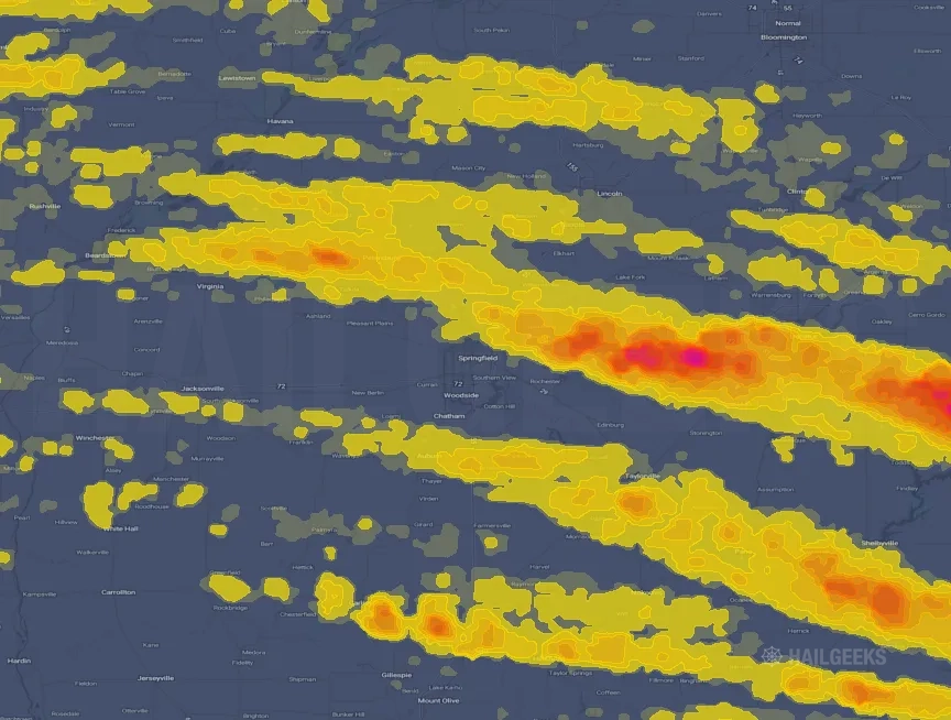
Hail Swath Map Preview
The Springfield, IL hail swath map preview was last reviewed on August 30, 2026 and shows mapped hail estimates up to 3.25". There are 16 public hail reports, 25 public wind reports, and 4 nearby tornado reports listed for the June 17, 2026 event.
View the June 17, 2026 Springfield, IL hail event on the free interactive hail map, then check a free Hail Report by ZIP to see a more local hail signal for your area.
Impact Area and Population for the Springfield, IL Hail Map
The June 17, 2026 hail swath map for Springfield, IL covers approximately 4,546 square miles and includes an estimated 184,845 people inside the mapped footprint. The largest mapped area is in the 0.50-0.75" hail band, covering 1,625 square miles. The highest estimated population exposure is in the 0.50-0.75" hail band with 49,303 people.
| Mapped Hail Band | Impact Area | Population |
|---|---|---|
| < 0.50" | 1,372 sq mi | 46,084 |
| 0.50-0.75" | 1,625 sq mi | 49,303 |
| 0.75-1.00" | 756 sq mi | 28,943 |
| 1.00-1.25" | 333 sq mi | 22,849 |
| 1.25-1.50" | 174 sq mi | 22,798 |
| 1.50-1.75" | 108 sq mi | 10,693 |
| 1.75-2.00" | 78 sq mi | 2,443 |
| 2.00-2.25" | 50 sq mi | 958 |
| 2.25-2.50" | 26 sq mi | 516 |
| 2.50-2.75" | 9 sq mi | 100 |
| 2.75-3.00" | 11 sq mi | 125 |
| 3.00-3.25" | 2 sq mi | 18 |
| 3.25-3.50" | 2 sq mi | 15 |
Get a free Hail Report by ZIP to see a more local hail signal and whether the June 17, 2026 Springfield, IL hail event may have reached your area.
Housing Exposure Inside the Springfield, IL Hail Swath Map
Inside the June 17, 2026 hail swath map area for Springfield, IL, HailGeeks estimates 96,654 single-family homes, 1,993 townhomes, and 13,197 multifamily properties within the mapped storm footprint. Single-family-home exposure is highest in the 0.50-0.75" hail band, with 25,636 single-family homes.
| Mapped Hail Band | Single-Family | Townhomes | Multifamily |
|---|---|---|---|
| < 0.50" | 23,788 | 459 | 3,255 |
| 0.50-0.75" | 25,636 | 540 | 2,656 |
| 0.75-1.00" | 15,642 | 366 | 2,086 |
| 1.00-1.25" | 11,604 | 267 | 2,568 |
| 1.25-1.50" | 12,010 | 293 | 2,100 |
| 1.50-1.75" | 5,806 | 51 | 414 |
| 1.75-2.00" | 1,273 | 8 | 82 |
| 2.00-2.25" | 500 | 3 | 21 |
| 2.25-2.50" | 257 | 5 | 13 |
| 2.50-2.75" | 54 | 0 | 1 |
| 2.75-3.00" | 63 | 1 | 1 |
| 3.00-3.25" | 11 | 0 | 0 |
| 3.25-3.50" | 10 | 0 | 0 |
Use this table to review housing exposure by hail band for the June 17, 2026 Springfield, IL hail map. To check a specific property more closely, use a free Hail Report by Address.
Counties Inside the Springfield, IL Hail Map
Hail from the June 17, 2026 storm was mapped across 27 counties in the Springfield, IL region. Macon County, IL had the strongest mapped signal, peaking at 3.25" with roughly 30,913 single-family homes inside the swath.
County pages group every mapped hail event in the area. For a closer look, drop to the city or ZIP level below, or run a free Hail Report by Address.
Cities Inside the Springfield, IL Hail Map
Zooming in, the swath touched 96 cities near Springfield, IL. Harristown, IL had the strongest mapped signal at 2.00", with an estimated 297 single-family homes exposed.
City cards show where the June 17, 2026 Springfield, IL hail activity was mapped, but your ZIP can show a closer local signal. Get a free Hail Report by ZIP, and if the signal looks meaningful, ask a local pro about a Remote Hail Inspection to see whether an on-site roof or exterior review may be worth scheduling.
ZIP Codes Inside the Springfield, IL Hail Swath Map
At the ZIP level, the June 17, 2026 Springfield, IL hail map spans 160 ZIP codes. ZIP 62547 shows the strongest local signal, with mapped hail estimates up to 3.25" and an estimated single-family-home exposure of 225.
Check your ZIP in seconds to see whether hail activity from the June 17, 2026 Springfield, IL event was mapped near your area.
Public Hail, Wind, and Tornado Reports
Public storm report tables connected to the June 17, 2026 hail map for Springfield, IL currently list 16 public hail reports, 25 public wind reports, and 4 tornado reports.
| Date & Time | Hail Size | City | State | Description |
|---|---|---|---|---|
June 17, 2026 3:17 PM CT |
1.00 in | Armington | IL | Quarter size hail. |
June 17, 2026 4:19 PM CT |
1.00 in | Adair | IL | No National Weather Service description provided. |
June 17, 2026 4:45 PM CT |
1.50 in | Boody | IL | Photo of ping pong size hail with a ruler. |
June 17, 2026 4:47 PM CT |
1.75 in | Illiopolis | IL | Golf Ball size hail. |
June 17, 2026 4:50 PM CT |
1.75 in | 1 W Illiopolis | IL | Report from mPING: Golf Ball (1.75 in.). |
June 17, 2026 4:53 PM CT |
1.75 in | 1 W Illiopolis | IL | Corrects previous hail report from 1 W Illiopolis. Report from mPING: Golf Ball (1.75 in.). Time estimated from radar. |
June 17, 2026 4:55 PM CT |
1.75 in | Illiopolis | IL | Corrects previous hail report from Illiopolis. Golf Ball size hail. Time estimated from radar. |
June 17, 2026 5:02 PM CT |
2.00 in | 2 SE Niantic | IL | No National Weather Service description provided. |
June 17, 2026 5:08 PM CT |
1.50 in | Boody | IL | Corrects previous hail report from Boody. Photo of ping pong size hail with a ruler. Time estimated from radar. |
June 17, 2026 5:10 PM CT |
1.50 in | Elwin | IL | Ping Pong size hail. |
June 17, 2026 5:45 PM CT |
1.75 in | Boody | IL | Golf ball size hail near route 48 outside of Boody. |
June 17, 2026 5:51 PM CT |
1.00 in | Decatur Airport | IL | No National Weather Service description provided. |
June 17, 2026 5:53 PM CT |
1.00 in | 1 W Decatur | IL | No National Weather Service description provided. |
June 17, 2026 5:58 PM CT |
1.00 in | 2 W Decatur | IL | Report from mPING: Quarter (1.00 in.). |
June 17, 2026 6:19 PM CT |
1.75 in | 4 SW Hammond | IL | Report from mPING: Golf Ball (1.75 in.). |
June 17, 2026 8:10 PM CT |
1.25 in | Litchfield | IL | Hail ranging from nickel to half dollar sized along with strong winds. Time and location estimated. |
| Date & Time | Wind Speed | City | State | Description |
|---|---|---|---|---|
June 18, 2026 4:35 AM CT | 2 E Sherman | IL | Lots of tree damage and a tree on a house. | |
June 17, 2026 9:45 AM CT | 4 NE Greenview | IL | Two transmission line poles broke off and blocking the road on North Middletown Ave and Hubly St. | |
June 17, 2026 9:59 AM CT | Broadwell | IL | Large tree limbs down. | |
June 17, 2026 3:30 PM CT | Waynesville | IL | Multiple trees blown down and blocking roads in Waynesville. | |
June 17, 2026 3:44 PM CT | Wapella | IL | Power pole snapped at 106 N Locust street in Wapella. | |
June 17, 2026 3:50 PM CT | 2 E Clinton | IL | Two power poles snapped along highway 10 and Weldon Springs road east of Clinton. Powerline hanging down. | |
June 17, 2026 4:15 PM CT | Petersburg | IL | Photo of Ameren Roof damage at 6th and Sheridan streets in Petersburg. | |
June 17, 2026 4:38 PM CT | Wapella | IL | Large oak tree split with part falling on a property fence. | |
June 17, 2026 4:46 PM CT | 2 E Dawson | IL | Power Poles and trees blown down on highway 36 est of Dawson. | |
June 17, 2026 4:50 PM CT | 5 NE Clinton | IL | Photos of transmission poles blown down at Prairie Center and Drive In roads. | |
June 17, 2026 4:53 PM CT | 1 SSW Illiopolis | IL | Corrects previous non-tstm wnd dmg report from 1 SSW Illiopolis. social media aerial image of straight line wind damage to trees and a farm outbuilding. time estimated from radar. | |
June 17, 2026 5:00 PM CT | Niantic | IL | Shed destroyed by high winds. | |
June 17, 2026 5:02 PM CT | 2 SE Niantic | IL | Sheet metal blown into a field near Niantic. | |
June 17, 2026 5:10 PM CT | Decatur | IL | Powerline line blown down at Shadow Ridge in Decatur. | |
June 17, 2026 5:15 PM CT | 2 S Macon | IL | Power poles snapped off near the ground near highway 51 south of Walker Road. | |
June 17, 2026 5:15 PM CT | 4 SE Harristown | IL | 10 trees snapped. | |
June 17, 2026 5:52 PM CT | Forsyth | IL | Tree damage and some siding off homes. | |
June 17, 2026 6:00 PM CT | Decatur | IL | Numerous powerlines blown down across Macon county. | |
June 17, 2026 6:02 PM CT | 1 E Long Creek | IL | Delayed report. 6 large two foot diameter trees blown down or uprooted. Shingles peeled off roof. Time estimated from radar. | |
June 17, 2026 6:17 PM CT | 1 S Macon | IL | Photos showing metal grain bin blown into corn field and some tree limbs blown down. | |
June 17, 2026 6:47 PM CT | 4 SE Clinton | IL | Route 10 between Weldon Springs and Taft road closed due to power lines down. | |
June 17, 2026 6:47 PM CT | 3 SSE Clinton | IL | A tree on power line... with tree currently on fire. | |
June 17, 2026 7:03 PM CT | 1 NW Langleyville | IL | Trees and powerlines blown down on route 104 between Taylorville and Kincaid. | |
June 17, 2026 7:08 PM CT | Blue Mound | IL | Some damage to Meridian Elementary School in Blue Mound. | |
June 17, 2026 6:00 PM CT | 78 mph | Decatur Airport | IL | No National Weather Service description provided. |
| Date & Time | Rating | City | State | Description |
|---|---|---|---|---|
June 17, 2026 4:19 PM CT | UNK | 3 WNW Salisbury | IL | EF-1... max winds 100 mph... path length 24.1 miles... width 150 yards. The tornado first touched down in southern Menard county and moved southeast into Salisbury. In town it mainly did tree damage... but also damaged a garage and roof of an adjacent home. As it continued southeast into northern Springfield... it continued to do mainly tree damage. As it exited the city on the northeast side... it blew in the garage door of a business. As it moved east-southeast it continued to do only tree damage and actually followed the same path as the June 10th EF1 tornado. The tornado ended about 2 miles west of Mechanicsburg. |
June 17, 2026 5:05 PM CT | UNK | 1 W Blue Mound | IL | EF-1... max winds 110 mph... path length 10.7 miles... width 700 yards. The tornado began in northern Christian County in the Griswold Conservation Area... causing extensive tree damage throughout the property. It crossed the county line into Macon County... damaging more trees and structures in Blue Mound... including the roof of Meridian Elementary School. It also destroyed 2 grain bins south of the school. It tracked east-southeast... taking down electrical transmission lines and numerous large tree branches. It crossed US-51 and tracked east-southeast into Shelby County where it damaged more trees and electrical transmission lines along the Shelby/Macon county line. The tornado lifted 3 miles northeast of Moweaqua along N 1000 East Rd. |
June 17, 2026 5:27 PM CT | UNK | 4 WSW Bethany | IL | EF-1... max winds 100 mph... path length 3.37 miles... width 75 yards. The tornado touched down about 4 miles southwest of Bethany in northeast Christian County where it snapped a softwood tree trunk and removed large branches from hardwood trees. It continued east... crossing the county line into Moultrie County and damaging more trees along its path. It lifted near County Road 300 N... about 2 miles south of Bethany. |
June 17, 2026 6:48 PM CT | UNK | 2 SW Glenarm | IL | EF-0... max wind 85 mph... path length 5.72 miles... max width 200 yards. The tornado touched down about 1.5 miles west of Pawnee Junction near the I-55 exit... then traveled east across I-55 affecting Commanche Village and the town of Pawnee before dissipating 0.75 miles southeast of Pawnee. During its time on the ground it produced mainly EF0 tree damage... along with minor damage to home soffits and roofs. No injuries were reported. during its 5.7 mile path. |
This table includes only public storm reports connected to the June 17, 2026 Springfield, IL storm event. When available, each report may include the time, size or magnitude, city, state, and a short description.
Related Hail Maps in the Springfield, IL Region
We found 6 more hail maps with reports from the same Springfield, IL region as the June 17, 2026 event. These related maps cover storm dates from May 14, 2026 through Jun 13, 2026, with mapped hail estimates ranging from 0.75" to 1.50". In this set, the strongest related map reached 1.50", and the most recent map shown is from Jun 13, 2026.
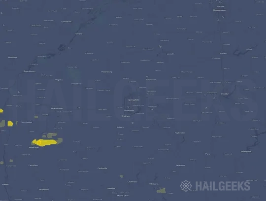

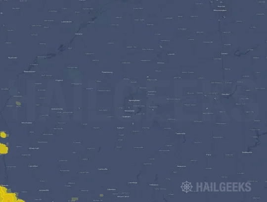


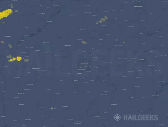
If none of these related Springfield, IL hail maps look close enough to your property, check a free Hail Report by Address. It reviews hail history for a specific location — not just the broader Springfield, IL region — so you can check whether hail activity may have reached your property.
Local Hail Review Options Near Springfield, IL
Not sure whether the June 17, 2026 Springfield, IL hail map matters for your property? Start with a free Hail Report by Address to see whether hail activity was mapped for that property. If the property signal looks meaningful, you can choose a local pro serving the Springfield, IL region and ask about a Remote Hail Inspection before deciding whether an on-site roof or exterior review is worth scheduling.
Check a specific property to see whether hail activity from the June 17, 2026 Springfield, IL event — or another recent hail event — may have been mapped at that address.
Find a roof or exterior pro serving the Springfield, IL region who can help you understand what the property hail signal may mean.
A participating local pro reviews property-level hail history remotely — not just the June 17, 2026 event — to help decide whether an on-site inspection may be worth scheduling.
A free Hail Report by Address and a Remote Hail Inspection can help you look beyond the June 17, 2026 hail map visuals alone. They do not confirm property damage and do not replace an on-site inspection for a property in the Springfield, IL region, but they can help you make a more informed next decision before anyone climbs on the roof.
Frequently Asked Questions
Common questions about the June 17, 2026 Springfield, IL hail event.