

Hail Swath Map Preview
The Charlottesville, VA hail swath map preview was last reviewed on August 30, 2026 and shows mapped hail estimates up to 1.75". There are 6 public hail reports, 74 public wind reports, and 0 nearby tornado reports listed for the July 4, 2026 event.
View the July 4, 2026 Charlottesville, VA hail event on the free interactive hail map, then check a free Hail Report by ZIP to see a more local hail signal for your area.
Impact Area and Population for the Charlottesville, VA Hail Map
The July 4, 2026 hail swath map for Charlottesville, VA covers approximately 1,942 square miles and includes an estimated 169,372 people inside the mapped footprint. The largest mapped area is in the 0.50-0.75" hail band, covering 824 square miles. The highest estimated population exposure is in the 0.50-0.75" hail band with 73,348 people.
| Mapped Hail Band | Impact Area | Population |
|---|---|---|
| < 0.50" | 648 sq mi | 53,997 |
| 0.50-0.75" | 824 sq mi | 73,348 |
| 0.75-1.00" | 321 sq mi | 33,565 |
| 1.00-1.25" | 103 sq mi | 6,373 |
| 1.25-1.50" | 31 sq mi | 1,513 |
| 1.50-1.75" | 12 sq mi | 450 |
| 1.75-2.00" | 4 sq mi | 126 |
Get a free Hail Report by ZIP to see a more local hail signal and whether the July 4, 2026 Charlottesville, VA hail event may have reached your area.
Housing Exposure Inside the Charlottesville, VA Hail Swath Map
Inside the July 4, 2026 hail swath map area for Charlottesville, VA, HailGeeks estimates 67,536 single-family homes, 7,660 townhomes, and 19,906 multifamily properties within the mapped storm footprint. Single-family-home exposure is highest in the 0.50-0.75" hail band, with 28,522 single-family homes.
| Mapped Hail Band | Single-Family | Townhomes | Multifamily |
|---|---|---|---|
| < 0.50" | 20,971 | 3,105 | 4,472 |
| 0.50-0.75" | 28,522 | 3,241 | 10,995 |
| 0.75-1.00" | 13,891 | 1,251 | 4,056 |
| 1.00-1.25" | 3,109 | 53 | 331 |
| 1.25-1.50" | 730 | 10 | 36 |
| 1.50-1.75" | 235 | 0 | 15 |
| 1.75-2.00" | 78 | 0 | 1 |
Use this table to review housing exposure by hail band for the July 4, 2026 Charlottesville, VA hail map. To check a specific property more closely, use a free Hail Report by Address.
Counties Inside the Charlottesville, VA Hail Map
Hail from the July 4, 2026 storm was mapped across 36 counties in the Charlottesville, VA region. Madison County, VA had the strongest mapped signal, peaking at 1.75" with roughly 3,018 single-family homes inside the swath.
County pages group every mapped hail event in the area. For a closer look, drop to the city or ZIP level below, or run a free Hail Report by Address.
Cities Inside the Charlottesville, VA Hail Map
Zooming in, the swath touched 41 cities near Charlottesville, VA. Spotsylvania Courthouse, VA had the strongest mapped signal at 1.00", with an estimated 993 single-family homes exposed.
City cards show where the July 4, 2026 Charlottesville, VA hail activity was mapped, but your ZIP can show a closer local signal. Get a free Hail Report by ZIP, and if the signal looks meaningful, ask a local pro about a Remote Hail Inspection to see whether an on-site roof or exterior review may be worth scheduling.
ZIP Codes Inside the Charlottesville, VA Hail Swath Map
At the ZIP level, the July 4, 2026 Charlottesville, VA hail map spans 102 ZIP codes. ZIP 22738 shows the strongest local signal, with mapped hail estimates up to 1.75" and an estimated single-family-home exposure of 387.
Check your ZIP in seconds to see whether hail activity from the July 4, 2026 Charlottesville, VA event was mapped near your area.
Public Hail, Wind, and Tornado Reports
Public storm report tables connected to the July 4, 2026 hail map for Charlottesville, VA currently list 6 public hail reports, 74 public wind reports, and 0 tornado reports.
| Date & Time | Hail Size | City | State | Description |
|---|---|---|---|---|
July 4, 2026 3:10 PM CT |
1.00 in | 2 ENE Hollymead | VA | Quarter sized hail. |
July 4, 2026 4:10 PM CT |
1.00 in | 1 ENE Wintergreen | VA | Quarter size hail was reported in Nellysford. |
July 4, 2026 4:20 PM CT |
1.25 in | 3 NW Corbin | VA | No National Weather Service description provided. |
July 4, 2026 4:22 PM CT |
1.00 in | 3 SSW Concord | VA | Hail... up to 1 inch in diameter... was observed along Wheeler Road. Hail was observed falling for about 5 minutes at this location. |
July 4, 2026 4:50 PM CT |
1.00 in | 3 NW Glenora | VA | Quarter size hail was reported in Lake Anna State Park. |
July 4, 2026 4:58 PM CT |
1.00 in | Hollymead | VA | Quarter size hail was reported in Forest Lakes. |
| Date & Time | Wind Speed | City | State | Description |
|---|---|---|---|---|
July 4, 2026 8:37 AM CT | 2 N Moscow | VA | Dozens of large trees... branches... and wires blew down in and around Mount Solon. | |
July 4, 2026 1:45 PM CT | 3 SE Broadway | VA | Several trees and wires blew down near Broadway. A large tree blew down in the 12000 block of Daphna Road. A couple of large trees blew down on US-11 Lee Highway/North Valley Pike near Lacey Spring Road to the 11000 block. Trees and wires blew down near the intersection of Wampler Road and Holsinger Road... and in the 2500 block of Mayland Road. | |
July 4, 2026 1:55 PM CT | 3 W Waynesboro | VA | A tree blew down in the 300 block of Hickory Hill Road. | |
July 4, 2026 2:08 PM CT | 2 WSW Ruddle | WV | Large tree limbs blew down along US-220 Petersburg Pike near Franklin. | |
July 4, 2026 2:15 PM CT | 2 NNE Grottoes | VA | Trees and wires blew down in the 6800 block of New Haven Road. | |
July 4, 2026 2:19 PM CT | 1 N Seneca Rocks | WV | Trees blew down onto wires on WV-28/WV-55 about one mile north of Seneca Rocks. | |
July 4, 2026 2:25 PM CT | 2 ENE Rocky Bar | VA | Trees and wires blew down in the 8600 block of US-340 East Side Highway... and in the 5100 block of Berrytown Road. | |
July 4, 2026 2:30 PM CT | 2 S Lydia | VA | Several large tree limbs blew down along VA-810 Dyke Road. | |
July 4, 2026 2:38 PM CT | 2 SSE Madison | VA | Numerous trees were down near Madison. | |
July 4, 2026 2:58 PM CT | 1 NNW Elmont | VA | Tree down on road On Rt. 626 in the County of Hanover... in the vicinity of Old Elmont Rd; Rt. 816N/S (Hanover County).... | |
July 4, 2026 2:58 PM CT | 3 W Winston | VA | Reports of multiple trees down in southwest Culpeper County. | |
July 4, 2026 3:10 PM CT | 1 WSW Ashland | VA | Multiple trees down on Elmont Rd near Ashland. | |
July 4, 2026 3:10 PM CT | 1 SW Ashland | VA | Public reported numerous trees down blocking roads... south side of Ashland. | |
July 4, 2026 3:10 PM CT | Stanley | VA | Large tree limbs fell onto power lines in the 200 block of Honeyville Avenue. | |
July 4, 2026 3:15 PM CT | 2 SE Hollymead | VA | Numerous trees and wires blew down near and north of Charlottesville. | |
July 4, 2026 3:15 PM CT | 2 S Keswick | VA | Dozens of trees and wires down widespread across eastern Albemarle County. 37 percent of the City of Charlottesville is without power. | |
July 4, 2026 3:28 PM CT | 3 NNW Rockbridge Baths | VA | Several trees down across the county. | |
July 4, 2026 3:34 PM CT | Craigsville | VA | There were a few reports of trees and wires blown down around Craigsville. | |
July 4, 2026 3:40 PM CT | 2 S Beaverdam | VA | Multiple trees knocked down powerlines on Tyler Station Rd. | |
July 4, 2026 3:45 PM CT | 1 SSW Beaverdam | VA | Trees down On Rt. 715 in the County of Hanover... in the vicinity of Tyler Station Rd. | |
July 4, 2026 3:45 PM CT | Christian | VA | Several trees blew down in Buffalo Gap. | |
July 4, 2026 3:47 PM CT | 3 E Sedalia | VA | Tree down on Sweet Hollow Road. | |
July 4, 2026 3:47 PM CT | 1 SE Beaverdam | VA | Multiple trees knocked down powerlines down along Beaverdam School Rd. | |
July 4, 2026 3:50 PM CT | 3 SW Vawter Corner | VA | Multiple trees and powerlines were knocked down on hickory creek Rd. | |
July 4, 2026 3:57 PM CT | 3 ESE Wintergreen | VA | Numerous trees blew down across Nelson County. | |
July 4, 2026 4:00 PM CT | 2 NNW Guinea | VA | Trees down On Rt. 1020 in the County of Caroline... in the vicinity of Tanglewood Dr; Tumbleweed Pl; Rt. 1021E/W (Caroline County). | |
July 4, 2026 4:00 PM CT | 4 NNW Union Mills | VA | A couple of trees down in the northwest corner of Fluvanna County... near Keswick. Time estimated from radar. | |
July 4, 2026 4:00 PM CT | 2 WSW Mint Spring | VA | Trees blew down in the 2800 block of Old Greenville Road. | |
July 4, 2026 4:00 PM CT | 3 WSW Deerfield | VA | Trees blew down in the 4200 block of VA-629 Deerfield Valley Road. | |
July 4, 2026 4:03 PM CT | 4 NE Big Island | VA | Tree down on Elon Road. | |
July 4, 2026 4:03 PM CT | Staunton | VA | There were about a half dozen reports of trees blown down around the City of Staunton. | |
July 4, 2026 4:05 PM CT | 3 NNE Trevilians | VA | Reports of several trees down in the vicinity of Oakland Road and Kents Mill Road. Time estimated from radar. | |
July 4, 2026 4:05 PM CT | 1 WSW Verona | VA | Trees blew down in the unit block of Dick Huff Lane. | |
July 4, 2026 4:05 PM CT | 2 NNE Trimbles Mill | VA | There were about a half dozen reports of trees and wires blown down in and around Swoope. | |
July 4, 2026 4:06 PM CT | 3 SE Falconerville | VA | Trained spotter reported a tree down in the Partridge Creek area in Amherst County. | |
July 4, 2026 4:06 PM CT | 1 N Coleman Falls | VA | Tree down on Skimming Creek Road. | |
July 4, 2026 4:10 PM CT | 5 ENE Massaponax | VA | Numerous large trees and several poles down along US-17 in eastern Spotsylvania County. | |
July 4, 2026 4:15 PM CT | Amherst | VA | Tree down reported by a spotter at the high school in Amherst County Virginia. | |
July 4, 2026 4:15 PM CT | 1 ENE Churchville | VA | Dozens of trees down across several locations in the county. | |
July 4, 2026 4:15 PM CT | 4 NW Staunton Arpt | VA | Trees blew down in the 500 block of Fadley Road. | |
July 4, 2026 4:18 PM CT | Churchville | VA | Dozens of large trees... branches... and wires blew down in and around Churchville. | |
July 4, 2026 4:18 PM CT | 3 NW West Augusta | VA | Trees blew down in the 2000 block of US-250 Hankey Mountain Highway/Shenandoah Mountain Drive. | |
July 4, 2026 4:20 PM CT | Waynesboro | VA | There were a few reports of wires down in the City of Waynesboro. | |
July 4, 2026 4:22 PM CT | 2 SE Forks Of Buffalo | VA | Multiple trees blown down completely blocking route 60 in Amherst county reported by a spotter. | |
July 4, 2026 4:23 PM CT | 2 NW Churchville | VA | Multiple reports of trees down in western Augusta County. Several roads closed. | |
July 4, 2026 4:27 PM CT | 3 NNE Crimora | VA | Trees blew down in the 400 block of Trayfoot Road. | |
July 4, 2026 4:28 PM CT | 5 SSW Rustburg | VA | Spotter reported multiple trees down across Campbell County Virginia... and pea to dime size hail at his location at Brownsville road and Stone road. | |
July 4, 2026 4:30 PM CT | 1 ENE Fredericksburg | VA | A tree was down along Prince Edward Street and Amelia Street. | |
July 4, 2026 4:35 PM CT | 2 N Falmouth | VA | Trees blew down on I-95 at mile marker 142. | |
July 4, 2026 4:37 PM CT | 3 ESE Wintergreen | VA | Numerous trees blew down across Nelson County. | |
July 4, 2026 4:40 PM CT | Charlottesville | VA | Dozens of trees... branches... and wires down in Charlottesville. Much of the city without power. | |
July 4, 2026 4:41 PM CT | Bridgewater | VA | Dozens of large trees... branches... and wires blew down around Bridgewater. | |
July 4, 2026 4:42 PM CT | 1 ENE Spout Spring | VA | Tree down on Richmond Highway near Spout Spring. | |
July 4, 2026 4:42 PM CT | 1 N Spout Spring | VA | Tree down on Little Dogwood Road. | |
July 4, 2026 4:44 PM CT | 1 NNE Charlottesville | VA | A large tree blew down onto a house tearing off siding near the intersection of Grove Road and Peterson Place. | |
July 4, 2026 4:45 PM CT | Charlottesville | VA | Numerous trees were down around Charlottesville and Albemarle County. The hardest hit areas were across Charlottesville as well as the eastern part of the county. There were about five reports of trees falling onto houses as well. | |
July 4, 2026 4:50 PM CT | 2 ENE Spout Spring | VA | Tree down near intersection of Richmond HWY and Depot Lane. | |
July 4, 2026 4:54 PM CT | Harrisonburg | VA | About 45 to 50 trees were down across Harrisonburg. | |
July 4, 2026 5:00 PM CT | 2 SSW Oakville | VA | Tree down on Blue Ridge Drive. | |
July 4, 2026 5:02 PM CT | 2 WSW Elkton | VA | Trees blew down in the unit block of Mount Hermon Road. | |
July 4, 2026 5:06 PM CT | 1 ESE Oakville | VA | Tree down on Quail Run. | |
July 4, 2026 5:12 PM CT | 3 NW Timberville | VA | Three trees and numerous branches down at spotter's residence. Estimated wind gusts to 65 mph. | |
July 4, 2026 5:34 PM CT | 5 N Buckingham | VA | Tree down on Saint Andrews Road. | |
July 4, 2026 5:40 PM CT | 2 SW Toga | VA | Two trees down on Mount Rush Highway. | |
July 4, 2026 5:45 PM CT | 3 NNW Centenary | VA | Tree down on Rock Island Road. | |
July 4, 2026 5:47 PM CT | 4 SW Antioch | VA | Broadcast media relayed information of multiple large pine trees fell near Scottsville. | |
July 4, 2026 5:50 PM CT | 2 NE Toga | VA | Tree down on Bridge Road. | |
July 4, 2026 5:52 PM CT | 3 SSW Buckingham | VA | Tree down on Dixie Hill Road. | |
July 4, 2026 5:55 PM CT | 1 SE Lake Monticello | VA | Tree knocked down powerline near Lake Monticello. | |
July 4, 2026 5:55 PM CT | 4 SE Dillwyn | VA | Tree down on East Anderson Highway. | |
July 4, 2026 6:05 PM CT | 1 SSW Ashby | VA | Multiple trees and trees on powerlines in the northern portion of the county. | |
July 4, 2026 6:06 PM CT | 7 SSE Dillwyn | VA | Tree down on Back Mountain Road. | |
July 4, 2026 4:55 PM CT | 63 mph | 1 S Broadway | VA | A wind gust of 55 knots (63 MPH) was measured by a CWOP station in Broadway (GW5695). |
July 4, 2026 5:12 PM CT | 65 mph | 3 NW Timberville | VA | Three trees and numerous branches down at spotter's residence. Estimated wind gusts to 65 mph. |
| Date & Time | Rating | City | State | Description |
|---|---|---|---|---|
| No public tornado reports are available for this event. | ||||
This table includes only public storm reports connected to the July 4, 2026 Charlottesville, VA storm event. When available, each report may include the time, size or magnitude, city, state, and a short description.
Related Hail Maps in the Charlottesville, VA Region
We found 6 more hail maps with reports from the same Charlottesville, VA region as the July 4, 2026 event. These related maps cover storm dates from Jun 10, 2026 through Jun 26, 2026, with mapped hail estimates ranging from 0.75" to 1.25". In this set, the strongest related map reached 1.25", and the most recent map shown is from Jun 26, 2026.

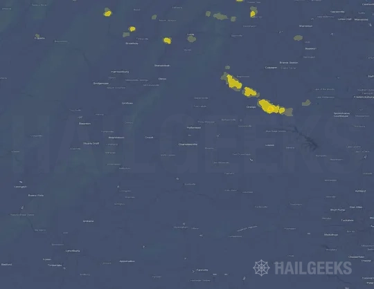

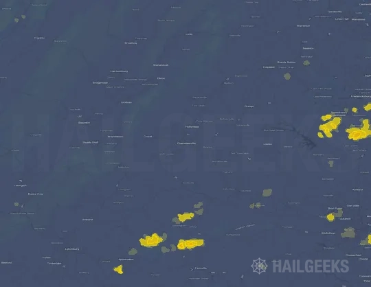

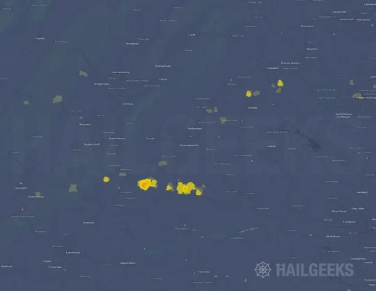
If none of these related Charlottesville, VA hail maps look close enough to your property, check a free Hail Report by Address. It reviews hail history for a specific location — not just the broader Charlottesville, VA region — so you can check whether hail activity may have reached your property.
Local Hail Review Options Near Charlottesville, VA
Not sure whether the July 4, 2026 Charlottesville, VA hail map matters for your property? Start with a free Hail Report by Address to see whether hail activity was mapped for that property. If the property signal looks meaningful, you can choose a local pro serving the Charlottesville, VA region and ask about a Remote Hail Inspection before deciding whether an on-site roof or exterior review is worth scheduling.
Check a specific property to see whether hail activity from the July 4, 2026 Charlottesville, VA event — or another recent hail event — may have been mapped at that address.
Find a roof or exterior pro serving the Charlottesville, VA region who can help you understand what the property hail signal may mean.
A participating local pro reviews property-level hail history remotely — not just the July 4, 2026 event — to help decide whether an on-site inspection may be worth scheduling.
A free Hail Report by Address and a Remote Hail Inspection can help you look beyond the July 4, 2026 hail map visuals alone. They do not confirm property damage and do not replace an on-site inspection for a property in the Charlottesville, VA region, but they can help you make a more informed next decision before anyone climbs on the roof.
Frequently Asked Questions
Common questions about the July 4, 2026 Charlottesville, VA hail event.