

Hail Swath Map Preview
The Morgantown, WV hail swath map preview was last reviewed on August 30, 2026 and shows mapped hail estimates up to 2.50". There are 4 public hail reports, 49 public wind reports, and 3 nearby tornado reports listed for the July 21, 2026 event.
View the July 21, 2026 Morgantown, WV hail event on the free interactive hail map, then check a free Hail Report by ZIP to see a more local hail signal for your area.
Impact Area and Population for the Morgantown, WV Hail Map
The July 21, 2026 hail swath map for Morgantown, WV covers approximately 1,198 square miles and includes an estimated 49,024 people inside the mapped footprint. The largest mapped area is in the 0.50-0.75" hail band, covering 405 square miles. The highest estimated population exposure is in the 0.50-0.75" hail band with 17,666 people.
| Mapped Hail Band | Impact Area | Population |
|---|---|---|
| < 0.50" | 306 sq mi | 17,233 |
| 0.50-0.75" | 405 sq mi | 17,666 |
| 0.75-1.00" | 136 sq mi | 3,482 |
| 1.00-1.25" | 122 sq mi | 5,640 |
| 1.25-1.50" | 86 sq mi | 2,373 |
| 1.50-1.75" | 75 sq mi | 1,611 |
| 1.75-2.00" | 54 sq mi | 738 |
| 2.00-2.25" | 9 sq mi | 218 |
| 2.25-2.50" | 4 sq mi | 45 |
| 2.50-2.75" | 2 sq mi | 18 |
Get a free Hail Report by ZIP to see a more local hail signal and whether the July 21, 2026 Morgantown, WV hail event may have reached your area.
Housing Exposure Inside the Morgantown, WV Hail Swath Map
Inside the July 21, 2026 hail swath map area for Morgantown, WV, HailGeeks estimates 23,141 single-family homes, 394 townhomes, and 2,950 multifamily properties within the mapped storm footprint. Single-family-home exposure is highest in the 0.50-0.75" hail band, with 8,631 single-family homes.
| Mapped Hail Band | Single-Family | Townhomes | Multifamily |
|---|---|---|---|
| < 0.50" | 8,178 | 117 | 1,052 |
| 0.50-0.75" | 8,631 | 192 | 1,153 |
| 0.75-1.00" | 1,672 | 14 | 181 |
| 1.00-1.25" | 2,470 | 23 | 446 |
| 1.25-1.50" | 987 | 20 | 72 |
| 1.50-1.75" | 703 | 13 | 33 |
| 1.75-2.00" | 366 | 12 | 5 |
| 2.00-2.25" | 98 | 3 | 8 |
| 2.25-2.50" | 26 | 0 | 0 |
| 2.50-2.75" | 10 | 0 | 0 |
Use this table to review housing exposure by hail band for the July 21, 2026 Morgantown, WV hail map. To check a specific property more closely, use a free Hail Report by Address.
Counties Inside the Morgantown, WV Hail Map
Hail from the July 21, 2026 storm was mapped across 15 counties in the Morgantown, WV region. Doddridge County, WV had the strongest mapped signal, peaking at 2.50" with roughly 1,740 single-family homes inside the swath.
County pages group every mapped hail event in the area. For a closer look, drop to the city or ZIP level below, or run a free Hail Report by Address.
Cities Inside the Morgantown, WV Hail Map
Zooming in, the swath touched 21 cities near Morgantown, WV. Pennsboro, WV had the strongest mapped signal at 1.50", with an estimated 77 single-family homes exposed.
City cards show where the July 21, 2026 Morgantown, WV hail activity was mapped, but your ZIP can show a closer local signal. Get a free Hail Report by ZIP, and if the signal looks meaningful, ask a local pro about a Remote Hail Inspection to see whether an on-site roof or exterior review may be worth scheduling.
ZIP Codes Inside the Morgantown, WV Hail Swath Map
At the ZIP level, the July 21, 2026 Morgantown, WV hail map spans 48 ZIP codes. ZIP 26456 shows the strongest local signal, with mapped hail estimates up to 2.50" and an estimated single-family-home exposure of 1,080.
Check your ZIP in seconds to see whether hail activity from the July 21, 2026 Morgantown, WV event was mapped near your area.
Public Hail, Wind, and Tornado Reports
Public storm report tables connected to the July 21, 2026 hail map for Morgantown, WV currently list 4 public hail reports, 49 public wind reports, and 3 tornado reports.
| Date & Time | Hail Size | City | State | Description |
|---|---|---|---|---|
July 21, 2026 1:25 PM CT |
0.50 in | 4 Sw Stonewall Jackson | WV | Report from mPING: Half-inch (0.50 in.). |
July 21, 2026 4:15 PM CT |
0.50 in | 1 S Shinnston | WV | No National Weather Service description provided. |
July 21, 2026 4:21 PM CT |
0.75 in | 3 Ne Bridgeport | WV | Report from mPING: Dime (0.75 in.). |
July 21, 2026 4:47 PM CT |
0.50 in | 1 E Jane Lew | WV | Report from mPING: Half-inch (0.50 in.). |
| Date & Time | Wind Speed | City | State | Description |
|---|---|---|---|---|
July 21, 2026 12:13 PM CT | 3 N Steubenville | OH | A tree was reported down on Township Road 380. | |
July 21, 2026 1:05 PM CT | 9 Ese Auburn | WV | Tree in the roadway on Vadis Rd. Time estimated from radar. | |
July 21, 2026 1:10 PM CT | 9 Nne Sand Fork | WV | Over 200 customers without power due to tree damage in the Linn area. | |
July 21, 2026 1:15 PM CT | 6 Wsw Stonewall Jackson | WV | Tree in roadway in the 1200 block of Loveberry Run Rd. Time estimated from radar. | |
July 21, 2026 1:27 PM CT | 2 Wsw Stonewall Jackson | WV | Tree down blocking roadway. | |
July 21, 2026 1:35 PM CT | 5 Sse Buckhannon | WV | Tree down on Trubie Run Road. Time estimated from radar. | |
July 21, 2026 3:10 PM CT | 4 Ne Star City | WV | Large tree down across Hoard Road blocking driveways. Time estimated via radar. | |
July 21, 2026 3:13 PM CT | 2 Ssw Morgantown | WV | A tree was reported down on Hite Street. | |
July 21, 2026 3:35 PM CT | 2 Nne Pine Grove | WV | A tree was reported down on a roadway on Barker Run Road. | |
July 21, 2026 3:38 PM CT | 2 Nne Pine Grove | WV | 3 trees down blocking traffic. Time estimated by radar. | |
July 21, 2026 3:51 PM CT | 5 Nne Pennsboro | WV | Trees down on Willow Lane. Time estimated from radar. | |
July 21, 2026 4:00 PM CT | 1 N Anmoore | WV | Numerous reports of trees and lines down near Bridgeport_ Clarksburg_ Hepzibah_ Lumberport_ Salem_ Spelter_ and Wallace. | |
July 21, 2026 4:00 PM CT | 2 Wsw West Union | WV | Multiple reports of trees down along US-50 west of West Union. | |
July 21, 2026 4:00 PM CT | 5 Ne Salem | WV | Tree and lines down on Grass Run Road. | |
July 21, 2026 4:00 PM CT | 6 Ene Salem | WV | Tree down on Marshville Road. Time estimated by radar. | |
July 21, 2026 4:05 PM CT | 4 W Lumberport | WV | Tree down on State Route 20. Time estimated by radar. | |
July 21, 2026 4:05 PM CT | 6 Ene Salem | WV | Tree down on Marshville Road. Time estimated by radar. | |
July 21, 2026 4:05 PM CT | 6 Wsw Lumberport | WV | Power lines down on Rock Camp Road. Time estimated by radar. | |
July 21, 2026 4:05 PM CT | Pennsboro | WV | Multiple trees and lines down near Pennsboro. | |
July 21, 2026 4:09 PM CT | 3 N Despard | WV | Several trees down_ some minor siding and roof damage to homes_ and power outages. Time is estimated by radar. | |
July 21, 2026 4:10 PM CT | 5 Sw Salem | WV | Trees and lines down on Hunters Fork Road. Time estimated from radar. | |
July 21, 2026 4:10 PM CT | 6 Wsw Lumberport | WV | Tree down on Big Rock Camp Road. Time estimated by radar. | |
July 21, 2026 4:15 PM CT | 4 N West Milford | WV | Power lines hanging 2 feet above the road on Isaac Creek Road. Time estimated by radar. | |
July 21, 2026 4:19 PM CT | 3 E Fairmont | WV | Tree down blocking road and power lines down. Time estimated from radar. | |
July 21, 2026 4:20 PM CT | 3 Ene Salem | WV | Tree down on Holden Hollow Road. Time estimated by radar. | |
July 21, 2026 4:20 PM CT | 5 Nw Salem | WV | Tree in the roadway in the 3000 block of Big Battle Run. | |
July 21, 2026 4:25 PM CT | 7 Nw Salem | WV | Over 1000 customers without power due to tree damage from Smithburg to near Center Point. | |
July 21, 2026 4:30 PM CT | Grafton | WV | Multiple reports of trees and lines down near Grafton_ Flemington_ and Rosemont. | |
July 21, 2026 4:32 PM CT | 4 N Philippi | WV | Tree down across Arden Road. Time estimated from radar. | |
July 21, 2026 4:36 PM CT | 3 W Jackson Mill | WV | One medium-sized sycamore and one large maple tree uprooted. In addition_ the intersection of Right Freemans Creek Road and Valley Chapel Road blocked by a large maple tree. Time is estimated by rada | |
July 21, 2026 4:40 PM CT | 1 Wnw Clarksburg | WV | Power lines down on Locust Avenue in Clarksburg. Time estimated by radar. | |
July 21, 2026 4:40 PM CT | 2 Se Salem | WV | Tree down near Halls Run Road southeast of Salem. Time Estimated by radar. | |
July 21, 2026 4:40 PM CT | 4 Wnw Clarksburg | WV | Tree down near Curtis Avenue. Time estimated by radar. | |
July 21, 2026 4:40 PM CT | 6 Wsw Lumberport | WV | Power lines down on Big Rock Camp Road. Time estimated by radar. | |
July 21, 2026 4:45 PM CT | 3 Nne Flemington | WV | Power lines down near Long Run Road. Time estimated by radar. | |
July 21, 2026 4:47 PM CT | Philippi | WV | Several trees down in and around the Philippi area including one fallen onto an unoccupied vehicle in the 2000 block of Arden Rd. | |
July 21, 2026 4:53 PM CT | 67 mph | 2 Ene Bridgeport | WV | ASOS station KCKB Clarksburg Airport. |
July 21, 2026 4:58 PM CT | 6 Sse Buckhannon | WV | Tree and line down along Gatrells Road. Time estimated from radar. | |
July 21, 2026 4:58 PM CT | 8 Nnw Montrose | WV | Tree down blocking all lanes along Nestor Rd. | |
July 21, 2026 5:00 PM CT | Buckhannon | WV | Multiple trees down near Buckhannon. One tree fell on a house. Time estimated from radar. | |
July 21, 2026 5:04 PM CT | 5 Se Buckhannon | WV | Tree fell into house. Time estimated from radar. | |
July 21, 2026 5:15 PM CT | Womelsdorf (Coalton) | WV | Tree down Coalton-Pumpkintown Rd and Broadway Rd. | |
July 21, 2026 5:25 PM CT | 1 Sw Elkins | WV | Multiple trees down in the Elkins area. | |
July 21, 2026 5:30 PM CT | 5 S Sand Fork | WV | Over 300 customers without power due to tree damage. | |
July 21, 2026 5:35 PM CT | 2 Nne Harman | WV | Tree down in the 800 block of Pennington Rd. | |
July 21, 2026 5:51 PM CT | 44 mph | 3 S Elkins | WV | ASOS station KEKN Elkins Airport. |
July 21, 2026 5:55 PM CT | Buckhannon | WV | Report of swift water rescue from the creek along Little Sand Run Road. | |
July 21, 2026 6:21 PM CT | 2 Se Burnsville | WV | Over 800 customers in and around Burnsville without power due to tree damage. | |
July 21, 2026 8:06 PM CT | 1 Ssw Montrose | WV | Flooded roads reported near Montrose and Valley Bend. |
| Date & Time | Rating | City | State | Description |
|---|---|---|---|---|
July 21, 2026 4:38 PM CT | UNK | 3 N Philippi | WV | An EF-0 tornado occurred near Taylors Drain Road with maximum estimated winds of up to 85 mph. Numerous hardwood trees were either uprooted or snapped along the track of the tornado. Some of the hard |
July 21, 2026 4:38 PM CT | UNK | 3 N Philippi | WV | EF0 tornado tracked 0.3 miles along railroad tracks south of Taylors Drain Rd. |
July 21, 2026 5:55 PM CT | UNK | 2 Wnw Whitmer | WV | An EF1 tornado with maximum estimated winds of up to 95 mph began just west of Whitmer Road midway up Rich Mountain_ or approximately 2 miles northwest of the town of Whitmer. It then traveled east-s |
This table includes only public storm reports connected to the July 21, 2026 Morgantown, WV storm event. When available, each report may include the time, size or magnitude, city, state, and a short description.
Related Hail Maps in the Morgantown, WV Region
We found 6 more hail maps with reports from the same Morgantown, WV region as the July 21, 2026 event. These related maps cover storm dates from May 27, 2026 through Jul 17, 2026, with mapped hail estimates ranging from 0.75" to 2.50". In this set, the strongest related map reached 2.50", and the most recent map shown is from Jul 17, 2026.

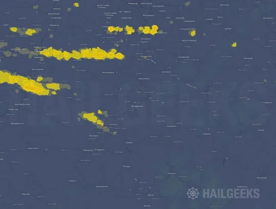


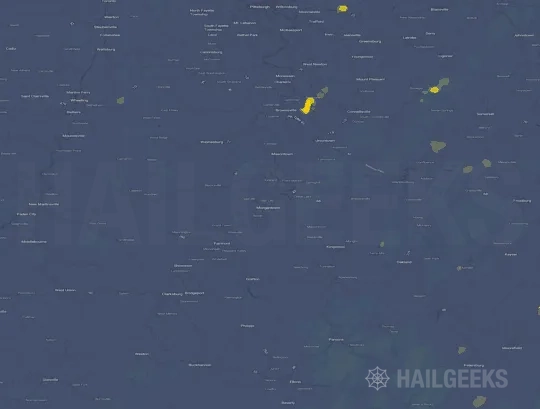

If none of these related Morgantown, WV hail maps look close enough to your property, check a free Hail Report by Address. It reviews hail history for a specific location — not just the broader Morgantown, WV region — so you can check whether hail activity may have reached your property.
Local Hail Review Options Near Morgantown, WV
Not sure whether the July 21, 2026 Morgantown, WV hail map matters for your property? Start with a free Hail Report by Address to see whether hail activity was mapped for that property. If the property signal looks meaningful, you can choose a local pro serving the Morgantown, WV region and ask about a Remote Hail Inspection before deciding whether an on-site roof or exterior review is worth scheduling.
Check a specific property to see whether hail activity from the July 21, 2026 Morgantown, WV event — or another recent hail event — may have been mapped at that address.
Find a roof or exterior pro serving the Morgantown, WV region who can help you understand what the property hail signal may mean.
A participating local pro reviews property-level hail history remotely — not just the July 21, 2026 event — to help decide whether an on-site inspection may be worth scheduling.
A free Hail Report by Address and a Remote Hail Inspection can help you look beyond the July 21, 2026 hail map visuals alone. They do not confirm property damage and do not replace an on-site inspection for a property in the Morgantown, WV region, but they can help you make a more informed next decision before anyone climbs on the roof.
Frequently Asked Questions
Common questions about the July 21, 2026 Morgantown, WV hail event.