

Hail Swath Map Preview
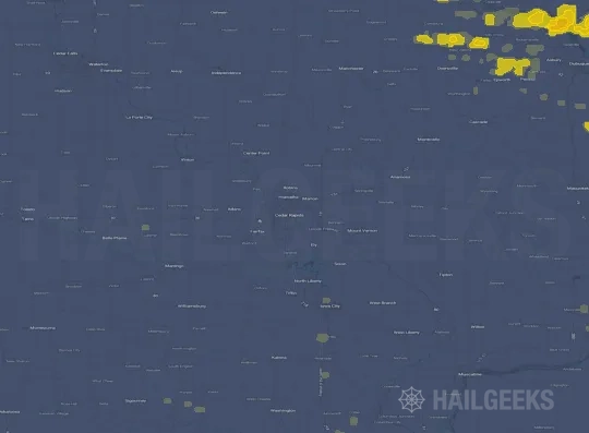
The Cedar Rapids, IA hail swath map preview was last reviewed on August 27, 2026 and shows mapped hail estimates up to 1.50". There are 0 public hail reports, 10 public wind reports, and 29 nearby tornado reports listed for the July 14, 2021 event.
View the July 14, 2021 Cedar Rapids, IA hail event on the free interactive hail map, then check a free Hail Report by ZIP to see a more local hail signal for your area.
Impact Area and Population for the Cedar Rapids, IA Hail Map
The July 14, 2021 hail swath map for Cedar Rapids, IA covers approximately 2,615 square miles and includes an estimated 167,014 people inside the mapped footprint. The largest mapped area is in the 0.50-0.75" hail band, covering 1,103 square miles. The highest estimated population exposure is in the < 0.50" hail band with 89,314 people.
| Mapped Hail Band | Impact Area | Population |
|---|---|---|
| < 0.50" | 1,070 sq mi | 89,314 |
| 0.50-0.75" | 1,103 sq mi | 60,862 |
| 0.75-1.00" | 349 sq mi | 11,581 |
| 1.00-1.25" | 79 sq mi | 4,698 |
| 1.25-1.50" | 12 sq mi | 548 |
| 1.50-1.75" | 2 sq mi | 11 |
Get a free Hail Report by ZIP to see a more local hail signal and whether the July 14, 2021 Cedar Rapids, IA hail event may have reached your area.
Housing Exposure Inside the Cedar Rapids, IA Hail Swath Map
Inside the July 14, 2021 hail swath map area for Cedar Rapids, IA, HailGeeks estimates 73,629 single-family homes, 4,590 townhomes, and 20,014 multifamily properties within the mapped storm footprint. Single-family-home exposure is highest in the < 0.50" hail band, with 39,522 single-family homes.
| Mapped Hail Band | Single-Family | Townhomes | Multifamily |
|---|---|---|---|
| < 0.50" | 39,522 | 2,377 | 12,747 |
| 0.50-0.75" | 26,659 | 1,904 | 5,970 |
| 0.75-1.00" | 5,450 | 227 | 670 |
| 1.00-1.25" | 1,789 | 66 | 545 |
| 1.25-1.50" | 203 | 16 | 82 |
| 1.50-1.75" | 6 | 0 | 0 |
Use this table to review housing exposure by hail band for the July 14, 2021 Cedar Rapids, IA hail map. To check a specific property more closely, use a free Hail Report by Address.
Counties Inside the Cedar Rapids, IA Hail Map
Hail from the July 14, 2021 storm was mapped across 30 counties in the Cedar Rapids, IA region. Keokuk County, IA had the strongest mapped signal, peaking at 1.50" with roughly 422 single-family homes inside the swath.
County pages group every mapped hail event in the area. For a closer look, drop to the city or ZIP level below, or run a free Hail Report by Address.
Cities Inside the Cedar Rapids, IA Hail Map
Zooming in, the swath touched 52 cities near Cedar Rapids, IA. Waverly, IA had the strongest mapped signal at 1.00", with an estimated 791 single-family homes exposed.
City cards show where the July 14, 2021 Cedar Rapids, IA hail activity was mapped, but your ZIP can show a closer local signal. Get a free Hail Report by ZIP, and if the signal looks meaningful, ask a local pro about a Remote Hail Inspection to see whether an on-site roof or exterior review may be worth scheduling.
ZIP Codes Inside the Cedar Rapids, IA Hail Swath Map
At the ZIP level, the July 14, 2021 Cedar Rapids, IA hail map spans 104 ZIP codes. ZIP 50268 shows the strongest local signal, with mapped hail estimates up to 1.50" and an estimated single-family-home exposure of 225.
Check your ZIP in seconds to see whether hail activity from the July 14, 2021 Cedar Rapids, IA event was mapped near your area.
Public Hail, Wind, and Tornado Reports
Public storm report tables connected to the July 14, 2021 hail map for Cedar Rapids, IA currently list 0 public hail reports, 10 public wind reports, and 29 tornado reports.
| Date & Time | Hail Size | City | State | Description |
|---|---|---|---|---|
| No public hail reports are available for this event. | ||||
| Date & Time | Wind Speed | City | State | Description |
|---|---|---|---|---|
July 14, 2021 6:17 PM CT | Waterloo | IA | NUMEROUS TREES DOWN. TIME ESTIMATED FROM RADAR. | |
July 14, 2021 6:22 PM CT | Waterloo | IA | TREES DOWN. TIME ESTIMATED. | |
July 14, 2021 6:23 PM CT | Oelwein | IA | REPORTS OF BUILDING DAMAGE AROUND TOWN. | |
July 14, 2021 6:50 PM CT | 2 NNW Hazleton | IA | BLOWN OVER CORN DAMAGE ALONG AND MAINLY EAST OF HWY 150 TOWARDS DELAWARE COUNTY. TIME ESTIMATED FROM RADAR. | |
July 14, 2021 7:24 PM CT | Dysart | IA | DYSART FIRE CALLED OUT FOR A DOWNED TRANSFORMER THAT STARTED A FIRE. | |
July 14, 2021 8:50 PM CT | 3 NNW Center Point | IA | LARGE AREA OF FLATTENED CORN. | |
July 14, 2021 9:50 PM CT | 4 NW Langworthy | IA | DAMAGE TO HOME AND MACHINE SHED. REPORT RELAYED BY EM. POSSIBLE TORNADO. TIME ESTIMATED FROM RADAR. | |
July 14, 2021 10:30 PM CT | West Branch | IA | A TRAINED SPOTTER RELAYED A PUBLIC REPORT OF A WALNUT TREE THAT SNAPPED AND LANDED ON THRE VEHICLES IN WEST BRANCH. | |
July 14, 2021 10:33 PM CT | 60 mph | 2 NE Buchanan | IA | COUNTY OFFICIAL REPORTED ESTIMATED WIND GUSTS OF UP TO 60 MPH GENERALLY 6 MILES WEST OF THE TIPTON AREA. |
July 14, 2021 10:56 PM CT | 60 mph | 1 W New Liberty | IA | HAM RADIO RELAY OF ESTIMATED 60 MPH WIND GUST JUST WEST OF NEW LIBERTY. |
| Date & Time | Rating | City | State | Description |
|---|---|---|---|---|
July 14, 2021 4:23 PM CT | UNK | 2 SW Waverly | IA | No National Weather Service description provided. |
July 14, 2021 5:16 PM CT | UNK | 2 SSW Shell Rock | IA | DAMAGE BEGINS AROUND 250TH AND WILLOW AVENUE. HOUSES DAMAGED. GRAIN BINS DAMAGED. POWER LINES DOWN. DAMAGE PARALLELED 250TH EAST. |
July 14, 2021 5:18 PM CT | UNK | 1 NE Shell Rock | IA | KGAN METEOROLOGIST REPORTS TORNADO NEAR SHELL ROCK. |
July 14, 2021 5:19 PM CT | UNK | 1 E Shell Rock | IA | NO DAMAGE SEEN YET. |
July 14, 2021 5:19 PM CT | UNK | 2 S Shell Rock | IA | DAMAGE TO TREES AND A HOME NEAR 250TH AND WOODS AVE. REPORT COURTESY IOWAS NEWS NOW. TIME ESTIMATED BY RADAR. |
July 14, 2021 5:21 PM CT | UNK | 2 ENE Shell Rock | IA | REPORT VIA SOCIAL MEDIA. PHOTOS AND VIDEOS REPORTED. |
July 14, 2021 5:25 PM CT | UNK | 2 SW Waverly | IA | TORNADO REPORTED NEAR THE INTERSECTION OF 240TH ST AND HWY 218. TORNADO HEADING EAST. |
July 14, 2021 5:28 PM CT | UNK | 1 S Shell Rock | IA | SIGNIFICANT TREE DAMAGE AND LIGHT STRUCTURE DAMAGE. |
July 14, 2021 5:35 PM CT | UNK | 2 S Waverly | IA | TORNADO ON THE GROUND. DEBRIS BEING LOFTED INTO THE AIR. |
July 14, 2021 5:35 PM CT | UNK | 3 ESE Waverly | IA | HOUSE COMPLETELY DESTROYED. |
July 14, 2021 5:37 PM CT | UNK | 2 S Waverly | IA | REPORT VIA SOCIAL MEDIA. |
July 14, 2021 5:39 PM CT | UNK | 4 WNW Denver | IA | TORNADO ON THE GROUND. DEBRIS BEING LOFTED INTO THE AIR. |
July 14, 2021 6:19 PM CT | UNK | 1 NW Waterloo | IA | DELAYED REPORT - BRIEF TORNADO TOUCHDOWN NEAR JOHN DEERE COMPLEX WITH SOME DAMAGE EITHER SIDE OF US 218. |
July 14, 2021 6:19 PM CT | UNK | 1 NW Waterloo | IA | BRIEF TORNADO REPORTED NEAR THE JOHN DEERE FACILITY WITH DAMAGE REPORTED NEAR US 218. |
July 14, 2021 6:40 PM CT | UNK | 3 SW Oelwein | IA | EF0 WITH 3 MILE PATH LENGTH WITH MAX WIDTH OF 30 YARDS AND ESTIMATED SPEED OF 70 MPH. MOSTLY CROP DAMAGE... BUT SOME LIGHT TREE AND HOUSE DAMAGE IN OELWEIN. |
July 14, 2021 6:40 PM CT | UNK | 3 NW Hazleton | IA | START LOCATION OF OELWEIN TORNADO IN BUCHANAN COUNTY. NOT A NEW TRACK. |
July 14, 2021 7:05 PM CT | UNK | Dysart | IA | STRUCTURAL DAMAGE TO BUILDINGS. TIME ESTIMATED FROM RADAR. |
July 14, 2021 7:10 PM CT | UNK | 3 SSE Aurora | IA | BRIEF TOUCHDOWN IN A FIELD WITH NO VISIBLE DAMAGE. |
July 14, 2021 7:20 PM CT | UNK | 1 N Garrison | IA | BENTON COUNTY EMA RELAYED PUBLIC REPORT OF A BRIEF TORNADO TOUCHDOWN ALONG 18TH AVENUE 1 MILE NORTH OF GARRISON. |
July 14, 2021 7:36 PM CT | UNK | 2 E Garrison | IA | BENTON COUNTY EMA RELAYED A PUBLIC REPORT OF A BRIEF TORNADO TOUCH DOWN NORTH OF 61ST STREET BETWEEN GARRISON AND VINTON. |
July 14, 2021 7:50 PM CT | UNK | 5 S Vinton | IA | No National Weather Service description provided. |
July 14, 2021 7:53 PM CT | UNK | 1 SW Manchester | IA | DELAWARE COUNTY EMA RELAYED LIKELY TORNADO DAMAGE REPORT OF A DAMAGED CONVENIENCE STORE AND POWER LINES DOWN ON SOUTHWEST SIDE OF MANCHESTER. |
July 14, 2021 7:58 PM CT | UNK | Manchester | IA | SPOTTERS REPORTING TWO SEPARATE TORNADOES... ONE ABOUT TO CROSS HIGHWAY 13... NORTH OF HIGHWAY 20 NEAR MANCHESTER AND THE OTHER ABOUT 3 MILES WEST OF MANCHESTER. |
July 14, 2021 8:46 PM CT | UNK | 4 NNE Lafayette | IA | BRIEF TORNADO. DELAYED REPORT FROM EMERGENCY MANAGER. |
July 14, 2021 8:50 PM CT | UNK | 4 NNE Lafayette | IA | BRIEF TOUCHDOWN IN A FIELD WITH NO VISIBLE DAMAGE. |
July 14, 2021 8:52 PM CT | UNK | 3 N Center Point | IA | BRIEF TOUCHDOWN IN A FIELD WITH NO VISIBLE DAMAGE. |
July 14, 2021 9:44 PM CT | UNK | 4 WNW Langworthy | IA | AN EF-1 TORNADO TOUCHED DOWN SOUTHWEST OF MONTICELLO DAMAGING OUTBUILDINGS AND SNAPPING LARGE TREES ON TWO FARMSTEADS. |
July 14, 2021 10:02 PM CT | UNK | 2 SSE Monticello Munici | IA | AN EF-1 TORNADO DEVELOPED SOUTHEAST OF MONTICELLO AND TRACKED ACROSS RURAL AREAS EAST OF MONTICELLO ALONG AN INTERMITTENT 8 MILE PATH THROUGH FARMLAND AND WOODED AREAS. |
July 14, 2021 10:30 PM CT | UNK | 3 WSW Canton | IA | AN EF-1 TORNADO TRACKED ACROSS RURAL JONES COUNTY SNAPPING TREES AND ENDING JUST SOUTH OF CANTON. |
This table includes only public storm reports connected to the July 14, 2021 Cedar Rapids, IA storm event. When available, each report may include the time, size or magnitude, city, state, and a short description.
Related Hail Maps in the Cedar Rapids, IA Region
We found 6 more hail maps with reports from the same Cedar Rapids, IA region as the July 14, 2021 event. These related maps cover storm dates from Jun 17, 2021 through Jul 13, 2021, with mapped hail estimates ranging from 1.00" to 1.50". In this set, the strongest related map reached 1.50", and the most recent map shown is from Jul 13, 2021.


If none of these related Cedar Rapids, IA hail maps look close enough to your property, check a free Hail Report by Address. It reviews hail history for a specific location — not just the broader Cedar Rapids, IA region — so you can check whether hail activity may have reached your property.
Local Hail Review Options Near Cedar Rapids, IA
Not sure whether the July 14, 2021 Cedar Rapids, IA hail map matters for your property? Start with a free Hail Report by Address to see whether hail activity was mapped for that property. If the property signal looks meaningful, you can choose a local pro serving the Cedar Rapids, IA region and ask about a Remote Hail Inspection before deciding whether an on-site roof or exterior review is worth scheduling.
Check a specific property to see whether hail activity from the July 14, 2021 Cedar Rapids, IA event — or another recent hail event — may have been mapped at that address.
Find a roof or exterior pro serving the Cedar Rapids, IA region who can help you understand what the property hail signal may mean.
A participating local pro reviews property-level hail history remotely — not just the July 14, 2021 event — to help decide whether an on-site inspection may be worth scheduling.
A free Hail Report by Address and a Remote Hail Inspection can help you look beyond the July 14, 2021 hail map visuals alone. They do not confirm property damage and do not replace an on-site inspection for a property in the Cedar Rapids, IA region, but they can help you make a more informed next decision before anyone climbs on the roof.
Frequently Asked Questions
Common questions about the July 14, 2021 Cedar Rapids, IA hail event.