

Hail Swath Map Preview
The Morgantown, WV hail swath map preview was last reviewed on August 27, 2026 and shows mapped hail estimates up to 2.00". There are 0 public hail reports, 23 public wind reports, and 9 nearby tornado reports listed for the July 29, 2021 event.
View the July 29, 2021 Morgantown, WV hail event on the free interactive hail map, then check a free Hail Report by ZIP to see a more local hail signal for your area.
Impact Area and Population for the Morgantown, WV Hail Map
The July 29, 2021 hail swath map for Morgantown, WV covers approximately 501 square miles and includes an estimated 50,658 people inside the mapped footprint. The largest mapped area is in the < 0.50" hail band, covering 236 square miles. The highest estimated population exposure is in the 0.50-0.75" hail band with 24,620 people.
| Mapped Hail Band | Impact Area | Population |
|---|---|---|
| < 0.50" | 236 sq mi | 19,006 |
| 0.50-0.75" | 198 sq mi | 24,620 |
| 0.75-1.00" | 27 sq mi | 5,390 |
| 1.00-1.25" | 13 sq mi | 402 |
| 1.25-1.50" | 13 sq mi | 780 |
| 1.50-1.75" | 7 sq mi | 246 |
| 1.75-2.00" | 5 sq mi | 165 |
| 2.00-2.25" | 2 sq mi | 49 |
Get a free Hail Report by ZIP to see a more local hail signal and whether the July 29, 2021 Morgantown, WV hail event may have reached your area.
Housing Exposure Inside the Morgantown, WV Hail Swath Map
Inside the July 29, 2021 hail swath map area for Morgantown, WV, HailGeeks estimates 23,497 single-family homes, 1,156 townhomes, and 7,421 multifamily properties within the mapped storm footprint. Single-family-home exposure is highest in the 0.50-0.75" hail band, with 10,792 single-family homes.
| Mapped Hail Band | Single-Family | Townhomes | Multifamily |
|---|---|---|---|
| < 0.50" | 8,801 | 497 | 2,706 |
| 0.50-0.75" | 10,792 | 597 | 3,772 |
| 0.75-1.00" | 2,751 | 62 | 872 |
| 1.00-1.25" | 232 | 0 | 16 |
| 1.25-1.50" | 600 | 0 | 44 |
| 1.50-1.75" | 161 | 0 | 6 |
| 1.75-2.00" | 122 | 0 | 4 |
| 2.00-2.25" | 38 | 0 | 1 |
Use this table to review housing exposure by hail band for the July 29, 2021 Morgantown, WV hail map. To check a specific property more closely, use a free Hail Report by Address.
Counties Inside the Morgantown, WV Hail Map
Hail from the July 29, 2021 storm was mapped across 18 counties in the Morgantown, WV region. Ohio County, WV had the strongest mapped signal, peaking at 2.00" with roughly 9,124 single-family homes inside the swath.
County pages group every mapped hail event in the area. For a closer look, drop to the city or ZIP level below, or run a free Hail Report by Address.
Cities Inside the Morgantown, WV Hail Map
Zooming in, the swath touched 15 cities near Morgantown, WV. Triadelphia, WV had the strongest mapped signal at 1.00", with an estimated 438 single-family homes exposed.
City cards show where the July 29, 2021 Morgantown, WV hail activity was mapped, but your ZIP can show a closer local signal. Get a free Hail Report by ZIP, and if the signal looks meaningful, ask a local pro about a Remote Hail Inspection to see whether an on-site roof or exterior review may be worth scheduling.
ZIP Codes Inside the Morgantown, WV Hail Swath Map
At the ZIP level, the July 29, 2021 Morgantown, WV hail map spans 39 ZIP codes. ZIP 26003 shows the strongest local signal, with mapped hail estimates up to 2.00" and an estimated single-family-home exposure of 8,796.
Check your ZIP in seconds to see whether hail activity from the July 29, 2021 Morgantown, WV event was mapped near your area.
Public Hail, Wind, and Tornado Reports
Public storm report tables connected to the July 29, 2021 hail map for Morgantown, WV currently list 0 public hail reports, 23 public wind reports, and 9 tornado reports.
| Date & Time | Hail Size | City | State | Description |
|---|---|---|---|---|
| No public hail reports are available for this event. | ||||
| Date & Time | Wind Speed | City | State | Description |
|---|---|---|---|---|
July 29, 2021 1:05 PM CT | 2 SSE Acme | PA | MUTLIPLE TREES DOWN AND STRUCTURAL DAMAGE IN SALTLICK TWP | |
July 29, 2021 1:06 PM CT | 2 WSW Donegal | PA | REPORT FROM MPING: HOMES/BUILDINGS COMPLETELY DESTROYED. | |
July 29, 2021 1:08 PM CT | 3 WSW Donegal | PA | REPORT FROM MPING: TREES UPROOTED OR SNAPPED; ROOF BLOWN OFF. | |
July 29, 2021 1:08 PM CT | 2 WSW Donegal | PA | REPORT FROM MPING: TREES UPROOTED OR SNAPPED; ROOF BLOWN OFF. | |
July 29, 2021 1:08 PM CT | 1 N Champion | PA | MULTIPLE TREES DOWN | |
July 29, 2021 1:22 PM CT | 3 ESE Seven Springs | PA | WIDESPREAD TREES DOWN IN LAUREL HILL STATE PARK. | |
July 29, 2021 3:55 PM CT | Harrisville | OH | A FEW TREES DOWN. | |
July 29, 2021 4:28 PM CT | Lombardy Heights | OH | A TREE WAS REPORTED DOWN ON KIRKWOOD HEIGHTS RD. | |
July 29, 2021 4:30 PM CT | 1 NE Greggsville | WV | A FEW TREES DOWN. | |
July 29, 2021 4:33 PM CT | Triadelphia | WV | A TREE WAS BLOWN DOWN. | |
July 29, 2021 4:40 PM CT | 2 ENE Lake Lodge | OH | WIDESPREAD DAMAGE WITH UTILITY LINES AND TREES DOWN BEING REPORTED ACROSS JEFFERSON COUNTY... OH. | |
July 29, 2021 4:50 PM CT | Wintersville | OH | REPORT OF NUMEROUS TREES DOWN... WINDOWS BROKEN... COLLAPSED ROOF AND HOME ON BANTAM RIDGE IN WINTERSVILLE. | |
July 29, 2021 4:59 PM CT | 1 E Crabapple | PA | REPORT OF MULTIPLE TREES DOWN ALONG CRABAPPLE ROAD. TIME ESTIMATED BASED ON RADAR. | |
July 29, 2021 5:00 PM CT | 2 N Durbin | PA | NUMEROUS TREES REPORTED DOWN IN RICHHILL TWP. ALONG DAY ROAD. | |
July 29, 2021 5:23 PM CT | Waynesburg | PA | NUMEROUS TREES REPORTED DOWN ALONG CRABAPPLE DRIVE ON THE NORTH END OF WAYNESBURG. | |
July 29, 2021 6:36 PM CT | Waynesburg | PA | NUMEROUS TREES REPORTED DOWN ALONG CRABAPPLE DRIVE ON THE NORTH END OF WAYNESBURG. TIME UPDATED BASED ON RADAR IMAGERY. | |
July 29, 2021 7:51 PM CT | Westover | WV | REPORT OF NUMEROUS DOWNED TREES IN WESTOVER. TIME ESTIMATED BASED ON RADAR. | |
July 29, 2021 7:59 PM CT | 1 WSW Ringgold | WV | REPORT OF TREES DOWN ON HORNBECK ROAD. TIME ESTIMATED BASED ON RADAR. | |
July 29, 2021 8:19 PM CT | Tunnelton | WV | REPORT OF TREES DOWN IN TUNNELTON. TIME ESTIMATED BASED ON RADAR. | |
July 29, 2021 8:30 PM CT | Newburg | WV | REPORT OF TREES DOWN IN NEWBURG. TIME ESTIMATED BASED ON RADAR. | |
July 29, 2021 8:40 PM CT | Rowlesburg | WV | REPORT OF TREES DOWN IN ROWLESBURG. TIME ESTIMATED BASED ON RADAR. | |
July 29, 2021 9:00 PM CT | Hannahsville | WV | REPORT OF A PORCH BLOWN OFF A PERSONS HOUSE ALONG CHEAT VALLEY HIGHWAY. TIME ESTIMATED BASED ON RADAR. | |
July 29, 2021 9:29 PM CT | 2 WSW Holly Meadows | WV | REPORT OF TREE DOWN ON CLOVER RUN ROAD NEAR PARSONS. TIME ESTIMATED BASED ON RADAR. |
| Date & Time | Rating | City | State | Description |
|---|---|---|---|---|
July 29, 2021 1:08 PM CT | UNK | 2 NNE White | PA | DAMAGE EXTENDING DOWN KESSLER SCHOOL ROAD NEAR KESSLER EXTENSION... IN SALT LICK TOWNSHIP IN FAYETTE COUNTY. PA. SINGLE STORY SHED OVERTURNED POWERLINES DOWN... BARN ROOF COMPLETELY TORN OFF... SINGLE STORY GARAGE LEVELED WITH ROOF ROTATED AND MOVED TO NEIGHBORS PROPERTY... MULTIPLE TREES TWISTED AND UPROOTED FACING MULTIPLE DIRECTIONS. AN OFFICIAL NWS SURVEY WILL BE CONDUCTED TOMORROW... FRIDAY JULY 29TH. |
July 29, 2021 1:27 PM CT | UNK | 3 ESE Seven Springs | PA | A TORNADO DEVELOPED WITHIN LAUREL HILL STATE PARK DURING THE AFTERNOON HOURS OF THURSDAY... JULY 29... 2021. THE TORNADO BEGAN JUST NORTH OF LAUREL HILL PARK DRIVE AND CONTINUED ON A SOUTHEAST TRACK THROUGH A PORTION OF THE PARK CONTAINING SEVERAL CONSERVATION BUILDINGS. NUMEROUS TREES WERE UPROOTED IN VARIOUS DIRECTIONS WHILE A FEW WERE ALSO SNAPPED... RESULTING IN DAMAGE TO SOME OF THE CONSERVATION BUILDINGS. ESTIMATED MAXIMUM WINDS REACHED 102 MPH. THE TORNADO LASTED THREE MINUTES WITH A PATH LENGTH OF 0.2 MILES AND A PATH WIDTH OF 65 YARDS. THE TORNADO TOUCHED DOWN AT 40.0099/-79.2367 AND LIFTED AT 40.0079/-79.2338. |
July 29, 2021 3:50 PM CT | UNK | 1 WNW New Athens | OH | NWS SURVEY TEAM DETECTED EF1 TORNADO DAMAGE ALONG WEBB ROAD IN NEW ATHENS... OH WHERE SOFTWOOD TREES WERE UPROOTED AND SNAPPED. TIME ESTIMATED BASED ON RADAR. |
July 29, 2021 3:55 PM CT | UNK | New Athens | OH | TORNADO SPOTTED HEADING FROM NEW ATHENS TOWARD HARRISVILLE. REPORT OF A HOUSE OUT IN THE ROAD IN NEW ATHENS. |
July 29, 2021 3:55 PM CT | UNK | New Athens | OH | NWS SURVEY TEAM OBSERVED EF2 TORNADO DAMAGE IN THE TOWN OF NEW ATHENS... OH... WHERE DAMAGE TO RESIDENTIAL STRUCTURES WAS OBSERVED. HARDWOOD TREES WERE SNAPPED OR UPROOTED. TIME BASED ON RADAR. |
July 29, 2021 3:57 PM CT | UNK | New Athens | OH | NWS SURVEY TEAM DETECTED EF1 TORNADO DAMAGE EAST OF NEW ATHENS... OH WHERE ELECTRICAL TRANSMISSION LINES WERE SNAPPED... HARDWOOD TREES UPROOTED AND SNAPPED... AND STRUCTURAL DAMAGE TO FARM OUTBUILDINGS OCCURRED. TIME BASED ON RADAR. |
July 29, 2021 4:50 PM CT | UNK | Wintersville | OH | NWS STORM SURVEY DETECTED EF1 DAMAGE SW OF WINTERSVILLE... OH... WHERE BOTH HARDWOOD AND SOFTWOOD TREES WERE SNAPPED... AND DAMAGE TO RESIDENTIAL PROPERTY AND FARM OUTBUILDINGS OCCURRED. TIME BASED ON RADAR. |
July 29, 2021 4:59 PM CT | UNK | New Alexandria | OH | TORNADO REPORTED SEEN ON THE GROUND IN NEW ALEXANDRIA PARTIALLY WRAPPED IN RAIN BANDS. |
July 29, 2021 5:01 PM CT | UNK | 2 ESE Majorsville | PA | CONFIRMED EF1 TORNADO |
This table includes only public storm reports connected to the July 29, 2021 Morgantown, WV storm event. When available, each report may include the time, size or magnitude, city, state, and a short description.
Related Hail Maps in the Morgantown, WV Region
We found 6 more hail maps with reports from the same Morgantown, WV region as the July 29, 2021 event. These related maps cover storm dates from Jun 21, 2021 through Jul 20, 2021, with mapped hail estimates ranging from 0.75" to 1.00". In this set, the strongest related map reached 1.00", and the most recent map shown is from Jul 20, 2021.


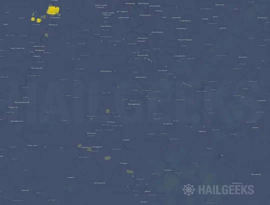
If none of these related Morgantown, WV hail maps look close enough to your property, check a free Hail Report by Address. It reviews hail history for a specific location — not just the broader Morgantown, WV region — so you can check whether hail activity may have reached your property.
Local Hail Review Options Near Morgantown, WV
Not sure whether the July 29, 2021 Morgantown, WV hail map matters for your property? Start with a free Hail Report by Address to see whether hail activity was mapped for that property. If the property signal looks meaningful, you can choose a local pro serving the Morgantown, WV region and ask about a Remote Hail Inspection before deciding whether an on-site roof or exterior review is worth scheduling.
Check a specific property to see whether hail activity from the July 29, 2021 Morgantown, WV event — or another recent hail event — may have been mapped at that address.
Find a roof or exterior pro serving the Morgantown, WV region who can help you understand what the property hail signal may mean.
A participating local pro reviews property-level hail history remotely — not just the July 29, 2021 event — to help decide whether an on-site inspection may be worth scheduling.
A free Hail Report by Address and a Remote Hail Inspection can help you look beyond the July 29, 2021 hail map visuals alone. They do not confirm property damage and do not replace an on-site inspection for a property in the Morgantown, WV region, but they can help you make a more informed next decision before anyone climbs on the roof.
Frequently Asked Questions
Common questions about the July 29, 2021 Morgantown, WV hail event.