

Hail Swath Map Preview
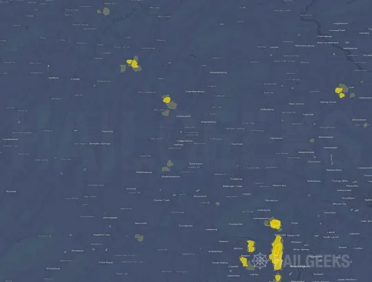
The Hagerstown, MD hail swath map preview was last reviewed on August 27, 2026 and shows mapped hail estimates up to 1.50". There are 1 public hail reports, 44 public wind reports, and 0 nearby tornado reports listed for the August 10, 2021 event.
View the August 10, 2021 Hagerstown, MD hail event on the free interactive hail map, then check a free Hail Report by ZIP to see a more local hail signal for your area.
Impact Area and Population for the Hagerstown, MD Hail Map
The August 10, 2021 hail swath map for Hagerstown, MD covers approximately 405 square miles and includes an estimated 232,126 people inside the mapped footprint. The largest mapped area is in the < 0.50" hail band, covering 225 square miles. The highest estimated population exposure is in the < 0.50" hail band with 153,532 people.
| Mapped Hail Band | Impact Area | Population |
|---|---|---|
| < 0.50" | 225 sq mi | 153,532 |
| 0.50-0.75" | 144 sq mi | 74,247 |
| 0.75-1.00" | 25 sq mi | 4,157 |
| 1.00-1.25" | 3 sq mi | 60 |
| 1.25-1.50" | 3 sq mi | 61 |
| 1.50-1.75" | 4 sq mi | 69 |
Get a free Hail Report by ZIP to see a more local hail signal and whether the August 10, 2021 Hagerstown, MD hail event may have reached your area.
Housing Exposure Inside the Hagerstown, MD Hail Swath Map
Inside the August 10, 2021 hail swath map area for Hagerstown, MD, HailGeeks estimates 58,613 single-family homes, 25,334 townhomes, and 41,289 multifamily properties within the mapped storm footprint. Single-family-home exposure is highest in the < 0.50" hail band, with 38,194 single-family homes.
| Mapped Hail Band | Single-Family | Townhomes | Multifamily |
|---|---|---|---|
| < 0.50" | 38,194 | 16,712 | 27,993 |
| 0.50-0.75" | 18,637 | 8,038 | 13,119 |
| 0.75-1.00" | 1,621 | 578 | 177 |
| 1.00-1.25" | 50 | 2 | 0 |
| 1.25-1.50" | 50 | 2 | 0 |
| 1.50-1.75" | 61 | 2 | 0 |
Use this table to review housing exposure by hail band for the August 10, 2021 Hagerstown, MD hail map. To check a specific property more closely, use a free Hail Report by Address.
Counties Inside the Hagerstown, MD Hail Map
Hail from the August 10, 2021 storm was mapped across 18 counties in the Hagerstown, MD region. Loudoun County, VA had the strongest mapped signal, peaking at 1.50" with roughly 11,154 single-family homes inside the swath.
County pages group every mapped hail event in the area. For a closer look, drop to the city or ZIP level below, or run a free Hail Report by Address.
Cities Inside the Hagerstown, MD Hail Map
Zooming in, the swath touched 32 cities near Hagerstown, MD. Upperville, VA had the strongest mapped signal at 1.50", with an estimated 34 single-family homes exposed.
City cards show where the August 10, 2021 Hagerstown, MD hail activity was mapped, but your ZIP can show a closer local signal. Get a free Hail Report by ZIP, and if the signal looks meaningful, ask a local pro about a Remote Hail Inspection to see whether an on-site roof or exterior review may be worth scheduling.
ZIP Codes Inside the Hagerstown, MD Hail Swath Map
At the ZIP level, the August 10, 2021 Hagerstown, MD hail map spans 45 ZIP codes. ZIP 20184 shows the strongest local signal, with mapped hail estimates up to 1.50" and an estimated single-family-home exposure of 442.
Check your ZIP in seconds to see whether hail activity from the August 10, 2021 Hagerstown, MD event was mapped near your area.
Public Hail, Wind, and Tornado Reports
Public storm report tables connected to the August 10, 2021 hail map for Hagerstown, MD currently list 1 public hail reports, 44 public wind reports, and 0 tornado reports.
| Date & Time | Hail Size | City | State | Description |
|---|---|---|---|---|
August 10, 2021 4:29 PM CT |
1.75 in | Upperville | VA | GOLF BALL SIZED HAIL REPORTED IN UPPERVILLE... VA. TIME ESTIMATED BY RADAR SIGNATURE. |
| Date & Time | Wind Speed | City | State | Description |
|---|---|---|---|---|
August 10, 2021 1:30 PM CT | 2 N Dauphin | PA | MULTIPLE TREES SNAPPED AND UPROOTED. | |
August 10, 2021 1:34 PM CT | 2 NNW Dauphin | PA | TREES ON ROAD. | |
August 10, 2021 1:35 PM CT | 2 WNW Ellendale Forge | PA | TREES DOWN ON CLARKS VALLEY RD. | |
August 10, 2021 3:34 PM CT | 1 ENE Summit Point | WV | A TREE BLEW DOWN IN THE 3900 BLOCK OF CR-13 SUMMIT POINT ROAD. | |
August 10, 2021 3:39 PM CT | Charles Town | WV | A TREE BLEW DOWN IN THE 400 BLOCK OF SOUTH WEST STREET. | |
August 10, 2021 3:40 PM CT | 3 S Dawsonville | MD | WIRES DOWN NEAR THE INTERSECTION OF MONTEVIDEO ROAD AND RIVER ROAD. | |
August 10, 2021 3:45 PM CT | 1 N Bloomery | WV | TREE DOWN ON CATTAIL RUN ROAD NEAR FLEETWOOD LANE. | |
August 10, 2021 3:52 PM CT | 1 NW North Potomac | MD | WIRES DOWN NEAR THE INTERSECTION OF JONES LANE AND QUAIL RUN DRIVE. A TREE BLEW DOWN ONTO WIRES IN THE 12900 BLOCK OF RIFFLE FORD COURT. | |
August 10, 2021 4:00 PM CT | 3 S Lovettsville | VA | A TREE BLEW DOWN NEAR THE INTERSECTION OF VA-692 RICKARD ROAD AND VA-691 BOLINGTON ROAD. | |
August 10, 2021 4:03 PM CT | 1 WNW Rosemont | MD | A TREE BLEW DOWN ON US-340 NEAR MD-17. A TREE BLEW DOWN ON MD-17 AT LEES ROAD. A TREE BLEW DOWN ON US-15 NEAR MILE MARKER 7. | |
August 10, 2021 4:15 PM CT | 3 WSW Olney | MD | A TREE BLEW DOWN ON MD-200 NEAR THE MILL RUN OVERPASS. | |
August 10, 2021 4:15 PM CT | 2 NW Clarksburg | MD | WIRES BLEW DOWN IN THE 24600 BLOCK OF MD-355 FREDERICK ROAD. | |
August 10, 2021 4:20 PM CT | 2 NE Fairfax | VA | TREE DOWN NEAR THE INTERSECTION OF BLAKE LANE AND US-29 | |
August 10, 2021 4:25 PM CT | Arlington | VA | NUMEROUS REPORTS OF SCATTERED TREES BLOWN DOWN ACROSS ARLINGTON. | |
August 10, 2021 4:29 PM CT | 1 SE Tysons Corner | VA | DOWNED WIRES ON VA-7 BETWEEN I-495 AND I-66... BLOCKING ALL LANES | |
August 10, 2021 4:29 PM CT | 1 W Merrifield | VA | DOWNED WIRES ON US-29 NEAR ELLENWOOD DRIVE AND HUNTER ROAD | |
August 10, 2021 4:29 PM CT | 2 S Mclean | VA | TREE DOWN NEAR THE INTERSECTION OF WESTMORELAND STREET AND POOLE LANE | |
August 10, 2021 4:29 PM CT | 1 S Mclean | VA | TREE DOWN NEAR THE INTERSECTION OF SIMMONS DRIVE AND OLD CHESTERBROOK ROAD | |
August 10, 2021 4:29 PM CT | 4 NE Upperville | VA | TREE DOWN NEAR THE INTERSECTION OF NEWSTEAD LANE AND GREENGARDEN ROAD | |
August 10, 2021 4:30 PM CT | 2 WSW Rivercrest | VA | TREES BLEW DOWN NEAR THE INTERSECTION OF VERMONT AVENUE AND VALLEY WOOD ROAD. | |
August 10, 2021 4:34 PM CT | Upperville | VA | NUMEROUS TREES AND POWERLINES DOWN IN AND AROUND THE CITY OF UPPERVILLE OFF ROUTE 50 NEAR TRAPPE ROAD. | |
August 10, 2021 4:35 PM CT | 1 E Rivercrest | DC | A TREE BLEW DOWN ON CANAL ROAD NORTHWEST NEAR FLETCHER'S BOATHOUSE. | |
August 10, 2021 4:37 PM CT | 1 ENE Ravensworth | VA | A TREE BLEW DOWN ON BRADDOCK ROAD NEAR HEMING AVENUE. | |
August 10, 2021 4:38 PM CT | 1 SE Mclean | VA | TREE DOWN NEAR THE INTERSECTION OF OLD DOMINION DRIVE AND LINWAY TERRACE | |
August 10, 2021 4:39 PM CT | 1 WNW Clarksburg | MD | TREES BLEW DOWN ON I-270 NEAR COMUS ROAD. | |
August 10, 2021 4:40 PM CT | Washington | DC | THERE WERE ABOUT TWO DOZEN CALLS FOR TREES AND WIRES DOWN THROUGHOUT DC. | |
August 10, 2021 4:42 PM CT | 1 ESE Green Valley | MD | A TREE BLEW DOWN ON MD-80 FINGERBOARD ROAD NEAR BARTHOLOWS ROAD. | |
August 10, 2021 4:43 PM CT | 1 N Middleburg | VA | 3 TREES DOWN ON THE 22000 BLOCK OF FOXCROFT ROAD | |
August 10, 2021 4:43 PM CT | 1 ENE Adams Morgan | DC | TREE DOWN ON 14TH STREET NW IN DC. TIME ESTIMATED BY RADAR. | |
August 10, 2021 4:48 PM CT | 2 SW Gleedsville | VA | TREES AND BRANCHES DOWN ALONG LIME KILN ROAD. | |
August 10, 2021 5:05 PM CT | 1 S Wagners Mill | MD | MULTIPLE TREES BLEW DOWN NEAR THE INTERSECTION OF MD-31 NEW WINDSOR ROAD AND MEDFORD ROAD. NUMEROUS TREES DOWN NEAR THE INTERSECTION OF ADAMS MILL ROAD AND BELL ROAD. | |
August 10, 2021 5:10 PM CT | 1 ENE Wagners Mill | MD | SEVERAL LARGE TREE LIMBS SNAPPED AND A SHUTTER BLOWN OFF A HOUSE. | |
August 10, 2021 5:15 PM CT | Falls Church | VA | THERE WERE OVER A DOZEN TREES AND WIRES BLOWN DOWN THROUGHOUT THE CITY OF FALLS CHURCH. | |
August 10, 2021 5:15 PM CT | Westminster | MD | MULTIPLE TREES AND WIRES BLEW DOWN IN THE 400 BLOCK OF UNIONTOWN ROAD. | |
August 10, 2021 5:15 PM CT | Spring Grove | PA | CORRECTS PREVIOUS TSTM WND DMG REPORT FROM SPRING GROVE. LARGE TREES DOWN AND PARTIAL COLLAPSE OF A GARAGE. | |
August 10, 2021 5:25 PM CT | Hanover | PA | TREES DOWN ON STOCK ST AND MCCOSH ST. | |
August 10, 2021 5:30 PM CT | 1 ENE Pikesville | MD | TREES DOWN ON I-695 BALTIMORE BELTWAY INNER LOOP AT EXIT 22/GREENSPRING AVENUE. OVER HALF A DOZEN OTHER REPORTS OF TREES DOWN BETWEEN TOWSON AND PIKESVILLE. | |
August 10, 2021 5:35 PM CT | 3 WSW York | PA | WIRES DOWN. | |
August 10, 2021 5:36 PM CT | 1 SE York | PA | WIRES DOWN. | |
August 10, 2021 5:45 PM CT | Falls Church | VA | THERE WERE OVER A DOZEN TREES AND WIRES BLOWN DOWN THROUGHOUT THE CITY OF FALLS CHURCH. | |
August 10, 2021 5:50 PM CT | Spring Grove | PA | LARGE TREES DOWN. | |
August 10, 2021 5:52 PM CT | 5 SSW Riva | MD | MULTIPLE TREES BLEW DOWN NEAR THE INTERSECTION OF HARWOOD ROAD AND LANKFORD ROAD. | |
August 10, 2021 4:30 PM CT | 59 mph | Falls Church | VA | A WIND GUST OF 51 KNOTS (59 MPH) WAS MEASURED BY A PERSONAL WEATHER STATION IN THE CITY OF FALLS CHURCH. |
August 10, 2021 4:56 PM CT | 66 mph | 2 N Germantown | MD | No National Weather Service description provided. |
| Date & Time | Rating | City | State | Description |
|---|---|---|---|---|
| No public tornado reports are available for this event. | ||||
This table includes only public storm reports connected to the August 10, 2021 Hagerstown, MD storm event. When available, each report may include the time, size or magnitude, city, state, and a short description.
Related Hail Maps in the Hagerstown, MD Region
We found 6 more hail maps with reports from the same Hagerstown, MD region as the August 10, 2021 event. These related maps cover storm dates from Jul 17, 2021 through Jul 29, 2021, with mapped hail estimates ranging from 0.75" to 4.00". In this set, the strongest related map reached 4.00", and the most recent map shown is from Jul 29, 2021.



If none of these related Hagerstown, MD hail maps look close enough to your property, check a free Hail Report by Address. It reviews hail history for a specific location — not just the broader Hagerstown, MD region — so you can check whether hail activity may have reached your property.
Local Hail Review Options Near Hagerstown, MD
Not sure whether the August 10, 2021 Hagerstown, MD hail map matters for your property? Start with a free Hail Report by Address to see whether hail activity was mapped for that property. If the property signal looks meaningful, you can choose a local pro serving the Hagerstown, MD region and ask about a Remote Hail Inspection before deciding whether an on-site roof or exterior review is worth scheduling.
Check a specific property to see whether hail activity from the August 10, 2021 Hagerstown, MD event — or another recent hail event — may have been mapped at that address.
Find a roof or exterior pro serving the Hagerstown, MD region who can help you understand what the property hail signal may mean.
A participating local pro reviews property-level hail history remotely — not just the August 10, 2021 event — to help decide whether an on-site inspection may be worth scheduling.
A free Hail Report by Address and a Remote Hail Inspection can help you look beyond the August 10, 2021 hail map visuals alone. They do not confirm property damage and do not replace an on-site inspection for a property in the Hagerstown, MD region, but they can help you make a more informed next decision before anyone climbs on the roof.
Frequently Asked Questions
Common questions about the August 10, 2021 Hagerstown, MD hail event.