

Hail Swath Map Preview
The Savannah, GA hail swath map preview was last reviewed on August 27, 2026 and shows mapped hail estimates up to 2.50". There are 4 public hail reports, 24 public wind reports, and 7 nearby tornado reports listed for the April 5, 2022 event.
View the April 5, 2022 Savannah, GA hail event on the free interactive hail map, then check a free Hail Report by ZIP to see a more local hail signal for your area.
Impact Area and Population for the Savannah, GA Hail Map
The April 5, 2022 hail swath map for Savannah, GA covers approximately 735 square miles and includes an estimated 39,044 people inside the mapped footprint. The largest mapped area is in the 0.50-0.75" hail band, covering 269 square miles. The highest estimated population exposure is in the 0.50-0.75" hail band with 9,001 people.
| Mapped Hail Band | Impact Area | Population |
|---|---|---|
| < 0.50" | 213 sq mi | 4,115 |
| 0.50-0.75" | 269 sq mi | 9,001 |
| 0.75-1.00" | 86 sq mi | 8,086 |
| 1.00-1.25" | 58 sq mi | 7,891 |
| 1.25-1.50" | 47 sq mi | 3,574 |
| 1.50-1.75" | 29 sq mi | 3,377 |
| 1.75-2.00" | 18 sq mi | 2,003 |
| 2.00-2.25" | 7 sq mi | 460 |
| 2.25-2.50" | 4 sq mi | 254 |
| 2.50-2.75" | 4 sq mi | 283 |
Get a free Hail Report by ZIP to see a more local hail signal and whether the April 5, 2022 Savannah, GA hail event may have reached your area.
Housing Exposure Inside the Savannah, GA Hail Swath Map
Inside the April 5, 2022 hail swath map area for Savannah, GA, HailGeeks estimates 14,609 single-family homes, 406 townhomes, and 1,615 multifamily properties within the mapped storm footprint. Single-family-home exposure is highest in the 0.50-0.75" hail band, with 3,270 single-family homes.
| Mapped Hail Band | Single-Family | Townhomes | Multifamily |
|---|---|---|---|
| < 0.50" | 1,455 | 57 | 213 |
| 0.50-0.75" | 3,270 | 126 | 283 |
| 0.75-1.00" | 3,124 | 116 | 441 |
| 1.00-1.25" | 2,897 | 88 | 464 |
| 1.25-1.50" | 1,290 | 6 | 53 |
| 1.50-1.75" | 1,378 | 13 | 93 |
| 1.75-2.00" | 901 | 0 | 48 |
| 2.00-2.25" | 124 | 0 | 20 |
| 2.25-2.50" | 82 | 0 | 0 |
| 2.50-2.75" | 88 | 0 | 0 |
Use this table to review housing exposure by hail band for the April 5, 2022 Savannah, GA hail map. To check a specific property more closely, use a free Hail Report by Address.
Counties Inside the Savannah, GA Hail Map
Hail from the April 5, 2022 storm was mapped across 14 counties in the Savannah, GA region. Bryan County, GA had the strongest mapped signal, peaking at 2.50" with roughly 2,095 single-family homes inside the swath.
County pages group every mapped hail event in the area. For a closer look, drop to the city or ZIP level below, or run a free Hail Report by Address.
Cities Inside the Savannah, GA Hail Map
Zooming in, the swath touched 11 cities near Savannah, GA. Pembroke, GA had the strongest mapped signal at 2.00", with an estimated 227 single-family homes exposed.
City cards show where the April 5, 2022 Savannah, GA hail activity was mapped, but your ZIP can show a closer local signal. Get a free Hail Report by ZIP, and if the signal looks meaningful, ask a local pro about a Remote Hail Inspection to see whether an on-site roof or exterior review may be worth scheduling.
ZIP Codes Inside the Savannah, GA Hail Swath Map
At the ZIP level, the April 5, 2022 Savannah, GA hail map spans 21 ZIP codes. ZIP 31308 shows the strongest local signal, with mapped hail estimates up to 2.50" and an estimated single-family-home exposure of 958.
Check your ZIP in seconds to see whether hail activity from the April 5, 2022 Savannah, GA event was mapped near your area.
Public Hail, Wind, and Tornado Reports
Public storm report tables connected to the April 5, 2022 hail map for Savannah, GA currently list 4 public hail reports, 24 public wind reports, and 7 tornado reports.
| Date & Time | Hail Size | City | State | Description |
|---|---|---|---|---|
April 5, 2022 4:25 PM CT |
2.75 in | 3 N Ellabell | GA | DAMAGE REPORTED TO VEHICLES. |
April 5, 2022 4:35 PM CT |
1.75 in | Pineora | GA | No National Weather Service description provided. |
April 5, 2022 4:45 PM CT |
2.00 in | 1 NNW Rincon | GA | 2 INCH HAIL REPORTED NEAR THE YMCA IN RINCON GA. |
April 5, 2022 4:46 PM CT |
1.75 in | Pineora | GA | No National Weather Service description provided. |
| Date & Time | Wind Speed | City | State | Description |
|---|---|---|---|---|
April 5, 2022 2:35 PM CT | 7 ESE Hilltonia | GA | SCREVEN COUNTY 911 CENTER REPORTED 2 TREES DOWN AT PINE GROVE INN ROAD AND BURTON'S FERRY ROAD. THIS WAS DUE TO A POSSIBLE TORNADO. | |
April 5, 2022 3:51 PM CT | Claxton | GA | THE EVANS COUNTY 911 CENTER REPORTED A TREE DOWN ON SOUTH GRADY STREET. TIME ESTIMATED BASED ON RADAR. | |
April 5, 2022 4:25 PM CT | 3 NW Mount Pleasant | GA | FIVE TREES DOWN ALONG HWY 341 BETWEEN AKIN ROAD AND WIRE ROAD. SOME TREES FELL ON POWERLINES. TIME ESTIMATED BY RADAR. | |
April 5, 2022 4:25 PM CT | 3 W Mount Pleasant | GA | DELAYED REPORT... TIME ESTIMATED BY RADAR. BILLBOARD BLOWN DOWN... SEMI TRAILER BLOWN OVER... AND DAMAGE TO WEAK STRUCTURES OF AN OLD OPEN AIR FLEA MARKET. ONE METAL ROOF BLOWN OFF... ONE METAL ROOF PARTIALLY COLLAPSED... AND METAL PANELS BLOWN OFF OF OTHER ROOFS. | |
April 5, 2022 4:33 PM CT | 2 E Pineora | GA | EFFINGHAM WARNING POINT REPORTED TREE DOWN ON COURTHOUSE ROAD NEAR THE LONESOME OAK NEIGHBORHOOD. | |
April 5, 2022 4:45 PM CT | Rincon | GA | PUBLIC REPORTED SEVERAL TREES DOWN ALONG LEXINGTON AVE IN RINCON. | |
April 5, 2022 4:56 PM CT | 3 NW Millen | GA | A SOLAR FARM ON OLD LOUISVILLE ROAD SUSTAINED SIGNIFICANT WIND DAMAGE. | |
April 5, 2022 4:58 PM CT | Statesboro | GA | BULLOCH COUNTY 911 CENTER REPORTED NUMEROUS TREES BLOWN DOWN IN STATESBORO. SEVERAL TREES FELL ON STRUCTURES. A METAL ROOF WAS BLOWN OFF A BUILDING ON HIGHWAY 301. | |
April 5, 2022 5:54 PM CT | 7 SE Islandton | SC | COLLETON COUNTY EMERGENCY MANAGEMENT REPORTED TREE DOWN AT LOWCOUNTRY HIGHWAY AND CANE BRANCH ROAD. | |
April 5, 2022 6:09 PM CT | 1 WNW Pritchardville | SC | BEAUFORT COUNTY WARNING POINT REPORTED WIRES DOWN AT THE 3700 BLOCK OF OKATIE HIGHWAY. | |
April 5, 2022 6:10 PM CT | 1 WNW Pritchardville | SC | BEAUFORT WARNING POINT REPORTED TREE AND POWERLINES DOWN AT OKATIE HIGHWAY AND EVAN WAY. | |
April 5, 2022 6:12 PM CT | 2 S Gardens Corner | SC | BEAUFORT COUNTY WARNING POINT REPORTED TREE DOWN ON POWERLINES AT 64 BUTLER FARM ROAD. | |
April 5, 2022 6:15 PM CT | 4 W Beaufort | SC | BEAUFORT COUNTY WARNING POINT REPORTED TREE DOWN AT ROSEIDA ROAD AND STROMAN LANE. | |
April 5, 2022 6:16 PM CT | 5 WNW Port Royal | SC | BEAUFORT COUNTY WARNING POINT REPORTED POWERLINES DOWN AT PLEASANT FARM DRIVE AND SALUDA WAY. | |
April 5, 2022 6:19 PM CT | 1 NNW Beaufort | SC | BEAUFORT COUNTY WARNING POINT REPORTED TREE DOWN AT DARBY DRIVE AND SYCAMORE STREET...AND TREE AND WIRES DOWN AT 1800 BLOCK OF MORRIS STREET. | |
April 5, 2022 6:37 PM CT | 1 SSW Ridgeville | GA | WARNING POINT REPORTED TREE DOWN ON BLOUNTS CROSSING BETWEEN CYPRESS STREET AND PALMETTO STREET. | |
April 5, 2022 6:39 PM CT | Yonges Island | SC | A LARGE TREE WAS BLOCKING STATE ROUTE 165 NEAR THE LONG ISLAND ROAD INTERSECTION. TIM WAS ESTIMATED FROM RADAR DATA. | |
April 5, 2022 6:44 PM CT | 4 WNW Johns Island | SC | NUMEROUS TREES AND LIMBS DOWN ALONG CHISOLM RD. FALLEN TREE LIMBS DAMAGED A BACK PORCH. WIND DAMAGED A DOCK. | |
April 5, 2022 6:45 PM CT | 4 WNW Johns Island | SC | ONE FOOT DIAMETER LIMB DOWN ALONG CHISHOLM RD ON JOHNS ISLAND. | |
April 5, 2022 6:45 PM CT | Meggett | SC | LARGE TREE BLOWN DOWN BLOCKING HWY 165 AT LONG ISLAND ROAD. STATE MAINTENANCE HAS BEEN NOTIFIED. | |
April 5, 2022 6:46 PM CT | 3 N Wadmalaw Island | SC | AT LEAST ONE DOWNED TREE AT RESIDENCE ALONG CHISHOLM RD. TIME ESTIMATED. | |
April 5, 2022 6:56 PM CT | 3 NW Millen | GA | A SOLAR FARM ON OLD LOUISVILLE ROAD SUSTAINED SIGNIFICANT WIND DAMAGE. | |
April 5, 2022 6:30 PM CT | 61 mph | 5 SW Adams Run | SC | ACE BASIN RAWS (ABRS1) |
April 5, 2022 7:00 PM CT | 61 mph | 5 SW Adams Run | SC | ACE BASIN RAWS (ABRS1) |
| Date & Time | Rating | City | State | Description |
|---|---|---|---|---|
April 5, 2022 4:17 PM CT | UNK | Pembroke | GA | FIRE DEPT REPORTED TORNADO ON THE GROUND WITH DAMAGE. THE COURTHOUSE AND THE COUNTY JAIL WERE DAMAGED. |
April 5, 2022 4:19 PM CT | UNK | Pembroke | GA | *** 1 FATAL... 12 INJ *** NWS STORM SURVEY DETERMINED THAT A TORNADO OF AT LEAST EF-3 INTENSITY TOUCHED DOWN NEAR THE BRYAN COUNTY COURTHOUSE IN PEMBROKE AND TRACKED ACROSS NORTHERN BRYAN COUNTY ALONG A PATH OVER 11 MILES LONG. THE TORNADO REACHED MAXIMUM INTENSITY IN THE PARK PLACE SUBDIVISION AREA... WHERE SEVERAL STRUCTURES WERE COMPLETELY DESTROYED AND WHERE THE TORNADO WIDTH REACHED THREE-QUARTERS OF A MILE. THE TORNADO ALSO COMPLETELY DESTROYED SEVERAL MOBILE HOMES ALONG HOMESTEAD ROAD WHERE 1 FATALITY OCCURRED. |
April 5, 2022 4:23 PM CT | UNK | Pembroke | GA | LAW ENFORCEMENT REPORTED INDIVIDUAL TRAPPED INSIDE A DAMAGED STRUCTURE ON LEDFORD STREET. NO INJURY REPORTED. |
April 5, 2022 4:25 PM CT | UNK | 3 NNE Lanier | GA | NUMEROUS HOMES DAMAGED AND MULTIPLE OCCUPANTS TRAPPED IN PARK PLACE SUBDIVISION NEAR ELLABELL. |
April 5, 2022 4:29 PM CT | UNK | 3 NNE Lanier | GA | *** 1 FATAL... 12 INJ *** EXTENSIVE DAMAGE TO THE PARK PLACE SUBDIVISION WITH NUMEROUS INJURIES. ONE FATALITY IN THE HOMESTEAD PARK NEIGHBORHOOD WHERE NUMEROUS HOMES WERE DAMAGED. WILMA EDWARDS RD WAS COMPLETELY IMPASSABLE DUE TO DOWNED TREES AND POWER LINES. RECREATION CENTER AT HENDRIX PARK DAMAGED. |
April 5, 2022 5:20 PM CT | UNK | 1 SSE Varnville | SC | NWS STORM SURVEY DETERMINED THAT AN EF-0 TORNADO TOUCHED DOWN JUST WEST OF PEPPER STREET IN VANRVILLE SC. THE TORNADO TRAVELLED NORTHEAST ALONG A PATH 1.75 MILES LONG AND 250 YARDS WIDE... CAUSING MINOR ROOF DAMAGE TO A HOME... SNAPPING AND UPROOTING MULTIPLE TREES... OVERTURNING SOME UTILITY TRAILERS AND THROWING A SMALL GRAIN BIN. THE TORNADO ENDED NEAR PAPAS ROAD AT 624 PM EDT. |
April 5, 2022 5:23 PM CT | UNK | 2 ENE Varnville | SC | HAMPTON COUNTY EMERGENCY MANAGER REPORTED A TORNADO TOUCH DOWN ALONG PAPAS ROAD IN EASTERN HAMPTON COUNTY. A GRAIN SILO WAS LOFTED AND CANNOT BE LOCATED. MULTIPLE LARGE TREES SNAPPED. A DOG KENNEL WAS DESTROYED. OTHER OUTBUILDINGS WERE DAMAGED OR DESTROYED. |
This table includes only public storm reports connected to the April 5, 2022 Savannah, GA storm event. When available, each report may include the time, size or magnitude, city, state, and a short description.
Related Hail Maps in the Savannah, GA Region
We found 6 more hail maps with reports from the same Savannah, GA region as the April 5, 2022 event. These related maps cover storm dates from Dec 4, 2021 through Mar 19, 2022, with mapped hail estimates ranging from 0.75" to 1.00". In this set, the strongest related map reached 1.00", and the most recent map shown is from Mar 19, 2022.
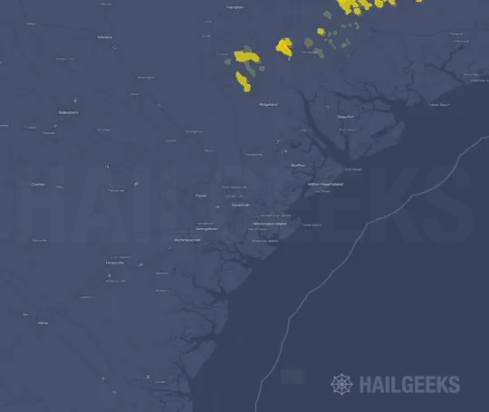


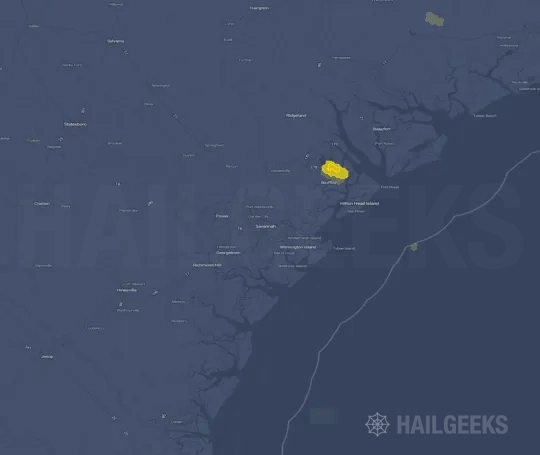


If none of these related Savannah, GA hail maps look close enough to your property, check a free Hail Report by Address. It reviews hail history for a specific location — not just the broader Savannah, GA region — so you can check whether hail activity may have reached your property.
Local Hail Review Options Near Savannah, GA
Not sure whether the April 5, 2022 Savannah, GA hail map matters for your property? Start with a free Hail Report by Address to see whether hail activity was mapped for that property. If the property signal looks meaningful, you can choose a local pro serving the Savannah, GA region and ask about a Remote Hail Inspection before deciding whether an on-site roof or exterior review is worth scheduling.
Check a specific property to see whether hail activity from the April 5, 2022 Savannah, GA event — or another recent hail event — may have been mapped at that address.
Find a roof or exterior pro serving the Savannah, GA region who can help you understand what the property hail signal may mean.
A participating local pro reviews property-level hail history remotely — not just the April 5, 2022 event — to help decide whether an on-site inspection may be worth scheduling.
A free Hail Report by Address and a Remote Hail Inspection can help you look beyond the April 5, 2022 hail map visuals alone. They do not confirm property damage and do not replace an on-site inspection for a property in the Savannah, GA region, but they can help you make a more informed next decision before anyone climbs on the roof.
Frequently Asked Questions
Common questions about the April 5, 2022 Savannah, GA hail event.