

Hail Swath Map Preview
The New Orleans, LA hail swath map preview was last reviewed on August 28, 2026 and shows mapped hail estimates up to 0.75". There are 0 public hail reports, 4 public wind reports, and 11 nearby tornado reports listed for the December 14, 2022 event.
View the December 14, 2022 New Orleans, LA hail event on the free interactive hail map, then check a free Hail Report by ZIP to see a more local hail signal for your area.
Impact Area and Population for the New Orleans, LA Hail Map
The December 14, 2022 hail swath map for New Orleans, LA covers approximately 295 square miles and includes an estimated 29,359 people inside the mapped footprint. The largest mapped area is in the < 0.50" hail band, covering 232 square miles. The highest estimated population exposure is in the < 0.50" hail band with 27,842 people.
| Mapped Hail Band | Impact Area | Population |
|---|---|---|
| < 0.50" | 232 sq mi | 27,842 |
| 0.50-0.75" | 62 sq mi | 1,516 |
| 0.75-1.00" | 2 sq mi | 1 |
Get a free Hail Report by ZIP to see a more local hail signal and whether the December 14, 2022 New Orleans, LA hail event may have reached your area.
Housing Exposure Inside the New Orleans, LA Hail Swath Map
Inside the December 14, 2022 hail swath map area for New Orleans, LA, HailGeeks estimates 12,828 single-family homes, 902 townhomes, and 3,063 multifamily properties within the mapped storm footprint. Single-family-home exposure is highest in the < 0.50" hail band, with 12,181 single-family homes.
| Mapped Hail Band | Single-Family | Townhomes | Multifamily |
|---|---|---|---|
| < 0.50" | 12,181 | 900 | 3,055 |
| 0.50-0.75" | 647 | 2 | 8 |
Use this table to review housing exposure by hail band for the December 14, 2022 New Orleans, LA hail map. To check a specific property more closely, use a free Hail Report by Address.
Counties Inside the New Orleans, LA Hail Map
Hail from the December 14, 2022 storm was mapped across 8 counties in the New Orleans, LA region. Plaquemines Parish, LA had the strongest mapped signal, peaking at 0.75" with roughly 8 single-family homes inside the swath.
County pages group every mapped hail event in the area. For a closer look, drop to the city or ZIP level below, or run a free Hail Report by Address.
Cities Inside the New Orleans, LA Hail Map
Zooming in, the swath touched 2 cities near New Orleans, LA. French Settlement, LA had the strongest mapped signal at 0.50", with an estimated 159 single-family homes exposed.
City cards show where the December 14, 2022 New Orleans, LA hail activity was mapped, but your ZIP can show a closer local signal. Get a free Hail Report by ZIP, and if the signal looks meaningful, ask a local pro about a Remote Hail Inspection to see whether an on-site roof or exterior review may be worth scheduling.
ZIP Codes Inside the New Orleans, LA Hail Swath Map
At the ZIP level, the December 14, 2022 New Orleans, LA hail map spans 9 ZIP codes. ZIP 70085 shows the strongest local signal, with mapped hail estimates up to 0.75" and an estimated single-family-home exposure of 1.
Check your ZIP in seconds to see whether hail activity from the December 14, 2022 New Orleans, LA event was mapped near your area.
Public Hail, Wind, and Tornado Reports
Public storm report tables connected to the December 14, 2022 hail map for New Orleans, LA currently list 0 public hail reports, 4 public wind reports, and 11 tornado reports.
| Date & Time | Hail Size | City | State | Description |
|---|---|---|---|---|
| No public hail reports are available for this event. | ||||
| Date & Time | Wind Speed | City | State | Description |
|---|---|---|---|---|
December 14, 2022 12:02 PM CT | 7 N Robert | LA | TWO LARGE OAK TREES REPORTED DOWN AND DAMAGE TO OUTER BUILDINGS. POSSIBLE TOR. | |
December 14, 2022 3:05 PM CT | Houma | LA | REPORTS OF ROOF DAMAGE AND POWERLINES DOWN. | |
December 14, 2022 5:20 PM CT | 5 NW Long Beach | MS | REPORTS OF POWERLINES DOWN ON ENCHANTED AVE... NEAR MYSTIC CIRCLE. | |
December 14, 2022 2:54 PM CT | 61 mph | Causeway Bridge | LA | MESONET STATION XPTN PONTCHARTRAIN CAUSEWAY. |
| Date & Time | Rating | City | State | Description |
|---|---|---|---|---|
December 14, 2022 12:10 PM CT | UNK | 7 N Robert | LA | A TORNADO DROPPED DOWN NEAR CHAPPEPEELA ROAD... DAMAGING A SHED AT 12:10 PM CST. IT CONTINUED NORTHEAST... TEARING A SHED IN HALF AND THROWING IT DOWNSTREAM ABOUT 100 YARDS. THE TORNADO TRACKED NORTHEAST... FLIPPING AND TURNING OVER A SHED AS IT REACHED AVERETT ROAD. A FEW SMALL TREES... LESS THAN 10 FEET TALL... WERE DOWNED AT THIS LOCATION. THE TORNADO CONTINUED NORTHEAST. IT TORN DOWN AND THREW SECTIONS OF RESIDENTIAL WOOD FENCING AS IT CROSSED BEAU PLACE LANE AND ALLEN DRIVE. ONE HOME ON ALLEN DRIVE HAD AROUND HALF A DOZEN HARDWOODS SNAPPED OR UPROOTED... CONSISTENT WITH WIND SPEEDS OF 100 MPH. THE PATH WIDTH AT THIS POINT WAS THE GREATEST AT 50 YARDS. THE REST OF THE TORNADO TRACK WAS IN INACCESSIBLE WOODS AREA. VIDEO EVIDENCE SHOWED THE TORNADO TRACKING THROUGH THIS WOODED AND FIELD AREA NORTH OF HIGHWAY 40 AND WEST OF HIGHWAY 445. THE TORNADO LIFTED BEFORE REACHING HIGHWAY 445 AT APPROXIMATELY 12:18 PM CST. |
December 14, 2022 2:21 PM CT | UNK | 4 WNW Hahnville | LA | CONFIRMED DAMAGE ALONG SCHOOLHOUSE ROAD WITH A HOUSE DAMAGED... POWER POLES AND STREET LIGHTS DOWN. |
December 14, 2022 2:21 PM CT | UNK | 1 SSW Killona | LA | *** 1 FATAL... 8 INJ *** CONFIRMED EF2 TORNADO WITH MAX WINDS OF 120 MPH... MAX WIDTH OF 75 YARDS... AND A LENGTH OF 5 MILES. SEVERAL MOBILE HOMES WERE DAMAGED OR DESTROYED ALONG THE PATH WITH A NUMBER OF OTHER HOMES RECEIVING MINOR TO MODERATE ROOF DAMAGE. |
December 14, 2022 2:23 PM CT | UNK | 4 W Norco | LA | LAW ENFORCEMENT REPORTING CALLS ABOUT HOUSE DAMAGE IN MONTZ. |
December 14, 2022 2:54 PM CT | UNK | 3 SE Abita Springs | LA | FIRE DEPARTMENT REPORTED TREES ACROSS HIGHWAY 36. |
December 14, 2022 3:05 PM CT | UNK | 6 E Abita Springs | LA | REPORTS OF POWER POLES SNAPPED AND TREES DOWN. |
December 14, 2022 3:05 PM CT | UNK | 6 SSE Bush | LA | TREES AND POWERLINES DOWN IN THE TALISHEEK AREA. |
December 14, 2022 3:50 PM CT | UNK | Marrero | LA | *** 6 INJ *** AN EF2 TORNADO WITH A MAXIMUM WIND SPEED OF 125 MPH AND A MAXIMUM WIDTH OF 175 YARDS TOUCHED DOWN IN JEFFERSON PARISH AND ENDED IN ST. BERNARD. THE TORNADO TOUCHED DOWN JUST EAST OF AMES BLVD NEAR THE INTERSECTION WITH AUGUST AVE. RIGHT AFTER TOUCH DOWN... IT PUSHED A LARGE SET OF BLEACHERS OFF ITS FOUNDATION. WIDESPREAD TREE DAMAGE WAS ALSO OBSERVED HERE. THE TORNADO MOVED NORTHEAST INTO MARRERO AND HARVEY WHERE IT CAUSED WIDESPREAD STRUCTURAL DAMAGE ALONG ITS PATH. A COUPLE HOMES IN HARVEY SUFFERED COMPLETE LOSS OF THEIR ROOFS WITH MULTIPLE WALLS COLLAPSED... AND WERE ALSO SHIFTED FROM THEIR FOUNDATIONS. OTHER HOMES ALONG THE PATH IN THIS AREA SUFFERED MINOR ROOF AND WALL DAMAGE. THE TORNADO WEAKENED AS IT MOVED EAST-NORTHEAST INTO GRETNA... CAUSING DAMAGE MOSTLY TO TREES. IT THEN STRENGTHENED AGAIN AS IT APPROACHED APPROACHED THE WESTBANK EXPRESSWAY IN FAR EASTERN GRETNA. IN THE VICINITY OF COOK ST AND THEARD ST... SEVERAL HOMES WERE SEVERELY DAMAGED... WITH PORTIONS OF ROOF |
December 14, 2022 3:56 PM CT | UNK | 2 NW Harvey | LA | DAMAGE REPORTED TO STRUCTURES. |
December 14, 2022 3:56 PM CT | UNK | 1 NW Harvey | LA | REPORTED POWERLINES DOWN. |
December 14, 2022 4:04 PM CT | UNK | 2 W Chalmette | LA | DAMAGE TO BUILDINGS. |
This table includes only public storm reports connected to the December 14, 2022 New Orleans, LA storm event. When available, each report may include the time, size or magnitude, city, state, and a short description.
Related Hail Maps in the New Orleans, LA Region
We found 6 more hail maps with reports from the same New Orleans, LA region as the December 14, 2022 event. These related maps cover storm dates from Aug 16, 2022 through Oct 12, 2022, with mapped hail estimates ranging from 0.75" to 1.00". In this set, the strongest related map reached 1.00", and the most recent map shown is from Oct 12, 2022.


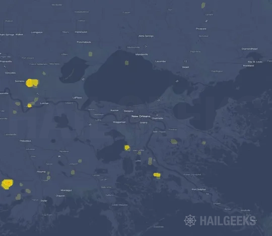
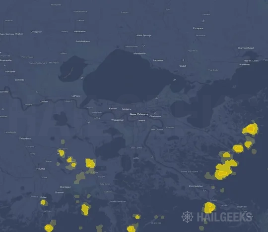

If none of these related New Orleans, LA hail maps look close enough to your property, check a free Hail Report by Address. It reviews hail history for a specific location — not just the broader New Orleans, LA region — so you can check whether hail activity may have reached your property.
Local Hail Review Options Near New Orleans, LA
Not sure whether the December 14, 2022 New Orleans, LA hail map matters for your property? Start with a free Hail Report by Address to see whether hail activity was mapped for that property. If the property signal looks meaningful, you can choose a local pro serving the New Orleans, LA region and ask about a Remote Hail Inspection before deciding whether an on-site roof or exterior review is worth scheduling.
Check a specific property to see whether hail activity from the December 14, 2022 New Orleans, LA event — or another recent hail event — may have been mapped at that address.
Find a roof or exterior pro serving the New Orleans, LA region who can help you understand what the property hail signal may mean.
A participating local pro reviews property-level hail history remotely — not just the December 14, 2022 event — to help decide whether an on-site inspection may be worth scheduling.
A free Hail Report by Address and a Remote Hail Inspection can help you look beyond the December 14, 2022 hail map visuals alone. They do not confirm property damage and do not replace an on-site inspection for a property in the New Orleans, LA region, but they can help you make a more informed next decision before anyone climbs on the roof.
Frequently Asked Questions
Common questions about the December 14, 2022 New Orleans, LA hail event.