

Hail Swath Map Preview
The Springfield, IL hail swath map preview was last reviewed on August 28, 2026 and shows mapped hail estimates up to 3.50". There are 11 public hail reports, 6 public wind reports, and 18 nearby tornado reports listed for the March 31, 2023 event.
View the March 31, 2023 Springfield, IL hail event on the free interactive hail map, then check a free Hail Report by ZIP to see a more local hail signal for your area.
Impact Area and Population for the Springfield, IL Hail Map
The March 31, 2023 hail swath map for Springfield, IL covers approximately 2,352 square miles and includes an estimated 144,852 people inside the mapped footprint. The largest mapped area is in the 0.50-0.75" hail band, covering 1,015 square miles. The highest estimated population exposure is in the 0.50-0.75" hail band with 74,818 people.
| Mapped Hail Band | Impact Area | Population |
|---|---|---|
| < 0.50" | 722 sq mi | 43,525 |
| 0.50-0.75" | 1,015 sq mi | 74,818 |
| 0.75-1.00" | 329 sq mi | 17,227 |
| 1.00-1.25" | 117 sq mi | 6,069 |
| 1.25-1.50" | 67 sq mi | 1,571 |
| 1.50-1.75" | 51 sq mi | 956 |
| 1.75-2.00" | 15 sq mi | 224 |
| 2.00-2.25" | 13 sq mi | 123 |
| 2.25-2.50" | 3 sq mi | 50 |
| 2.50-2.75" | 7 sq mi | 102 |
| 2.75-3.00" | 7 sq mi | 150 |
| 3.00-3.25" | 1 sq mi | 8 |
| 3.25-3.50" | 0 sq mi | 3 |
| 3.50-3.75" | 4 sq mi | 26 |
Get a free Hail Report by ZIP to see a more local hail signal and whether the March 31, 2023 Springfield, IL hail event may have reached your area.
Housing Exposure Inside the Springfield, IL Hail Swath Map
Inside the March 31, 2023 hail swath map area for Springfield, IL, HailGeeks estimates 75,235 single-family homes, 2,965 townhomes, and 16,544 multifamily properties within the mapped storm footprint. Single-family-home exposure is highest in the 0.50-0.75" hail band, with 38,416 single-family homes.
| Mapped Hail Band | Single-Family | Townhomes | Multifamily |
|---|---|---|---|
| < 0.50" | 23,202 | 719 | 3,744 |
| 0.50-0.75" | 38,416 | 1,901 | 10,154 |
| 0.75-1.00" | 8,379 | 196 | 1,899 |
| 1.00-1.25" | 3,431 | 126 | 641 |
| 1.25-1.50" | 882 | 19 | 81 |
| 1.50-1.75" | 506 | 2 | 22 |
| 1.75-2.00" | 127 | 1 | 3 |
| 2.00-2.25" | 79 | 1 | 0 |
| 2.25-2.50" | 31 | 0 | 0 |
| 2.50-2.75" | 64 | 0 | 0 |
| 2.75-3.00" | 94 | 0 | 0 |
| 3.00-3.25" | 5 | 0 | 0 |
| 3.25-3.50" | 2 | 0 | 0 |
| 3.50-3.75" | 17 | 0 | 0 |
Use this table to review housing exposure by hail band for the March 31, 2023 Springfield, IL hail map. To check a specific property more closely, use a free Hail Report by Address.
Counties Inside the Springfield, IL Hail Map
Hail from the March 31, 2023 storm was mapped across 26 counties in the Springfield, IL region. Fulton County, IL had the strongest mapped signal, peaking at 3.50" with roughly 4,313 single-family homes inside the swath.
County pages group every mapped hail event in the area. For a closer look, drop to the city or ZIP level below, or run a free Hail Report by Address.
Cities Inside the Springfield, IL Hail Map
Zooming in, the swath touched 52 cities near Springfield, IL. Banner, IL had the strongest mapped signal at 3.00", with an estimated 12 single-family homes exposed.
City cards show where the March 31, 2023 Springfield, IL hail activity was mapped, but your ZIP can show a closer local signal. Get a free Hail Report by ZIP, and if the signal looks meaningful, ask a local pro about a Remote Hail Inspection to see whether an on-site roof or exterior review may be worth scheduling.
ZIP Codes Inside the Springfield, IL Hail Swath Map
At the ZIP level, the March 31, 2023 Springfield, IL hail map spans 99 ZIP codes. ZIP 61520 shows the strongest local signal, with mapped hail estimates up to 3.50" and an estimated single-family-home exposure of 1,105.
Check your ZIP in seconds to see whether hail activity from the March 31, 2023 Springfield, IL event was mapped near your area.
Public Hail, Wind, and Tornado Reports
Public storm report tables connected to the March 31, 2023 hail map for Springfield, IL currently list 11 public hail reports, 6 public wind reports, and 18 tornado reports.
| Date & Time | Hail Size | City | State | Description |
|---|---|---|---|---|
March 31, 2023 2:49 PM CT |
1.75 in | 2W Banner | IL | GOLFBALL HAIL MEASURED. SIGNIFICANT WINDSHIELD DAMAGE TO VEHICLES. MULTIPLE CARS DAMAGED REQUIRING TOWING FROM THE ROADWAY DUE TO HAIL. |
March 31, 2023 2:56 PM CT |
2.75 in | Banner | IL | . |
March 31, 2023 5:25 PM CT |
1.25 in | Chapin | IL | No National Weather Service description provided. |
March 31, 2023 5:42 PM CT |
1.00 in | Jacksonville | IL | ONE HALF MILE FROM MORTON AVE EXIT ON I-72. |
March 31, 2023 5:45 PM CT |
1.75 in | W Prentice | IL | No National Weather Service description provided. |
March 31, 2023 7:33 PM CT |
1.00 in | N Taylorville | IL | No National Weather Service description provided. |
March 31, 2023 7:38 PM CT |
1.25 in | 1 NE Taylorville | IL | REPORT FROM MPING: HALF DOLLAR (1.25 IN.). |
March 31, 2023 7:42 PM CT |
1.00 in | 3 S Stonington | IL | No National Weather Service description provided. |
March 31, 2023 7:51 PM CT |
1.25 in | SE Mount Zion | IL | No National Weather Service description provided. |
March 31, 2023 7:53 PM CT |
1.00 in | Mount Zion | IL | No National Weather Service description provided. |
March 31, 2023 7:58 PM CT |
1.25 in | 1 SSE Mount Zion | IL | REPORT FROM MPING: HALF DOLLAR (1.25 IN.). |
| Date & Time | Wind Speed | City | State | Description |
|---|---|---|---|---|
March 31, 2023 6:10 PM CT | 2 SW Delavan | IL | POWER POLE AND LINES BLOWN DOWN AT 1817 MORRIS MILL ROAD. | |
March 31, 2023 6:10 PM CT | 1 N Leland Grove | IL | DELAYED REPORT. LARGE TREE DOWN NEAR WASHINGTON PARK. TIME ESTIMATED. | |
March 31, 2023 6:48 PM CT | Bloomington | IL | LARGE TREES BLOWN DOWN AT 1642 OLIVE STREET IN BLOOMINGTON. | |
March 31, 2023 6:09 PM CT | 58 mph | Capital Airport | IL | CORRECTED TIME OF WIND GUST AT SPRINGFIELD AIRPORT. |
March 31, 2023 6:39 PM CT | 63 mph | N Stanford | IL | No National Weather Service description provided. |
March 31, 2023 6:47 PM CT | 65 mph | Latham | IL | No National Weather Service description provided. |
| Date & Time | Rating | City | State | Description |
|---|---|---|---|---|
March 31, 2023 2:37 PM CT | UNK | 5.5 Nw Manito | IL | CORRECTS PREVIOUS TORNADO REPORT FROM MANITO. LOCATION UPDATED TO BE 5.5 MILES NW OF MANITO. NO EF RATING IS AVAILABLE AT THIS TIME. BRIEF TORNADO TOUCHDOWN NEAR THE INTERSECTION OF STATE PARK RD AND SPRING LAKE RD. |
March 31, 2023 2:37 PM CT | UNK | 4 SE Banner | IL | BRIEF TOUCHDOWN NEAR THE INTERSECTION OF SPRING LAKE RD. AND STATE PARK RD. NO DAMAGE WAS REPORTED... SO NO INTENSITY RATING CAN BE ASSIGNED. |
March 31, 2023 5:12 PM CT | UNK | 6.5 Wnw Winchester | IL | SPOTTER RECORDED VIDEO OF A TORNADO MOVING THROUGH THE ILLINOIS RIVER BOTTOMS. NO DAMAGE REPORTED. |
March 31, 2023 5:27 PM CT | UNK | Chapin | IL | SPOTTER SAW TORNADO ON THE GROUND. |
March 31, 2023 5:35 PM CT | UNK | 5 N Jacksonville Airpor | IL | SPOTTER POSSIBLY DROVE THROUGH TORNADO. SAID THERE WAS STRONG WINDS AND POSSIBLE DEBRIS AS IT PASSED. |
March 31, 2023 5:54 PM CT | UNK | Sherman | IL | SPOTTER SAW WHAT LOOKS LIKE A TORNADO AND POWER FASHES 20 MILES WSW OF SHERMAN. |
March 31, 2023 6:12 PM CT | UNK | Sherman | IL | CORRECTS PREVIOUS TORNADO REPORT FROM SHERMAN. PATH LENGTH 5.5 MILES... WIDTH 400 YARDS.... MAXIMUM PEAK WINDS 130 MPH. A TORNADO DEVELOPED ONE MILE NORTHWEST OF SHERMAN IN AN OPEN FIELD... THEN CAUSED DAMAGE TO TWO HOUSES AND TWO OUTBUILDINGS BEFORE CROSSING I-55. MORE SIGNIFICANT DAMAGE WAS NOTED IN A SUBDIVISION IMMEDIATELY EAST OF I-55. THERE... NUMEROUS HOUSES HAD SEVERE ROOF AND SIDING DAMAGE... AND SEVERAL OUTBUILDINGS AND DETACHED GARAGES WERE SEVERELY DAMAGED. THE TORNADO CONTINUED NORTHEAST INTO MORE RURAL AREAS... DAMAGING TWO LARGE BARNS AT A HORSE FARM. MINOR DAMAGE WAS NOTED FARTHER NORTHEAST... WITH SHEET METAL FROM OUTBUILDINGS STREWN INTO OPEN FIELDS. THE TORNADO LIFTED 2 MILES SOUTHEAST OF WILLIAMSVILLE. |
March 31, 2023 6:15 PM CT | UNK | Sherman | IL | TORNADO ON GROUND NEAR COUNTRY MARKET IN SHERMAN. |
March 31, 2023 6:18 PM CT | UNK | 1 ESE Riverton | IL | PATH LENGTH 21 MILES... PEAK WIDTH 200 YARDS... MAX WIND 130 MPH. THE TORNADO DEVELOPED NEAR THE INTERSECTION OF OVERPASS RD AND OLD RT. 36 CAUSING DAMAGE TO TREES. NORTHEAST OF THIS LOCATION... THE ROOF WAS COMPLETELY REMOVED FROM A BUSINESS. THE REMAINDER OF THE TORNADO PATH THROUGH NORTHERN SANGAMON AND SOUTHERN LOGAN COUNTIES WAS MAINLY IN OPEN FIELDS... WITH MINOR DAMAGE NOTED TO FARM OUTBUILDINGS. THE TORNADO DISSIPATED NEAR LATHAM... PRODUCING SHINGLE DAMAGE TO SEVERAL HOUSES IN TOWN. |
March 31, 2023 6:19 PM CT | UNK | Riverton | IL | STORM CHASER REPORTING A STOVEPIPE TORNADO TOUCHDOWN N OF TACO JOHNS OUTSIDE OF RIVERTON THAT HIT SEVERAL HOMES. SAW SEVERE DAMAGE ON THE HOMES WHILE TRAVELLING E ON I-72. |
March 31, 2023 6:26 PM CT | UNK | Dawson | IL | DAWSON FPD REPORTING TORNADO TOUCHDOWN ON ROUTE 36/172 OVERPASS. |
March 31, 2023 6:28 PM CT | UNK | Sherman | IL | HEAVY DAMAGE TO STRUCTURES IN SHERMAN BY OLD BUSINESS 55 BY FIRE STATION. |
March 31, 2023 6:29 PM CT | UNK | Dawson | IL | REPORTING AND CONFIRMED BY FIRE DEPARTMENT ROUTE 36 AND WASHINGTON IN DAWSON HIT BY TORNADO. |
March 31, 2023 6:38 PM CT | UNK | 6 SSW Mount Pulaski | IL | HAM RADIO OPERATOR REPORTING THAT THE FIRE DEPARTMENT ON SCENE OF DAMAGE NEAR 6 MILES SSW OF MT. PULASKI. 2 SHEDS... 2 GRAIN BINS DAMAGED. ADJACENT HOME HAS BROKEN WINDOWS. |
March 31, 2023 6:47 PM CT | UNK | Latham | IL | ROOF DAMAGE TO SEVERAL BUILDINGS IN LATHAM. |
March 31, 2023 7:01 PM CT | UNK | E Dawson | IL | SPOTTER REPORTING TORNADO AND DEBRIS ON TELSTAR AND SCULLY RD JUST E OF DAWSON. |
March 31, 2023 7:06 PM CT | UNK | Morrisonville | IL | SPOTTER REPORTING REPEATED BRIEF TOUCHDOWNS OF SMALL ROPE TORNADO N OF MORRISONVILLE. |
March 31, 2023 7:13 PM CT | UNK | 2 SE Taylorville Airpor | IL | 20 POWER POLES BLOWN DOWN ALONG THE TAYLORVILLE NOKOMIS BLACKTOP SOUTH OF TAYLORVILLE TOWARD THE POWER SUB-STATION. |
This table includes only public storm reports connected to the March 31, 2023 Springfield, IL storm event. When available, each report may include the time, size or magnitude, city, state, and a short description.
Related Hail Maps in the Springfield, IL Region
We found 6 more hail maps with reports from the same Springfield, IL region as the March 31, 2023 event. These related maps cover storm dates from Aug 28, 2022 through Jan 3, 2023, with mapped hail estimates ranging from 0.75" to 2.50". In this set, the strongest related map reached 2.50", and the most recent map shown is from Jan 3, 2023.
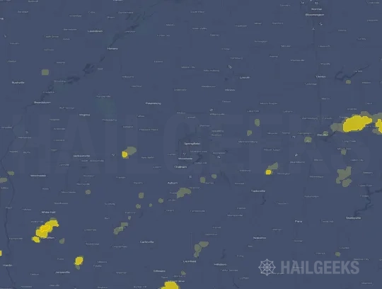


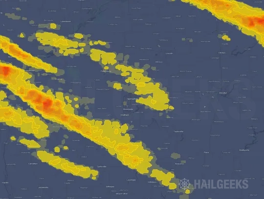
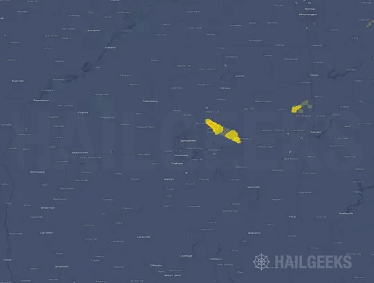

If none of these related Springfield, IL hail maps look close enough to your property, check a free Hail Report by Address. It reviews hail history for a specific location — not just the broader Springfield, IL region — so you can check whether hail activity may have reached your property.
Local Hail Review Options Near Springfield, IL
Not sure whether the March 31, 2023 Springfield, IL hail map matters for your property? Start with a free Hail Report by Address to see whether hail activity was mapped for that property. If the property signal looks meaningful, you can choose a local pro serving the Springfield, IL region and ask about a Remote Hail Inspection before deciding whether an on-site roof or exterior review is worth scheduling.
Check a specific property to see whether hail activity from the March 31, 2023 Springfield, IL event — or another recent hail event — may have been mapped at that address.
Find a roof or exterior pro serving the Springfield, IL region who can help you understand what the property hail signal may mean.
A participating local pro reviews property-level hail history remotely — not just the March 31, 2023 event — to help decide whether an on-site inspection may be worth scheduling.
A free Hail Report by Address and a Remote Hail Inspection can help you look beyond the March 31, 2023 hail map visuals alone. They do not confirm property damage and do not replace an on-site inspection for a property in the Springfield, IL region, but they can help you make a more informed next decision before anyone climbs on the roof.
Frequently Asked Questions
Common questions about the March 31, 2023 Springfield, IL hail event.