

Hail Swath Map Preview
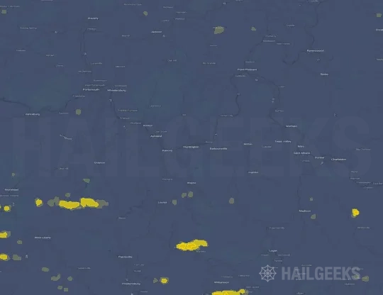
The Huntington, WV hail swath map preview was last reviewed on August 28, 2026 and shows mapped hail estimates up to 1.75". There are 5 public hail reports, 45 public wind reports, and 0 nearby tornado reports listed for the July 18, 2023 event.
View the July 18, 2023 Huntington, WV hail event on the free interactive hail map, then check a free Hail Report by ZIP to see a more local hail signal for your area.
Impact Area and Population for the Huntington, WV Hail Map
The July 18, 2023 hail swath map for Huntington, WV covers approximately 1,034 square miles and includes an estimated 63,070 people inside the mapped footprint. The largest mapped area is in the < 0.50" hail band, covering 486 square miles. The highest estimated population exposure is in the < 0.50" hail band with 30,133 people.
| Mapped Hail Band | Impact Area | Population |
|---|---|---|
| < 0.50" | 486 sq mi | 30,133 |
| 0.50-0.75" | 385 sq mi | 23,056 |
| 0.75-1.00" | 118 sq mi | 7,619 |
| 1.00-1.25" | 31 sq mi | 1,585 |
| 1.25-1.50" | 9 sq mi | 558 |
| 1.50-1.75" | 4 sq mi | 86 |
| 1.75-2.00" | 2 sq mi | 33 |
Get a free Hail Report by ZIP to see a more local hail signal and whether the July 18, 2023 Huntington, WV hail event may have reached your area.
Housing Exposure Inside the Huntington, WV Hail Swath Map
Inside the July 18, 2023 hail swath map area for Huntington, WV, HailGeeks estimates 30,659 single-family homes, 569 townhomes, and 5,192 multifamily properties within the mapped storm footprint. Single-family-home exposure is highest in the < 0.50" hail band, with 14,495 single-family homes.
| Mapped Hail Band | Single-Family | Townhomes | Multifamily |
|---|---|---|---|
| < 0.50" | 14,495 | 250 | 2,608 |
| 0.50-0.75" | 11,373 | 261 | 2,137 |
| 0.75-1.00" | 3,643 | 54 | 387 |
| 1.00-1.25" | 762 | 4 | 41 |
| 1.25-1.50" | 294 | 0 | 19 |
| 1.50-1.75" | 65 | 0 | 0 |
| 1.75-2.00" | 27 | 0 | 0 |
Use this table to review housing exposure by hail band for the July 18, 2023 Huntington, WV hail map. To check a specific property more closely, use a free Hail Report by Address.
Counties Inside the Huntington, WV Hail Map
Hail from the July 18, 2023 storm was mapped across 30 counties in the Huntington, WV region. Mason County, WV had the strongest mapped signal, peaking at 1.75" with roughly 2,229 single-family homes inside the swath.
County pages group every mapped hail event in the area. For a closer look, drop to the city or ZIP level below, or run a free Hail Report by Address.
Cities Inside the Huntington, WV Hail Map
Zooming in, the swath touched 31 cities near Huntington, WV. Mason, WV had the strongest mapped signal at 1.00", with an estimated 325 single-family homes exposed.
City cards show where the July 18, 2023 Huntington, WV hail activity was mapped, but your ZIP can show a closer local signal. Get a free Hail Report by ZIP, and if the signal looks meaningful, ask a local pro about a Remote Hail Inspection to see whether an on-site roof or exterior review may be worth scheduling.
ZIP Codes Inside the Huntington, WV Hail Swath Map
At the ZIP level, the July 18, 2023 Huntington, WV hail map spans 85 ZIP codes. ZIP 25082 shows the strongest local signal, with mapped hail estimates up to 1.75" and an estimated single-family-home exposure of 491.
Check your ZIP in seconds to see whether hail activity from the July 18, 2023 Huntington, WV event was mapped near your area.
Public Hail, Wind, and Tornado Reports
Public storm report tables connected to the July 18, 2023 hail map for Huntington, WV currently list 5 public hail reports, 45 public wind reports, and 0 tornado reports.
| Date & Time | Hail Size | City | State | Description |
|---|---|---|---|---|
July 18, 2023 4:32 PM CT |
1.00 in | 9 W Buffalo | WV | Also spotted a funnel cloud forming and spinning... falling apart and forming again several times before it went over the hill while on the phone at 540 pm. |
July 18, 2023 4:36 PM CT |
1.00 in | Mason | WV | Hail between 1 inch to half dollar size. Time estimated from radar. Verified 1 inch hail from picture on social media. |
July 18, 2023 4:53 PM CT |
1.00 in | New Haven | WV | Also heard that a funnel cloud had been spotted. |
July 18, 2023 5:00 PM CT |
1.00 in | New Haven | WV | No National Weather Service description provided. |
July 18, 2023 5:07 PM CT |
1.00 in | Racine | OH | No National Weather Service description provided. |
| Date & Time | Wind Speed | City | State | Description |
|---|---|---|---|---|
July 18, 2023 1:52 PM CT | 1 SW Murphyfork | KY | Off-duty NWS employee relayed a report of a down tree about a mile up Murphy Fork Road. Time estimated from radar. | |
July 18, 2023 3:38 PM CT | 1 NNE Hollonville | KY | Social media report of two picnics flipped over and moved about 30 feet at intersection of Terrill Fork Rd and Holly Road. Time estimated by velocity signature on radar. | |
July 18, 2023 3:52 PM CT | 1 SW Murphyfork | KY | Corrects previous tstm wnd dmg report from 1 SW Murphyfork. Off-duty NWS employee relayed a report of a down tree about a mile up Murphy Fork Road. Time estimated from radar. | |
July 18, 2023 4:13 PM CT | Swampton | KY | Tree down along SE Licking River Rd and Higgins Branch Rd. | |
July 18, 2023 4:18 PM CT | 10 SSW West Portsmouth | OH | Corrects time from previous tstm wnd dmg report from 10 SSW West Portsmouth. Trees reported down on Tipton Lane. Time estimated from RADAR. | |
July 18, 2023 4:26 PM CT | 6 SW West Portsmouth | OH | Trees reported down in Nile Township. Time estimated from RADAR. | |
July 18, 2023 4:41 PM CT | 7 WNW Greenup | KY | Tree down along Beechy Creek. Time estimated on radar. | |
July 18, 2023 4:45 PM CT | 3 S Kincaid Springs | OH | Corrects report source from previous tstm wnd dmg report from 3 S Kincaid Springs. Trees reported down on Grassy Fork Road near Houghland Hill Road. Time estimated from RADAR. | |
July 18, 2023 4:45 PM CT | 2 E Franklin Furnace | OH | Trees down on Back Road. Time estimated from RADAR. | |
July 18, 2023 4:45 PM CT | 6 SE Culloden | WV | Two trees down blocking State Route 34 South. | |
July 18, 2023 4:45 PM CT | 1 WNW Ironton | OH | Tree fell on top of a vehicle and into the road at the intersection of North Second Street and Railroad Street. Time estimated from radar. | |
July 18, 2023 4:45 PM CT | 1 ESE Ironton | OH | Lawrence County 911 reporting a tree has fallen in the 2000 block of Murdock Road at Ora Richey Road. Time estimated by radar. | |
July 18, 2023 4:46 PM CT | 4 ENE Coal Grove | OH | Lawrence County 911 reporting a tree has fallen and is blocking the road in the 700 block of County Rd 6. in Ironton. Power lines were also compromised. Time estimated from Radar. | |
July 18, 2023 4:50 PM CT | Saint Albans | WV | Corrects previous tstm wnd dmg report from Saint Albans. Large tree down. Power is also out. | |
July 18, 2023 4:50 PM CT | 10 W Greenup | KY | Trees down. time estimated from radar. | |
July 18, 2023 4:50 PM CT | 1 SSE Greenup | KY | Tree contact caused power outages. | |
July 18, 2023 4:52 PM CT | 2 SW Bellefonte | KY | Trees down. Time estimated from radar. | |
July 18, 2023 4:54 PM CT | 7 NNW Harts | WV | Tree down on a house on Guyan River Road in Ranger. Time estimated from radar. | |
July 18, 2023 4:55 PM CT | 3 SSE Teays Valley | WV | Tree reported down. Time estimated by radar. | |
July 18, 2023 4:55 PM CT | 1 W Nitro | WV | Tree reported down. Time estimated by radar. | |
July 18, 2023 4:57 PM CT | 1 WNW Buffalo | WV | Tree down blocking the southbound lane of Winfield Rd at Plantation Rd in Fraziers Bottom. Time estimated by radar. Reported via Putnam County 911. | |
July 18, 2023 4:57 PM CT | 4 N Hurricane | WV | Putnam County 911 reported a tree down on Hurricane Creek Road at Coleman Creek Road near Hurricane. Time estimated by radar. | |
July 18, 2023 4:57 PM CT | 2 WSW Winfield | WV | Tree down in Winfield along State Route 34... in the 5000 block... near a business. Time estimated by radar. Report received from Putnam County 911 Center. | |
July 18, 2023 4:59 PM CT | 1 W Winfield | WV | Tree down in the 13000 block of Winfield Rd.... near a fast food restaurant. Time estimated by radar. Report received via Putnam County 911 Center. | |
July 18, 2023 4:59 PM CT | 1 ENE Winfield | WV | PUTNAM COUNTY 911-TREE DOWN... BLOCKING BOTH LANES IN THE 10000 BLOCK OF CHARLESTON RD IN HOMETOWN. LINES INVOLVED... UNSURE IF POWER LINES. ROAD IS NOT PASSABLE. TIME ESTIMATED BY RADAR. | |
July 18, 2023 5:00 PM CT | Bellefonte | KY | Multiple trees with power lines down. Time estimated from radar. | |
July 18, 2023 5:00 PM CT | 1 SW Nitro | WV | Received some pictures out of Nitro via social media of some medium and large size trees down in a backyard. A shed was damaged due to one of the trees falling. Time estimated from radar. | |
July 18, 2023 5:00 PM CT | Syracuse | OH | Multiple pictures of trees down or snapped in and around town of Syracuse sent on social media. Time radar estimated. | |
July 18, 2023 5:00 PM CT | 3 NNW Greenup | KY | Trees down near intersection of Smith Branch Road and US Highway 23 south. | |
July 18, 2023 5:02 PM CT | 2 SW Poca | WV | Putnam County 911 is reporting a tree down in the 4000 block of Winfield Rd near an industrial park. Time estimated by radar. | |
July 18, 2023 5:02 PM CT | 7 E Lake Vesuvius | OH | Tree down on state route 93. Time estimated from radar. | |
July 18, 2023 5:03 PM CT | Hartford City | WV | 15 to 20 trees down between Hartford and the Jackson county line. Power poles also down in this area in 2 separate places. Time estimated from radar. | |
July 18, 2023 5:05 PM CT | Flatwoods | KY | Trees down near Russell Soccer Complex. | |
July 18, 2023 5:05 PM CT | 1 SSE Ironton | OH | Tree down near the intersection of Oak Street and South 4th Street. Time estimated by radar. | |
July 18, 2023 5:07 PM CT | Racine | OH | Several trees and large limbs reported down in town. Time estimated from radar. | |
July 18, 2023 5:10 PM CT | 4 E Coal Grove | OH | Tree reported down on State Route 243. Time estimated from radar. | |
July 18, 2023 5:12 PM CT | 7 NNW Harts | WV | Multiple trees and power lines down in the area of Ranger. | |
July 18, 2023 5:16 PM CT | 3 WSW Piketon | OH | Trees reported down near Jasper on State Route 104. Time estimated from RADAR. | |
July 18, 2023 5:24 PM CT | 2 SW Russell | KY | Tree across the roadway. | |
July 18, 2023 5:35 PM CT | 4 WSW Mcarthur | OH | Tree down along Martindill Road. | |
July 18, 2023 5:36 PM CT | 4 NNW Hamden | OH | Tree down along Lake Road. Time estimated from radar. | |
July 18, 2023 5:36 PM CT | 5 E Hamden | OH | Tree down near intersection of 324 and state route 160. | |
July 18, 2023 5:42 PM CT | 11 NNW Clendenin | WV | Tree down along Ambler Road. | |
July 18, 2023 5:44 PM CT | 10 E Kenna | WV | Tree and power lines down along Harmony Road. Time estimated from radar. | |
July 18, 2023 8:13 PM CT | 10 SSW West Portsmouth | OH | Trees reported down on Tipton Lane. Time estimated from RADAR. |
| Date & Time | Rating | City | State | Description |
|---|---|---|---|---|
| No public tornado reports are available for this event. | ||||
This table includes only public storm reports connected to the July 18, 2023 Huntington, WV storm event. When available, each report may include the time, size or magnitude, city, state, and a short description.
Related Hail Maps in the Huntington, WV Region
We found 6 more hail maps with reports from the same Huntington, WV region as the July 18, 2023 event. These related maps cover storm dates from Jun 3, 2023 through Jul 17, 2023, with mapped hail estimates ranging from 0.75" to 1.25". In this set, the strongest related map reached 1.25", and the most recent map shown is from Jul 17, 2023.



If none of these related Huntington, WV hail maps look close enough to your property, check a free Hail Report by Address. It reviews hail history for a specific location — not just the broader Huntington, WV region — so you can check whether hail activity may have reached your property.
Local Hail Review Options Near Huntington, WV
Not sure whether the July 18, 2023 Huntington, WV hail map matters for your property? Start with a free Hail Report by Address to see whether hail activity was mapped for that property. If the property signal looks meaningful, you can choose a local pro serving the Huntington, WV region and ask about a Remote Hail Inspection before deciding whether an on-site roof or exterior review is worth scheduling.
Check a specific property to see whether hail activity from the July 18, 2023 Huntington, WV event — or another recent hail event — may have been mapped at that address.
Find a roof or exterior pro serving the Huntington, WV region who can help you understand what the property hail signal may mean.
A participating local pro reviews property-level hail history remotely — not just the July 18, 2023 event — to help decide whether an on-site inspection may be worth scheduling.
A free Hail Report by Address and a Remote Hail Inspection can help you look beyond the July 18, 2023 hail map visuals alone. They do not confirm property damage and do not replace an on-site inspection for a property in the Huntington, WV region, but they can help you make a more informed next decision before anyone climbs on the roof.
Frequently Asked Questions
Common questions about the July 18, 2023 Huntington, WV hail event.