

Hail Swath Map Preview
The Saint Louis, MO hail swath map preview was last reviewed on August 28, 2026 and shows mapped hail estimates up to 1.50". There are 0 public hail reports, 85 public wind reports, and 0 nearby tornado reports listed for the July 29, 2023 event.
View the July 29, 2023 Saint Louis, MO hail event on the free interactive hail map, then check a free Hail Report by ZIP to see a more local hail signal for your area.
Impact Area and Population for the Saint Louis, MO Hail Map
The July 29, 2023 hail swath map for Saint Louis, MO covers approximately 1,907 square miles and includes an estimated 620,021 people inside the mapped footprint. The largest mapped area is in the 0.50-0.75" hail band, covering 831 square miles. The highest estimated population exposure is in the 0.50-0.75" hail band with 289,423 people.
| Mapped Hail Band | Impact Area | Population |
|---|---|---|
| < 0.50" | 607 sq mi | 170,672 |
| 0.50-0.75" | 831 sq mi | 289,423 |
| 0.75-1.00" | 320 sq mi | 109,203 |
| 1.00-1.25" | 102 sq mi | 31,694 |
| 1.25-1.50" | 44 sq mi | 18,783 |
| 1.50-1.75" | 3 sq mi | 246 |
Get a free Hail Report by ZIP to see a more local hail signal and whether the July 29, 2023 Saint Louis, MO hail event may have reached your area.
Housing Exposure Inside the Saint Louis, MO Hail Swath Map
Inside the July 29, 2023 hail swath map area for Saint Louis, MO, HailGeeks estimates 279,786 single-family homes, 16,601 townhomes, and 71,446 multifamily properties within the mapped storm footprint. Single-family-home exposure is highest in the 0.50-0.75" hail band, with 131,249 single-family homes.
| Mapped Hail Band | Single-Family | Townhomes | Multifamily |
|---|---|---|---|
| < 0.50" | 74,212 | 5,165 | 23,611 |
| 0.50-0.75" | 131,249 | 7,226 | 30,794 |
| 0.75-1.00" | 54,689 | 3,096 | 12,759 |
| 1.00-1.25" | 12,829 | 702 | 2,128 |
| 1.25-1.50" | 6,708 | 410 | 2,144 |
| 1.50-1.75" | 99 | 2 | 10 |
Use this table to review housing exposure by hail band for the July 29, 2023 Saint Louis, MO hail map. To check a specific property more closely, use a free Hail Report by Address.
Counties Inside the Saint Louis, MO Hail Map
Hail from the July 29, 2023 storm was mapped across 25 counties in the Saint Louis, MO region. Lincoln County, MO had the strongest mapped signal, peaking at 1.50" with roughly 5,423 single-family homes inside the swath.
County pages group every mapped hail event in the area. For a closer look, drop to the city or ZIP level below, or run a free Hail Report by Address.
Cities Inside the Saint Louis, MO Hail Map
Zooming in, the swath touched 110 cities near Saint Louis, MO. Fountain N' Lakes, MO had the strongest mapped signal at 1.50", with an estimated 50 single-family homes exposed.
City cards show where the July 29, 2023 Saint Louis, MO hail activity was mapped, but your ZIP can show a closer local signal. Get a free Hail Report by ZIP, and if the signal looks meaningful, ask a local pro about a Remote Hail Inspection to see whether an on-site roof or exterior review may be worth scheduling.
ZIP Codes Inside the Saint Louis, MO Hail Swath Map
At the ZIP level, the July 29, 2023 Saint Louis, MO hail map spans 123 ZIP codes. ZIP 63362 shows the strongest local signal, with mapped hail estimates up to 1.50" and an estimated single-family-home exposure of 936.
Check your ZIP in seconds to see whether hail activity from the July 29, 2023 Saint Louis, MO event was mapped near your area.
Public Hail, Wind, and Tornado Reports
Public storm report tables connected to the July 29, 2023 hail map for Saint Louis, MO currently list 0 public hail reports, 85 public wind reports, and 0 tornado reports.
| Date & Time | Hail Size | City | State | Description |
|---|---|---|---|---|
| No public hail reports are available for this event. | ||||
| Date & Time | Wind Speed | City | State | Description |
|---|---|---|---|---|
July 29, 2023 2:41 PM CT | 3 N Warrenton | MO | Multiple areas suffered tree and powerline damage. Most extensive was along the stretch of highway 47 between Warrenton and Hawk Point. Time estimated by radar. | |
July 29, 2023 2:53 PM CT | Troy | MO | 4-5 ft diameter tree fell on residence near west cherry and 4th street. EM stated that multiple areas around the county suffered tree damage. Repeater to the Monroe Fire Dept was knocked out by wind. | |
July 29, 2023 2:55 PM CT | 1 SE Troy | MO | Multiple trees down south of Troy. Largest limbs were 6-10 inches in diameter. Spotter recorded 53 mph gust at his personal weather station their residence in Troy. | |
July 29, 2023 2:55 PM CT | 1 WSW Flint Hill | MO | shingles peeled off of roof. picture from social media. time estimate from radar. | |
July 29, 2023 3:07 PM CT | Union | MO | Trees reported down in the union area. Time estimated by radar. | |
July 29, 2023 3:12 PM CT | 1 ESE O'Fallon | MO | Large limb down over a residential driveway. Photos submitted via social media. Time estimated by radar. | |
July 29, 2023 3:12 PM CT | 2 NW O'Fallon | MO | Multiple limbs down off Magnolia Drive. Report submitted via social media with photos. Time estimated by radar. | |
July 29, 2023 3:15 PM CT | 2 N Saint Paul | MO | Trees approx. 50 ft. tall and 8-10 in. diameter. Several houses lost siding in Riverdale neighborhood (Hwy 79/Hwy Y area). Multiple houses had garage doors caved in from winds. Electricity out in area. | |
July 29, 2023 3:15 PM CT | 1 NW Dardenne Prairie | MO | 6-8 inch tree snapped and Crossroads Elementary. time estimate from radar. | |
July 29, 2023 3:16 PM CT | Saint Clair | MO | Tree reported down around St. Clair. Time estimated by radar. | |
July 29, 2023 3:16 PM CT | 1 WNW Saint Peters | MO | mature tree fallen on house. 1 foot diameter tree fallen on house. time estimate from radar. | |
July 29, 2023 3:17 PM CT | 1 ESE O'Fallon | MO | Several trees down in the area of Feise Road and Highway K. Pictures accompanied report via social media. Time of occurrence estimated by radar. | |
July 29, 2023 3:20 PM CT | 1 SW Saint Peters | MO | Several tree limbs down. Wind gusts estimated to be 60-70 mph. | |
July 29, 2023 3:21 PM CT | 4 W Kampville | MO | MODOT will be closing the roadway near the junction of highway B and highway C in northern St. Charles County due to multiple powerlines down in the area. Time of event estimated by radar. | |
July 29, 2023 3:23 PM CT | 2 SSE Catawissa | MO | Large tree snapped at the base. Photo submitted via social media. Time estimated by radar. | |
July 29, 2023 3:25 PM CT | Dardenne Prairie | MO | 6 inch tree limbs down. A limb fell on house and caused gutter damage. | |
July 29, 2023 3:28 PM CT | 2 W O'Fallon | MO | 10 inch diameter tree down on Hwy P/Bryan Road near Mexico Road. Time estimated from radar. | |
July 29, 2023 3:28 PM CT | 3 SSE Catawissa | MO | Large limb down partially covering highway HH. Photos submitted via social media. Time estimated by radar. | |
July 29, 2023 3:29 PM CT | 1 ESE Saint Charles | MO | St. Charles County Emergency Operations Center reporting multiple trees and wires down across the county. Transformer fire reported near Sawyer and W Clay. | |
July 29, 2023 3:29 PM CT | 2 ESE Saint Charles | MO | 40 ft tree down at clintonview court in st charles city. | |
July 29, 2023 3:30 PM CT | 1 N Saint Peters | MO | small tree down... flashing torn from roof. | |
July 29, 2023 3:37 PM CT | 1 SW Frontenac | MO | Multiple tree branches down. Largest limb was about 10 inches in diameter which knocked down a residential fence. Time estimated by radar. | |
July 29, 2023 3:39 PM CT | 3 NNE O'Fallon | MO | Multiple trees down near St. Matthews and Manor Hill in OFallon. Time estimated by radar. | |
July 29, 2023 3:40 PM CT | Wildwood | MO | Large tree branches down. | |
July 29, 2023 3:41 PM CT | 1 WSW Kirkwood | MO | Multiple photos of tree damage at a residence near highway 270 west of Kirkwood. Photos submitted on social media. Time estimated by radar. | |
July 29, 2023 3:45 PM CT | 1 NW Harvester | MO | 4-6 inch tree limbs down. Location is approximate. Estimated 50 mph wind gusts. | |
July 29, 2023 3:46 PM CT | 1 NNE Maplewood | MO | Large Maple tree blown over at the corner of Sutton and Richmond in Maplewood. Report accompanied by photo courtesy of KMOV-TV. Time estimated by radar. | |
July 29, 2023 3:46 PM CT | 2 S Sunset Hills | MO | Large tree branch down just southwest of George Winter Park. Photo submitted via social media. Time estimated by radar. | |
July 29, 2023 3:50 PM CT | Manchester | MO | Large branches down. | |
July 29, 2023 3:53 PM CT | 1 NNW Affton | MO | Roof soffit and a few shingle removed from residence. Report submitted via social media. Time estimated by radar. | |
July 29, 2023 3:53 PM CT | 1 NNE Nutwood | IL | Trees down on Route 16 west of Fieldon. | |
July 29, 2023 3:55 PM CT | 1 SSE Florissant | MO | 6 inch tree limbs down. | |
July 29, 2023 3:55 PM CT | Oakville | MO | Multiple tree limbs down. One landed on a powerline. Photos submitted via social media. Time estimated by radar. | |
July 29, 2023 3:57 PM CT | 1 SW Granite City | IL | 6 in tree limb down. | |
July 29, 2023 4:00 PM CT | 1 NNE Defiance | MO | 12 inch diameter tree down near HWY 94. 4 inch diameter branch down near HWY 94. report from social media. time is estimated. | |
July 29, 2023 4:00 PM CT | Cedar Hill | MO | Trees and powerlines down in the Cedar Hill area. | |
July 29, 2023 4:05 PM CT | Breese | IL | Trees and limbs down. | |
July 29, 2023 4:07 PM CT | Caseyville | IL | Large tree down. Photo sent in via social media. Time estimated by radar. | |
July 29, 2023 4:07 PM CT | 1 NW Wood River | IL | 3-inch tree limbs broken; Power poles broken. Time estimated by radar. | |
July 29, 2023 4:10 PM CT | Okawville | IL | Trees down. | |
July 29, 2023 4:10 PM CT | 2 SE Collinsville | IL | 5 to 8 inch tree limbs down near Bethel Road. Time estimated by radar. | |
July 29, 2023 4:10 PM CT | Jamestown | IL | Trees and limbs down. | |
July 29, 2023 4:10 PM CT | 1 NNW Pocahontas | IL | Road signs down. | |
July 29, 2023 4:18 PM CT | Carlyle | IL | Trees and limbs down. | |
July 29, 2023 4:20 PM CT | Nashville | IL | Line down. | |
July 29, 2023 4:21 PM CT | O'Fallon | IL | partial roof collapse from wind. time estimated from radar. | |
July 29, 2023 4:21 PM CT | 1 NW Wood River | IL | 6 inch tree limb down at Wood River Ave and First Street. 4 inch tree limbs down along Washington Ave. Time estimated from radar. | |
July 29, 2023 4:22 PM CT | 2 NW Wood River | IL | Tree limbs down in the East Alton area. Lost power in the area. Time estimated by radar. | |
July 29, 2023 4:22 PM CT | Wood River | IL | A few 2 inch tree limbs down in the area. Spotter also noted a powerline was down a block away from their residence. Time estimated by radar. | |
July 29, 2023 4:24 PM CT | 1 W Scott Afb | IL | 12 inch diameter tree limb blown down. Time estimated by radar. | |
July 29, 2023 4:25 PM CT | New Minden | IL | Large tree branches down. | |
July 29, 2023 4:25 PM CT | 2 W O'Fallon | IL | trees down... power poles snapped... and power lines down in Fairview Heights and OFallon IL. a partial roof collapse in OFallon. | |
July 29, 2023 4:25 PM CT | Greenville | IL | Trees and limbs down. | |
July 29, 2023 4:26 PM CT | 3 E O'Fallon | IL | large tree snapped. photos from social media. time estimate from radar. | |
July 29, 2023 4:27 PM CT | Keyesport | IL | Trees down. | |
July 29, 2023 4:28 PM CT | 4 SSE Mascoutah | IL | 6 ft diameter tree snapped. Time estimated by radar. | |
July 29, 2023 4:30 PM CT | Lenzburg | IL | tree limbs down and roof damage. | |
July 29, 2023 4:30 PM CT | 1 WNW Swansea | IL | Numerous large tree limbs blown down... winds estimated around 60 mph. | |
July 29, 2023 4:47 PM CT | Lebanon | IL | Large tree branches down. | |
July 29, 2023 4:50 PM CT | 1 ESE Troy | IL | HAM radio relayed report of 4 inch diameter tulip tree being blown down. | |
July 29, 2023 4:52 PM CT | 2 WNW Steeleville | IL | Corrects previous non-tstm wnd dmg report from 2 WNW Steeleville. Several power poles down. | |
July 29, 2023 4:55 PM CT | Highland | IL | Report of four broken power poles within the city. | |
July 29, 2023 5:00 PM CT | Coulterville | IL | Reports of trees and limbs down scattered about the town. | |
July 29, 2023 5:09 PM CT | Pinckneyville | IL | Multiple trees... power lines... and power poles down across county. Much of county is without power. | |
July 29, 2023 5:20 PM CT | Du Quoin | IL | Tree down on a house. | |
July 29, 2023 2:40 PM CT | 68 mph | 3 NNE Warrenton | MO | Multiple tree damage. Time estimated from radar. |
July 29, 2023 2:51 PM CT | 60 mph | Wright City | MO | Local affiliate estimated gusts to be 60 mph or higher. Courtesy of KTVI-TV. |
July 29, 2023 3:23 PM CT | 60 mph | 4 NNW Saint Peters | MO | No National Weather Service description provided. |
July 29, 2023 3:33 PM CT | 72 mph | 2 NNE Saint Charles | MO | Spotter measured the gust with an anemometer installed at their residence. |
July 29, 2023 3:50 PM CT | 60 mph | 2 N Hazelwood | MO | Report submitted via social media. |
July 29, 2023 3:53 PM CT | 62 mph | 2 SSW Hazelwood | MO | Wind gust measured at St. Louis Lambert International Airport. |
July 29, 2023 3:54 PM CT | 79 mph | 2 NNW Woodson Terrace | MO | Lambert St. Louis International Airport. |
July 29, 2023 4:03 PM CT | 60 mph | 1 N Kirkwood | MO | Area around Kirkwood continued to gust around 60 mph. The area has lost power. |
July 29, 2023 4:10 PM CT | 60 mph | 2 ENE Fairview Heights | IL | Wind gusts estimated near 60 mph. Time estimated by radar. |
July 29, 2023 4:12 PM CT | 60 mph | 2 E Shrewsbury | MO | No National Weather Service description provided. |
July 29, 2023 4:13 PM CT | 62 mph | 2 W New Handover | IL | No National Weather Service description provided. |
July 29, 2023 4:15 PM CT | 60 mph | 2 E Maplewood | MO | Lost power. Location is approximate. |
July 29, 2023 4:15 PM CT | 60 mph | 2 ENE Fairview Heights | IL | Estimated 50-60 mph gusts. |
July 29, 2023 4:17 PM CT | 62 mph | 1 W Waterloo | IL | Observation from the Monroe County Fairground near Waterloo IL. |
July 29, 2023 4:17 PM CT | 59 mph | Collinsville | IL | CWOP report. |
July 29, 2023 4:32 PM CT | 64 mph | 2 SE Belleville | IL | Observation relayed by St. Clair County Skywarn. |
July 29, 2023 4:37 PM CT | 63 mph | Scott Afb | IL | No National Weather Service description provided. |
July 29, 2023 4:40 PM CT | 66 mph | Smithton | IL | CWOP report. |
July 29, 2023 4:41 PM CT | 73 mph | 2 SE Swansea | IL | No National Weather Service description provided. |
July 29, 2023 4:50 PM CT | 60 mph | 2 NE Houston | IL | Time estimate from radar. |
| Date & Time | Rating | City | State | Description |
|---|---|---|---|---|
| No public tornado reports are available for this event. | ||||
This table includes only public storm reports connected to the July 29, 2023 Saint Louis, MO storm event. When available, each report may include the time, size or magnitude, city, state, and a short description.
Related Hail Maps in the Saint Louis, MO Region
We found 6 more hail maps with reports from the same Saint Louis, MO region as the July 29, 2023 event. These related maps cover storm dates from Jul 18, 2023 through Jul 28, 2023, with mapped hail estimates ranging from 1.00" to 2.00". In this set, the strongest related map reached 2.00", and the most recent map shown is from Jul 28, 2023.


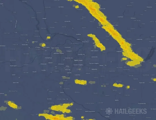


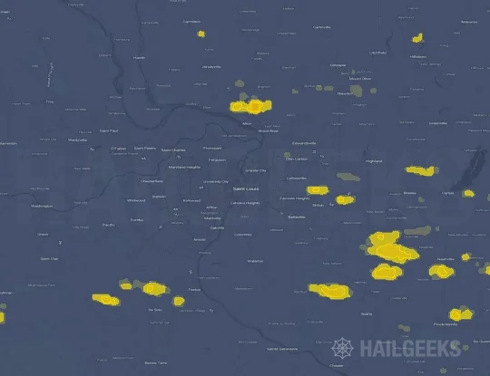
If none of these related Saint Louis, MO hail maps look close enough to your property, check a free Hail Report by Address. It reviews hail history for a specific location — not just the broader Saint Louis, MO region — so you can check whether hail activity may have reached your property.
Local Hail Review Options Near Saint Louis, MO
Not sure whether the July 29, 2023 Saint Louis, MO hail map matters for your property? Start with a free Hail Report by Address to see whether hail activity was mapped for that property. If the property signal looks meaningful, you can choose a local pro serving the Saint Louis, MO region and ask about a Remote Hail Inspection before deciding whether an on-site roof or exterior review is worth scheduling.
Check a specific property to see whether hail activity from the July 29, 2023 Saint Louis, MO event — or another recent hail event — may have been mapped at that address.
Find a roof or exterior pro serving the Saint Louis, MO region who can help you understand what the property hail signal may mean.
A participating local pro reviews property-level hail history remotely — not just the July 29, 2023 event — to help decide whether an on-site inspection may be worth scheduling.
A free Hail Report by Address and a Remote Hail Inspection can help you look beyond the July 29, 2023 hail map visuals alone. They do not confirm property damage and do not replace an on-site inspection for a property in the Saint Louis, MO region, but they can help you make a more informed next decision before anyone climbs on the roof.
Frequently Asked Questions
Common questions about the July 29, 2023 Saint Louis, MO hail event.