

Hail Swath Map Preview
The Hagerstown, MD hail swath map preview was last reviewed on August 27, 2026 and shows mapped hail estimates up to 1.00". There are 0 public hail reports, 60 public wind reports, and 0 nearby tornado reports listed for the August 11, 2021 event.
View the August 11, 2021 Hagerstown, MD hail event on the free interactive hail map, then check a free Hail Report by ZIP to see a more local hail signal for your area.
Impact Area and Population for the Hagerstown, MD Hail Map
The August 11, 2021 hail swath map for Hagerstown, MD covers approximately 688 square miles and includes an estimated 277,107 people inside the mapped footprint. The largest mapped area is in the < 0.50" hail band, covering 360 square miles. The highest estimated population exposure is in the < 0.50" hail band with 144,953 people.
| Mapped Hail Band | Impact Area | Population |
|---|---|---|
| < 0.50" | 360 sq mi | 144,953 |
| 0.50-0.75" | 276 sq mi | 101,305 |
| 0.75-1.00" | 43 sq mi | 29,125 |
| 1.00-1.25" | 9 sq mi | 1,724 |
Get a free Hail Report by ZIP to see a more local hail signal and whether the August 11, 2021 Hagerstown, MD hail event may have reached your area.
Housing Exposure Inside the Hagerstown, MD Hail Swath Map
Inside the August 11, 2021 hail swath map area for Hagerstown, MD, HailGeeks estimates 93,106 single-family homes, 20,325 townhomes, and 30,557 multifamily properties within the mapped storm footprint. Single-family-home exposure is highest in the < 0.50" hail band, with 46,616 single-family homes.
| Mapped Hail Band | Single-Family | Townhomes | Multifamily |
|---|---|---|---|
| < 0.50" | 46,616 | 10,300 | 20,742 |
| 0.50-0.75" | 35,107 | 7,679 | 7,087 |
| 0.75-1.00" | 10,647 | 2,291 | 2,715 |
| 1.00-1.25" | 736 | 55 | 13 |
Use this table to review housing exposure by hail band for the August 11, 2021 Hagerstown, MD hail map. To check a specific property more closely, use a free Hail Report by Address.
Counties Inside the Hagerstown, MD Hail Map
Hail from the August 11, 2021 storm was mapped across 28 counties in the Hagerstown, MD region. Washington County, MD had the strongest mapped signal, peaking at 1.00" with roughly 10,773 single-family homes inside the swath.
County pages group every mapped hail event in the area. For a closer look, drop to the city or ZIP level below, or run a free Hail Report by Address.
Cities Inside the Hagerstown, MD Hail Map
Zooming in, the swath touched 53 cities near Hagerstown, MD. St. James, MD had the strongest mapped signal at 1.00", with an estimated 1,699 single-family homes exposed.
City cards show where the August 11, 2021 Hagerstown, MD hail activity was mapped, but your ZIP can show a closer local signal. Get a free Hail Report by ZIP, and if the signal looks meaningful, ask a local pro about a Remote Hail Inspection to see whether an on-site roof or exterior review may be worth scheduling.
ZIP Codes Inside the Hagerstown, MD Hail Swath Map
At the ZIP level, the August 11, 2021 Hagerstown, MD hail map spans 86 ZIP codes. ZIP 21713 shows the strongest local signal, with mapped hail estimates up to 1.00" and an estimated single-family-home exposure of 2,571.
Check your ZIP in seconds to see whether hail activity from the August 11, 2021 Hagerstown, MD event was mapped near your area.
Public Hail, Wind, and Tornado Reports
Public storm report tables connected to the August 11, 2021 hail map for Hagerstown, MD currently list 0 public hail reports, 60 public wind reports, and 0 tornado reports.
| Date & Time | Hail Size | City | State | Description |
|---|---|---|---|---|
| No public hail reports are available for this event. | ||||
| Date & Time | Wind Speed | City | State | Description |
|---|---|---|---|---|
August 11, 2021 1:30 PM CT | 2 NE Ranson | WV | TREE DOWN ON WALNUT GROVE RD. NEAR CHARLES TOWN. | |
August 11, 2021 1:39 PM CT | 2 NW Karo | VA | POWER LINES DOWN AT THE INTERSECTION OF LAKESIDE DRIVE AND ROYAL WALNUT ROAD. | |
August 11, 2021 1:46 PM CT | Front Royal | VA | MULTIPLE TREES DOWN NEAR JOHN MARSHALL ROAD & HIGH KNOB ROAD. TIME BASED ON RADAR. | |
August 11, 2021 1:49 PM CT | 3 WNW Linden | VA | MULTIPLE TREES DOWN ALONG DISMAL HOLLOW ROAD NEAR I-66. | |
August 11, 2021 1:51 PM CT | Markham | VA | SEVERAL TREES DOWN ALONG ROUTE 55 IN MARKHAM | |
August 11, 2021 1:52 PM CT | 2 SE Clifton | PA | WIRES DOWN ACROSS ROAD. | |
August 11, 2021 1:58 PM CT | 3 SSE Chester Gap | VA | TREE LIMBS WENT THROUGH A CAR WINDSHIELD AT THE INTERSECTION OF VA-522 & LITTLE LONG MOUNTAIN RD. | |
August 11, 2021 2:00 PM CT | 3 E Berkeley | WV | A TREE BLEW DOWN IN THE 2000 BLOCK OF SCRABBLE ROAD. | |
August 11, 2021 2:03 PM CT | 3 SSW Williamsport | MD | TREE DOWN ON FALLING WATERS RD. IN WILLIAMSPORT. | |
August 11, 2021 2:05 PM CT | 4 S Bluemont | VA | TREES BLEW DOWN NEAR THE INTERSECTION OF VA-719 AIRMONT ROAD AND VA-736 BLOOMFIELD ROAD. | |
August 11, 2021 2:07 PM CT | Hagerstown | MD | SEVERAL TREES DOWN IN AND AROUND THE CITY OF HAGERSTOWN. | |
August 11, 2021 2:19 PM CT | 2 W Marshall | VA | A TREE FELL ONTO A CAR ON I-66 AT MM 26... WITH NO INJURIES. | |
August 11, 2021 2:20 PM CT | 3 SSW Jefferson | MD | TREES BLEW DOWN ON MD-464 POINT OF ROCKS ROAD BETWEEN LANDER ROAD AND FRY ROAD. | |
August 11, 2021 2:20 PM CT | 1 S Round Hill | VA | 2 TREES DOWN NEAR THE INTERSECTION OF AIRMONT ROAD AND FUR LANE | |
August 11, 2021 2:22 PM CT | Boonsboro | MD | SEVERAL TREES DOWN NEAR BOONSBORO | |
August 11, 2021 2:22 PM CT | 3 NE Marklesburg | PA | TREES AND WIRES DOWN. | |
August 11, 2021 2:31 PM CT | Middletown | MD | TREE DOWN AT THE INTERSECTION OF US-40 AND MD-17 IN MIDDLETOWN. | |
August 11, 2021 2:33 PM CT | 3 WSW Waterford | VA | TREE DOWN ON CHARLES TOWN PIKE BETWEEN HAMPTON RD. AND WHEATLAND RD. | |
August 11, 2021 2:40 PM CT | Capon Springs | WV | SEVERAL TREES BLEW DOWN IN THE CAPON SPRINGS AREA. | |
August 11, 2021 2:40 PM CT | 1 S Mill Creek | PA | TREES AND WIRES DOWN. | |
August 11, 2021 2:43 PM CT | Myersville | MD | SEVERAL TREES DOWN IN THE VICINITY OF MYERSVILLE. | |
August 11, 2021 2:45 PM CT | Myersville | MD | STORM DEBRIS IN ROADWAY REPORTED BY MDOT. AT THE INTERSECTION OF U.S. 40 & MD 17. | |
August 11, 2021 2:45 PM CT | Frederick | MD | SEVERAL TREES DOWN IN THE CITY OF FREDERICK | |
August 11, 2021 2:45 PM CT | 3 W Waterford | VA | TREE DOWN ON VA-9 NEAR THE INTERSECTION OF HAMPTON ROAD AND OLD STAGE PLACE | |
August 11, 2021 2:50 PM CT | 2 SSW High View Manor | VA | A TREE BLEW DOWN IN THE 2400 BLOCK OF VA-629 LAUREL GROVE ROAD. | |
August 11, 2021 2:51 PM CT | 3 ENE Park Mills | MD | TREE DOWN ON I-270 S NEAR EXIT 26 | |
August 11, 2021 2:59 PM CT | 2 SE Poolesville | MD | TREE DOWN AT THE INTERSECTION OF MD-107 AND PARTNERSHIP RD. | |
August 11, 2021 3:27 PM CT | 3 ENE Park Mills | MD | TREE DOWN ON THE SOUTHBOUND LANES OF I-270 BEFORE MD-109 | |
August 11, 2021 3:30 PM CT | Westminster | MD | A FEW TREES BLEW DOWN IN THE WESTMINSTER AREA. | |
August 11, 2021 3:30 PM CT | 1 SE Oakton | VA | A TREE BLEW DOWN ONTO A CAR ON SNOWBOUND COURT. | |
August 11, 2021 3:32 PM CT | 1 S Mclean | VA | POWERLINES DOWN ON OLD CHESTERBROOK RD. NEAR THE INTERSECTION WITH RT. 690 E. | |
August 11, 2021 3:33 PM CT | 1 SW Potomac | MD | TREE DOWN ONTO A VEHICLE IN THE 10000 BLOCK OF RIVER RD. | |
August 11, 2021 3:35 PM CT | 2 SSW Great Cacapon | WV | A TREE BLEW DOWN IN THE 2000 BLOCK OF ROCK FORD ROAD. | |
August 11, 2021 3:36 PM CT | 3 NNW Pecktonville | MD | SEVERAL BRANCHES AND A TREE BLEW DOWN NEAR ORCHARD RIDGE. | |
August 11, 2021 3:40 PM CT | 1 SSW Garrett Park | MD | NUMEROUS REPORTS OF TREES DOWN ALONG THE NORTH SIDE OF I-495. | |
August 11, 2021 3:40 PM CT | 2 SW Smith Crossroads | WV | WIRES BLEW DOWN ON APPLE ORCHARD CIRCLE. | |
August 11, 2021 3:40 PM CT | The I66 And I495 | VA | WIRES BLEW DOWN NEAR THE INTERSECTION OF ROSWELL COURT AND ROSWELL DRIVE. | |
August 11, 2021 3:40 PM CT | 1 SSW Mclean | VA | A TREE BLEW DOWN ONTO WIRES CAUSING A FIRE IN THE 1600 BLOCK OF DAVIDSON ROAD. | |
August 11, 2021 3:45 PM CT | 1 NNW Stotlers Crossroa | WV | A TREE BLEW DOWN NEAR THE INTERSECTION OF WINCHESTER GRADE ROAD AND EPPINGER ROAD. | |
August 11, 2021 3:45 PM CT | Manchester | MD | A FEW TREES BLEW DOWN IN THE MANCHESTER AREA. | |
August 11, 2021 3:45 PM CT | 1 WSW Ballston | VA | WIRES BLEW DOWN IN THE 5200 BLOCK OF WILSON BOULEVARD. | |
August 11, 2021 3:46 PM CT | 1 NNE Bethesda | MD | POWERLINE WIRES DOWN ON THE 5500 BLOCK OF JOHNSON AVENUE | |
August 11, 2021 3:46 PM CT | 2 NW Skyline View | PA | TREE ACROSS ROAD. | |
August 11, 2021 3:48 PM CT | Linglestown | PA | TREE DOWN. REPORTED VIA TWITTER. | |
August 11, 2021 3:49 PM CT | 2 SSW Hogestown | PA | WIRES DOWN ON TWO TRACTOR TRAILERS ON I-76. | |
August 11, 2021 3:50 PM CT | 1 WSW Four Corners | MD | LARGE TREE BRANCHES DOWN ON FOREST GLEN ROAD NEAR HOLY CROSS HOSPITAL | |
August 11, 2021 3:50 PM CT | 1 ENE Ravensworth | VA | A TREE BLEW DOWN NEAR THE INTERSECTION OF VA-620 BRADDOCK ROAD AND HEMING AVENUE. | |
August 11, 2021 3:51 PM CT | 3 W Garrett Park | MD | TREE DOWN WITH ROAD BLOCKED ON TUCKERMAN LANE NEAR WHISPER WOOD LANE | |
August 11, 2021 3:51 PM CT | 1 W Takoma Park | DC | TREE DOWN ALONG MD-410 W JUST PAST GEORGIA AVE. | |
August 11, 2021 3:52 PM CT | 1 WNW Colonial Park | PA | TREE ON A HOUSE. | |
August 11, 2021 3:55 PM CT | 1 S Garrett Park | MD | TREES AND WIRES DOWN NEAR THE 10000 BLOCK OF WEYMOUTH STREET | |
August 11, 2021 3:55 PM CT | 1 SSW Garrett Park | MD | TREE DOWN ON AN UNOCCUPIED VEHICLE ON THE I-495 INNER LOOP BETWEEN EXIT 35 AND EXIT 33 | |
August 11, 2021 3:55 PM CT | 2 WSW Garrett Park | MD | TREE DOWN ONTO A HOUSE ON THE 10200 BLOCK OF FARNHAM DRIVE | |
August 11, 2021 3:57 PM CT | 1 NNW Hillandale | MD | WIRES DOWN ON THE 1600 BLOCK OF OAKLAWN COURT | |
August 11, 2021 4:00 PM CT | 2 WSW Garrett Park | MD | WIRES DOWN ACROSS THE ROAD ON THE 10100 BLOCK OF ASHBURTON LANE | |
August 11, 2021 4:00 PM CT | 3 SE Penn National Race | PA | TREES ACROSS ROAD. | |
August 11, 2021 4:09 PM CT | 1 WSW Kensington | MD | TREE DOWN ONTO A HOUSE ON THE 10100 BLOCK OF WILDWOOD ROAD | |
August 11, 2021 4:43 PM CT | 6 NW Cockeysville | MD | TREE DOWN ON CUBA ROAD NEAR WESTERN RUN | |
August 11, 2021 4:52 PM CT | 3 ESE Bentley Springs | MD | TREE DOWN NEAR THE INTERSECTION OF ENSOR ROAD AND STABLERSVILLE ROAD | |
August 11, 2021 4:56 PM CT | 4 NE Bentley Springs | MD | 3 TREES DOWN NEAR THE INTERSECTION OF HARRIS MILL ROAD AND DUNK FREELAND ROAD |
| Date & Time | Rating | City | State | Description |
|---|---|---|---|---|
| No public tornado reports are available for this event. | ||||
This table includes only public storm reports connected to the August 11, 2021 Hagerstown, MD storm event. When available, each report may include the time, size or magnitude, city, state, and a short description.
Related Hail Maps in the Hagerstown, MD Region
We found 6 more hail maps with reports from the same Hagerstown, MD region as the August 11, 2021 event. These related maps cover storm dates from Jul 19, 2021 through Aug 10, 2021, with mapped hail estimates ranging from 0.75" to 4.00". In this set, the strongest related map reached 4.00", and the most recent map shown is from Aug 10, 2021.


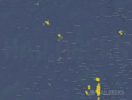

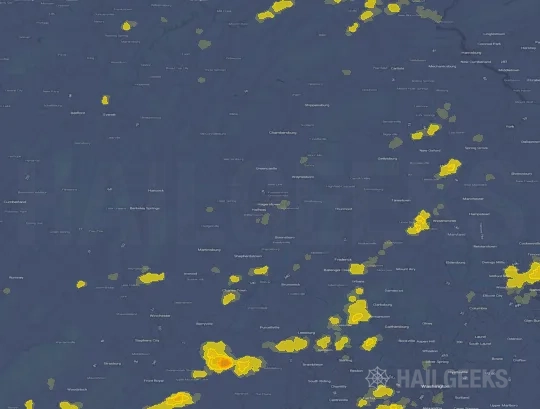
If none of these related Hagerstown, MD hail maps look close enough to your property, check a free Hail Report by Address. It reviews hail history for a specific location — not just the broader Hagerstown, MD region — so you can check whether hail activity may have reached your property.
Local Hail Review Options Near Hagerstown, MD
Not sure whether the August 11, 2021 Hagerstown, MD hail map matters for your property? Start with a free Hail Report by Address to see whether hail activity was mapped for that property. If the property signal looks meaningful, you can choose a local pro serving the Hagerstown, MD region and ask about a Remote Hail Inspection before deciding whether an on-site roof or exterior review is worth scheduling.
Check a specific property to see whether hail activity from the August 11, 2021 Hagerstown, MD event — or another recent hail event — may have been mapped at that address.
Find a roof or exterior pro serving the Hagerstown, MD region who can help you understand what the property hail signal may mean.
A participating local pro reviews property-level hail history remotely — not just the August 11, 2021 event — to help decide whether an on-site inspection may be worth scheduling.
A free Hail Report by Address and a Remote Hail Inspection can help you look beyond the August 11, 2021 hail map visuals alone. They do not confirm property damage and do not replace an on-site inspection for a property in the Hagerstown, MD region, but they can help you make a more informed next decision before anyone climbs on the roof.
Frequently Asked Questions
Common questions about the August 11, 2021 Hagerstown, MD hail event.