

Hail Swath Map Preview
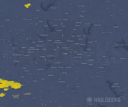
The Dallas, TX hail swath map preview was last reviewed on August 27, 2026 and shows mapped hail estimates up to 2.00". There are 9 public hail reports, 12 public wind reports, and 1 nearby tornado reports listed for the April 4, 2022 event.
View the April 4, 2022 Dallas, TX hail event on the free interactive hail map, then check a free Hail Report by ZIP to see a more local hail signal for your area.
Impact Area and Population for the Dallas, TX Hail Map
The April 4, 2022 hail swath map for Dallas, TX covers approximately 4,146 square miles and includes an estimated 1,987,963 people inside the mapped footprint. The largest mapped area is in the 0.50-0.75" hail band, covering 1,602 square miles. The highest estimated population exposure is in the 0.50-0.75" hail band with 748,992 people.
| Mapped Hail Band | Impact Area | Population |
|---|---|---|
| < 0.50" | 979 sq mi | 482,910 |
| 0.50-0.75" | 1,602 sq mi | 748,992 |
| 0.75-1.00" | 997 sq mi | 374,026 |
| 1.00-1.25" | 370 sq mi | 216,096 |
| 1.25-1.50" | 109 sq mi | 108,114 |
| 1.50-1.75" | 56 sq mi | 45,036 |
| 1.75-2.00" | 26 sq mi | 12,100 |
| 2.00-2.25" | 8 sq mi | 689 |
Get a free Hail Report by ZIP to see a more local hail signal and whether the April 4, 2022 Dallas, TX hail event may have reached your area.
Housing Exposure Inside the Dallas, TX Hail Swath Map
Inside the April 4, 2022 hail swath map area for Dallas, TX, HailGeeks estimates 657,645 single-family homes, 42,181 townhomes, and 425,402 multifamily properties within the mapped storm footprint. Single-family-home exposure is highest in the 0.50-0.75" hail band, with 241,613 single-family homes.
| Mapped Hail Band | Single-Family | Townhomes | Multifamily |
|---|---|---|---|
| < 0.50" | 173,318 | 8,352 | 80,450 |
| 0.50-0.75" | 241,613 | 19,078 | 182,321 |
| 0.75-1.00" | 117,321 | 7,539 | 85,918 |
| 1.00-1.25" | 72,817 | 4,644 | 43,602 |
| 1.25-1.50" | 35,909 | 1,613 | 17,733 |
| 1.50-1.75" | 11,619 | 919 | 13,163 |
| 1.75-2.00" | 4,793 | 34 | 2,200 |
| 2.00-2.25" | 255 | 2 | 15 |
Use this table to review housing exposure by hail band for the April 4, 2022 Dallas, TX hail map. To check a specific property more closely, use a free Hail Report by Address.
Counties Inside the Dallas, TX Hail Map
Hail from the April 4, 2022 storm was mapped across 22 counties in the Dallas, TX region. Denton County, TX had the strongest mapped signal, peaking at 2.00" with roughly 145,591 single-family homes inside the swath.
County pages group every mapped hail event in the area. For a closer look, drop to the city or ZIP level below, or run a free Hail Report by Address.
Cities Inside the Dallas, TX Hail Map
Zooming in, the swath touched 122 cities near Dallas, TX. New Fairview, TX had the strongest mapped signal at 2.00", with an estimated 920 single-family homes exposed.
City cards show where the April 4, 2022 Dallas, TX hail activity was mapped, but your ZIP can show a closer local signal. Get a free Hail Report by ZIP, and if the signal looks meaningful, ask a local pro about a Remote Hail Inspection to see whether an on-site roof or exterior review may be worth scheduling.
ZIP Codes Inside the Dallas, TX Hail Swath Map
At the ZIP level, the April 4, 2022 Dallas, TX hail map spans 158 ZIP codes. ZIP 76247 shows the strongest local signal, with mapped hail estimates up to 2.00" and an estimated single-family-home exposure of 5,294.
Check your ZIP in seconds to see whether hail activity from the April 4, 2022 Dallas, TX event was mapped near your area.
Public Hail, Wind, and Tornado Reports
Public storm report tables connected to the April 4, 2022 hail map for Dallas, TX currently list 9 public hail reports, 12 public wind reports, and 1 tornado reports.
| Date & Time | Hail Size | City | State | Description |
|---|---|---|---|---|
April 4, 2022 8:12 PM CT |
1.00 in | 1 N Boyd | TX | QUARTER HAIL 1 MILE NORTH OF BOYD. |
April 4, 2022 8:26 PM CT |
1.00 in | 6 N Rhome | TX | QUARTER HAIL 6 MILES NORTH OF RHOME. |
April 4, 2022 8:30 PM CT |
1.50 in | 5 NE Rhome | TX | HALF DOLLAR HAIL IN NEW FAIRVIEW. |
April 4, 2022 8:38 PM CT |
1.50 in | 4 WNW Justin | TX | HALF DOLLAR HAIL 1 MILE NORTH OF PROPWASH AIRPORT. |
April 4, 2022 9:58 PM CT |
1.25 in | 2 SW Celeste | TX | HALF DOLLAR HAIL 1 MILE WEST OF KINGSTON. |
April 4, 2022 10:05 PM CT |
1.00 in | Coppell | TX | QUARTER HAIL IN COPPELL. |
April 4, 2022 10:45 PM CT |
1.00 in | 4 SW Crowley | TX | QUARTER HAIL AT FM1902 AND CR920. |
April 4, 2022 10:48 PM CT |
1.00 in | Dallas | TX | QUARTER HAIL AT WALNUT HILL LANE AND HILLCREST RD. |
April 4, 2022 10:50 PM CT |
1.00 in | Burleson | TX | QUARTER HAIL 2 MILES SOUTHWEST OF SPINKS AIRPORT. |
| Date & Time | Wind Speed | City | State | Description |
|---|---|---|---|---|
April 4, 2022 9:35 PM CT | Blue Ridge | TX | HOME LOST ROOF... PARTIAL COLLAPSE OF STRUCTURE (FM545 AND CHURCH ST.). | |
April 4, 2022 10:30 PM CT | 4 SSW Ovilla | TX | DELAYED REPORT: 12 INCH TREE KNOCKED OVER NEAR HACKBERRY CT IN MIDLOTHIAN. | |
April 4, 2022 10:45 PM CT | 3 SSW Joshua | TX | MULTIPLE POWER POLES AND LARGE TREES DOWN AT MAIN ST. (STATE HIGHWAY 174) AND FM3048. | |
April 4, 2022 11:00 PM CT | 5 NNE Alvarado | TX | HOMES DAMAGED 2 MILES SOUTH OF LILLIAN (FM2738 AND MARIANNA WAY). | |
April 4, 2022 11:05 PM CT | Venus | TX | CR510 AND ADRIELS LANE (HOMESTEAD AREA OF VENUS) - 3 MOBILE HOMES... BARNS... AND SMALL BUILDINGS DAMAGED. | |
April 4, 2022 11:17 PM CT | Midlothian | TX | 18-WHEELER FLIPPED OVER AT LOVE'S IN MIDLOTHIAN (US 67 AND W. MAIN ST.). | |
April 4, 2022 11:30 PM CT | 4 SSW Ovilla | TX | CORRECTS PREVIOUS TSTM WND DMG REPORT FROM 4 SSW OVILLA. DELAYED REPORT: 12 INCH TREE KNOCKED OVER NEAR HACKBERRY CT IN MIDLOTHIAN. TIME CORRECTED. | |
April 5, 2022 12:16 AM CT | 9 W Seven Points | TX | DELAYED REPORT: TREE DAMAGE CONSISTENT WITH STRAIGHT LINE WINDS WAS FOUND IN FAR NORTHEAST NAVARRO COUNTY ALONG FM 85 GOING TOWARD HENDERSON COUNTY. TIME ESTIMATED. | |
April 5, 2022 12:28 AM CT | 3 NNW Kemp | TX | SIGNIFICANT BUILDING DAMAGE AND METAL DEBRIS UP AND DOWN HIGHWAY 175. | |
April 5, 2022 12:35 AM CT | 4 E Kemp | TX | TREES DOWN ACROSS POWER LINES. | |
April 5, 2022 12:50 AM CT | 6 NE Mabank | TX | HOMEOWNER REPORTED ROOF BLOWN OFF HOME. | |
April 5, 2022 1:36 AM CT | 9 NE Mabank | TX | BARN BLOWN DOWN AND MULTIPLE TREES BLOCKING VZCR 2416 APPROXIMATELY 3/4 MILE WEST OF HIGHWAY 198. POWER OUTAGES REPORTED. |
| Date & Time | Rating | City | State | Description |
|---|---|---|---|---|
April 4, 2022 9:32 PM CT | UNK | Blue Ridge | TX | AN NWS STORM SURVEY TEAM CONFIRMED AN EF-1 TORNADO WITH PEAK WINDS OF 100 MPH OCCURRED NEAR BLUE RIDGE IN COLLIN COUNTY. THE TORNADO BEGAN ON THE WEST SIDE OF BLUE RIDGE AND TRACKED EAST-NORTHEAST CROSSING N BUSINESS HIGHWAY 78 BEFORE THE CIRCULATION IS BELIEVED TO HAVE LIFTED. THE TORNADO PRODUCED DAMAGE TO SEVERAL STRUCTURES INCLUDING TWO SMALL WORKSHOPS/FARM OUTBUILDINGS THAT LOST A LARGE SECTION OF THE METAL ROOF. AS THE TORNADO MOVED NORTHEAST IT LEFT BEHIND A PATH OF DAMAGE RUNNING ROUGHLY ALONG AND JUST NORTH OF FM 545. ADDITIONAL DAMAGE WAS FOUND ON N CHURCH STREET WHERE THE WOOD ROOF PANELS WERE REMOVED FROM ONE SMALL BARN AND THE WALLS COLLAPSED ON ANOTHER NEARBY METAL OUTBUILDING. IN ADDITION TO ROOF DAMAGE TO MULTIPLE AREA HOMES AND STRUCTURES... A SINGLE-FAMILY HOME NEAR FM 545 AND N MORROW STREET HAD SUBSTANTIAL DAMAGE TO THE ROOF AND ROOF DECK. AS THE TORNADO CONTINUED EAST-NORTHEAST IT CAUSED DAMAGE TO THE METAL ROOF CANOPY OF THE CAR WASH ON THE CORNER OF S MAIN ST AN |
This table includes only public storm reports connected to the April 4, 2022 Dallas, TX storm event. When available, each report may include the time, size or magnitude, city, state, and a short description.
Related Hail Maps in the Dallas, TX Region
We found 6 more hail maps with reports from the same Dallas, TX region as the April 4, 2022 event. These related maps cover storm dates from Nov 10, 2021 through Mar 21, 2022, with mapped hail estimates ranging from 0.75" to 2.75". In this set, the strongest related map reached 2.75", and the most recent map shown is from Mar 21, 2022.



If none of these related Dallas, TX hail maps look close enough to your property, check a free Hail Report by Address. It reviews hail history for a specific location — not just the broader Dallas, TX region — so you can check whether hail activity may have reached your property.
Local Hail Review Options Near Dallas, TX
Not sure whether the April 4, 2022 Dallas, TX hail map matters for your property? Start with a free Hail Report by Address to see whether hail activity was mapped for that property. If the property signal looks meaningful, you can choose a local pro serving the Dallas, TX region and ask about a Remote Hail Inspection before deciding whether an on-site roof or exterior review is worth scheduling.
Check a specific property to see whether hail activity from the April 4, 2022 Dallas, TX event — or another recent hail event — may have been mapped at that address.
Find a roof or exterior pro serving the Dallas, TX region who can help you understand what the property hail signal may mean.
A participating local pro reviews property-level hail history remotely — not just the April 4, 2022 event — to help decide whether an on-site inspection may be worth scheduling.
A free Hail Report by Address and a Remote Hail Inspection can help you look beyond the April 4, 2022 hail map visuals alone. They do not confirm property damage and do not replace an on-site inspection for a property in the Dallas, TX region, but they can help you make a more informed next decision before anyone climbs on the roof.
Frequently Asked Questions
Common questions about the April 4, 2022 Dallas, TX hail event.